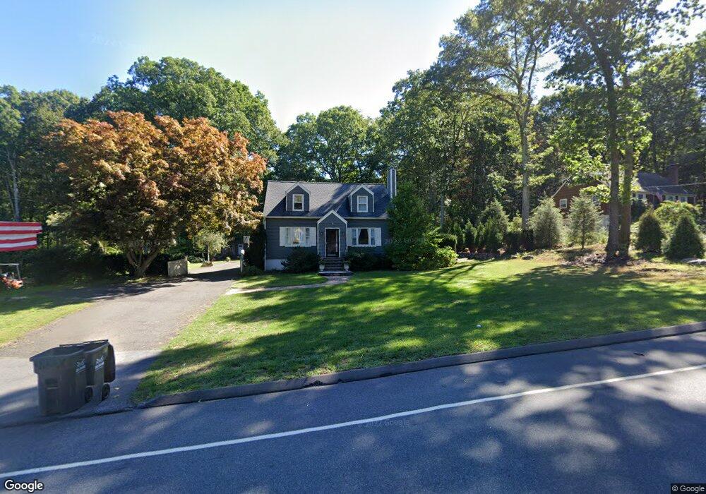
62 Moose Hill Rd Trumbull, CT 06611
Daniel Farm District NeighborhoodEstimated Value: $503,000 - $619,000
3
Beds
2
Baths
1,206
Sq Ft
$449/Sq Ft
Est. Value
About This Home
This home is located at 62 Moose Hill Rd, Trumbull, CT 06611 and is currently estimated at $541,455, approximately $448 per square foot. 62 Moose Hill Rd is a home located in Fairfield County with nearby schools including Daniels Farm School, Hillcrest Middle School, and Trumbull High School.
Ownership History
Date
Name
Owned For
Owner Type
Purchase Details
Closed on
Dec 7, 1998
Sold by
Borucki Michael J and Borucki Kristine L
Bought by
Waychowsky Theresa M
Current Estimated Value
Purchase Details
Closed on
Jun 28, 1996
Sold by
Blakeman Eugene
Bought by
Borucki Michael and Borucki Kristine
Purchase Details
Closed on
Apr 12, 1996
Sold by
King Horrex J and King Edith E
Bought by
Blakeman Eugene
Create a Home Valuation Report for This Property
The Home Valuation Report is an in-depth analysis detailing your home's value as well as a comparison with similar homes in the area
Home Values in the Area
Average Home Value in this Area
Purchase History
| Date | Buyer | Sale Price | Title Company |
|---|---|---|---|
| Waychowsky Theresa M | $182,225 | -- | |
| Borucki Michael | $175,000 | -- | |
| Blakeman Eugene | $230,000 | -- |
Source: Public Records
Mortgage History
| Date | Status | Borrower | Loan Amount |
|---|---|---|---|
| Open | Blakeman Eugene | $288,575 | |
| Closed | Blakeman Eugene | $35,000 | |
| Closed | Blakeman Eugene | $40,000 |
Source: Public Records
Tax History
| Year | Tax Paid | Tax Assessment Tax Assessment Total Assessment is a certain percentage of the fair market value that is determined by local assessors to be the total taxable value of land and additions on the property. | Land | Improvement |
|---|---|---|---|---|
| 2025 | $7,854 | $212,730 | $131,320 | $81,410 |
| 2024 | $7,639 | $212,730 | $131,320 | $81,410 |
| 2023 | $7,516 | $212,730 | $131,320 | $81,410 |
| 2022 | $7,396 | $212,730 | $131,320 | $81,410 |
| 2021 | $6,807 | $186,270 | $119,420 | $66,850 |
| 2020 | $6,678 | $186,270 | $119,420 | $66,850 |
| 2018 | $6,513 | $186,270 | $119,420 | $66,850 |
| 2017 | $6,382 | $186,270 | $119,420 | $66,850 |
| 2016 | $6,253 | $186,270 | $119,420 | $66,850 |
| 2015 | $6,521 | $192,000 | $125,200 | $66,800 |
| 2014 | $6,380 | $192,000 | $125,200 | $66,800 |
Source: Public Records
Map
Nearby Homes
- 17 Moose Hill Rd
- 110 Porters Hill Rd
- 121 Lewis Rd
- 97 Greenbrier Rd
- 261 Moose Hill Rd
- 23 Federal Rd
- 9 Lazy Brook Rd
- 286 Moose Hill Rd
- 424 Waverly Rd
- 93 Putting Green Rd N
- 33 Ryegate Terrace
- 4 Winthrop Woods Rd
- 2 Winthrop Woods Rd
- 16 Winthrop Woods Rd
- 166 Palomino Pass
- 184 Putting Green Rd
- 699 Daniels Farm Rd
- 23 Bonita Dr
- 1215 Arganese Place
- 15 Squire Ct
- 70 Moose Hill Rd
- 56 Moose Hill Rd
- 33 Danube Dr
- 46 Moose Hill Rd
- 76 Moose Hill Rd
- 59 Moose Hill Rd
- 63 Moose Hill Rd
- 67 Moose Hill Rd
- 49 Moose Hill Rd
- 42 Moose Hill Rd
- 41 Moose Hill Rd
- 26 Danube Dr
- 82 Moose Hill Rd
- 6 Whitefield Dr
- 15 Whitefield Dr
- 55 Moose Hill Rd
- 25 Danube Dr
- 88 Moose Hill Rd
- 39 Moose Hill Rd
- 11 Petticoat Ln
Your Personal Tour Guide
Ask me questions while you tour the home.