
Seller's Agent in 2021
Robyn Van Vechten
Coldwell Banker LIFESTYLES- Franconia
(603) 616-8618
10 in this area
25 Total Sales
Estimated Value: $238,385 - $332,000
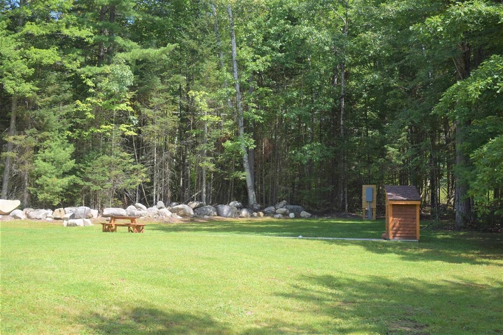
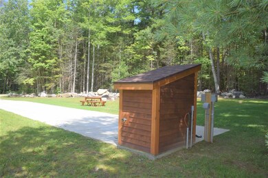
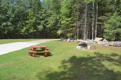
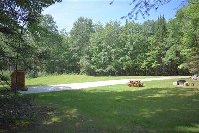
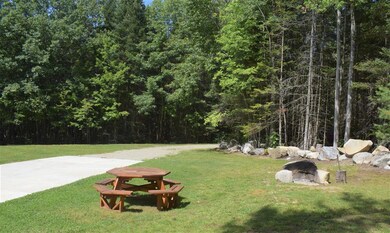
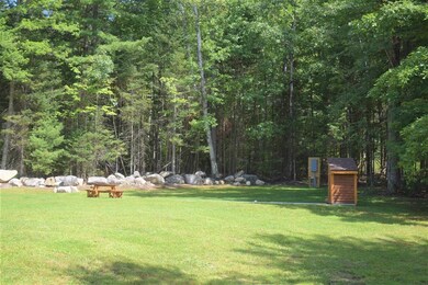
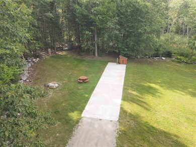
Land and SO much more! Beautifully landscaped yard with electric, a drilled well and 2-bedroom septic already done for you! There are so many possibilities; park your RV on the existing concrete pad, and enjoy your new vacation spot. Explore the walking path that winds through the 7.83 acres and gather round the fire pit with friends and family in the evening. Build your vacation cabin or enjoy the beautiful White Mountains year-round and build the home of your dreams! This property is on a quiet, dead-end street and is minutes to downtown Littleton, and centrally located to hiking, biking, snowmobile and ATV trails, skiing and shopping. Sellers have short term rentals on the property and have bookings through the fall. ***SHOWINGS BY APPOINTMENT ONLY. DO NOT ENTER PROPERTY WITHOUT AN APPOINTMENT***
Last Agent to Sell the Property
Coldwell Banker LIFESTYLES- Franconia License #075523 Listed on: 08/17/2021
| Date | Buyer | Sale Price | Title Company |
|---|---|---|---|
| Woodsville Guaranty Sb | $10,000 | -- | |
| Woodsville Guaranty Sb | $10,000 | -- |
| Date | Event | Price | List to Sale | Price per Sq Ft |
|---|---|---|---|---|
| 10/28/2021 10/28/21 | Sold | $164,000 | -0.6% | -- |
| 08/25/2021 08/25/21 | Pending | -- | -- | -- |
| 08/17/2021 08/17/21 | For Sale | $165,000 | -- | -- |
| Year | Tax Paid | Tax Assessment Tax Assessment Total Assessment is a certain percentage of the fair market value that is determined by local assessors to be the total taxable value of land and additions on the property. | Land | Improvement |
|---|---|---|---|---|
| 2024 | $3,118 | $125,000 | $35,500 | $89,500 |
| 2023 | $2,818 | $125,000 | $35,500 | $89,500 |
| 2022 | $819 | $35,500 | $35,500 | $0 |
| 2021 | $819 | $35,500 | $35,500 | $0 |
| 2020 | $769 | $35,500 | $35,500 | $0 |
| 2019 | $1,441 | $62,400 | $32,400 | $30,000 |
| 2018 | $1,668 | $72,200 | $32,400 | $39,800 |
| 2017 | $2,024 | $78,400 | $29,000 | $49,400 |
| 2016 | $2,031 | $78,400 | $29,000 | $49,400 |
| 2015 | $1,807 | $77,500 | $34,900 | $42,600 |
| 2014 | $1,721 | $77,500 | $34,900 | $42,600 |
| 2013 | $1,741 | $77,500 | $34,900 | $42,600 |
Seller's Agent in 2021
Robyn Van Vechten
Coldwell Banker LIFESTYLES- Franconia
(603) 616-8618
10 in this area
25 Total Sales
K
Buyer's Agent in 2021
Kim Bruneau
Old Mill Properties REALTORS
(603) 530-1091
1 in this area
97 Total Sales
Source: PrimeMLS
MLS Number: 4878128
APN: LTLN-000006-000009
Disclaimer: Certain information contained herein is derived from information provided by parties other than Homes.com. All information provided is deemed reliable, but is not guaranteed to be accurate and should be independently verified.
![]() Copyright 2025 PrimeMLS, Inc. All rights reserved. This information is deemed reliable, but not guaranteed. The data relating to real estate displayed on this display comes in part from the IDX Program of PrimeMLS. The information being provided is for consumers’ personal, non-commercial use and may not be used for any purpose other than to identify prospective properties consumers may be interested in purchasing.
Copyright 2025 PrimeMLS, Inc. All rights reserved. This information is deemed reliable, but not guaranteed. The data relating to real estate displayed on this display comes in part from the IDX Program of PrimeMLS. The information being provided is for consumers’ personal, non-commercial use and may not be used for any purpose other than to identify prospective properties consumers may be interested in purchasing.