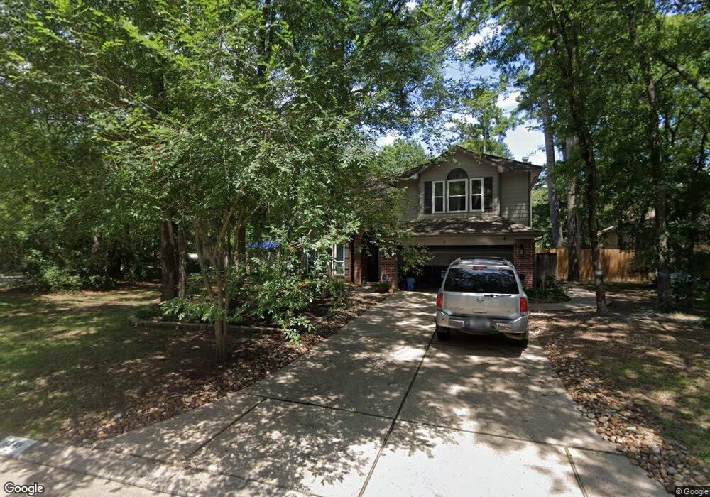
62 N Elm Branch Place Unit 1 Spring, TX 77380
Grogan's Mill NeighborhoodEstimated Value: $400,000 - $495,000
3
Beds
3
Baths
2,215
Sq Ft
$195/Sq Ft
Est. Value
About This Home
This home is located at 62 N Elm Branch Place Unit 1, Spring, TX 77380 and is currently estimated at $431,848, approximately $194 per square foot. 62 N Elm Branch Place Unit 1 is a home located in Montgomery County with nearby schools including Hailey Elementary School, W.D Wilkerson Intermediate School, and Knox J High School.
Ownership History
Date
Name
Owned For
Owner Type
Purchase Details
Closed on
Aug 17, 2015
Sold by
Callen Patrick G
Bought by
Grisham Stanley V and Grisham Susan
Current Estimated Value
Purchase Details
Closed on
Dec 20, 2004
Sold by
Szatny Michael and Szatny Jennifer L
Bought by
Callen Patrick G
Home Financials for this Owner
Home Financials are based on the most recent Mortgage that was taken out on this home.
Original Mortgage
$130,000
Interest Rate
5.74%
Mortgage Type
Purchase Money Mortgage
Purchase Details
Closed on
Nov 29, 1993
Sold by
The Ryland Group Inc
Bought by
Szatny Michael and Szatny Jennifer L
Home Financials for this Owner
Home Financials are based on the most recent Mortgage that was taken out on this home.
Original Mortgage
$104,081
Interest Rate
6.71%
Mortgage Type
FHA
Create a Home Valuation Report for This Property
The Home Valuation Report is an in-depth analysis detailing your home's value as well as a comparison with similar homes in the area
Home Values in the Area
Average Home Value in this Area
Purchase History
| Date | Buyer | Sale Price | Title Company |
|---|---|---|---|
| Grisham Stanley V | -- | -- | |
| Callen Patrick G | -- | First American Title | |
| Szatny Michael | -- | -- |
Source: Public Records
Mortgage History
| Date | Status | Borrower | Loan Amount |
|---|---|---|---|
| Previous Owner | Callen Patrick G | $130,000 | |
| Previous Owner | Szatny Michael | $104,081 |
Source: Public Records
Tax History Compared to Growth
Tax History
| Year | Tax Paid | Tax Assessment Tax Assessment Total Assessment is a certain percentage of the fair market value that is determined by local assessors to be the total taxable value of land and additions on the property. | Land | Improvement |
|---|---|---|---|---|
| 2025 | $7,446 | $373,690 | $50,000 | $323,690 |
| 2024 | $7,446 | $405,428 | $50,000 | $355,428 |
| 2023 | $6,236 | $337,480 | $50,000 | $287,480 |
| 2022 | $6,044 | $299,100 | $50,000 | $249,100 |
| 2021 | $5,606 | $256,960 | $15,000 | $241,960 |
| 2020 | $5,927 | $260,170 | $15,000 | $245,170 |
| 2019 | $5,480 | $232,760 | $15,000 | $217,760 |
| 2018 | $5,481 | $232,830 | $15,000 | $217,830 |
| 2017 | $5,773 | $242,220 | $15,000 | $227,220 |
| 2016 | $5,971 | $250,520 | $15,000 | $235,520 |
| 2015 | $4,164 | $198,450 | $15,000 | $215,880 |
| 2014 | $4,164 | $180,410 | $15,000 | $165,410 |
Source: Public Records
Map
Nearby Homes
- 25 N Summer Star Ct
- 26 N Summer Star Ct
- 36 N Rain Forest Ct
- 40 N Morningwood Ct
- 56 N Morningwood Ct
- 98 S Dreamweaver Cir
- 50 Dew Fall Ct
- 71 Timberspire Ln
- 62 Laughing Brook Ct
- 190 N Tranquil Path Dr
- 118 Angel Leaf Rd
- 28 Sawmill Grove Ln
- 25225 Liberty Mill Dr
- 205 Grogans Point Rd
- 1237 Pruitt Rd
- 713 Sawdust Rd
- 1231 Pruitt Rd
- 25234 Calhoun Creek Dr
- 723 Shadowbrook Dr
- 722 Shadowbrook Dr
- 62 N Elm Branch Place
- 58 N Elm Branch Place
- 2 Cirrus Ct
- 54 Elm Branch Ct
- 66 N Elm Branch Place
- 67 N Elm Branch Place
- 10 Cirrus Ct
- 50 Elm Branch Ct
- 3 Cirrus Ct
- 70 N Elm Branch Place
- 7 Cirrus Ct
- 14 Cirrus Ct
- 98 N High Oaks Cir
- 46 Elm Branch Ct
- 74 N Elm Branch Place
- 71 N Elm Branch Place
- 71 N Elm Branch Place
- 10 S White Pebble Ct
- 14 S White Pebble Ct
- 18 S White Pebble Ct