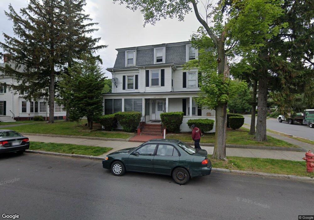
62 Nahant St Lynn, MA 01902
Diamond District NeighborhoodEstimated Value: $707,235
13
Beds
4
Baths
4,039
Sq Ft
$175/Sq Ft
Est. Value
About This Home
This home is located at 62 Nahant St, Lynn, MA 01902 and is currently priced at $707,235, approximately $175 per square foot. 62 Nahant St is a home located in Essex County with nearby schools including E.J. Harrington School, William R. Fallon School, and Marshall Middle School.
Ownership History
Date
Name
Owned For
Owner Type
Purchase Details
Closed on
Aug 20, 2001
Sold by
Nahant St Rt and Zelano Joseph
Bought by
Crescent Rt and Conti Jeffrey S
Current Estimated Value
Home Financials for this Owner
Home Financials are based on the most recent Mortgage that was taken out on this home.
Original Mortgage
$200,000
Outstanding Balance
$78,073
Interest Rate
7.16%
Mortgage Type
Commercial
Create a Home Valuation Report for This Property
The Home Valuation Report is an in-depth analysis detailing your home's value as well as a comparison with similar homes in the area
Home Values in the Area
Average Home Value in this Area
Purchase History
| Date | Buyer | Sale Price | Title Company |
|---|---|---|---|
| Crescent Rt | $280,000 | -- | |
| Crescent Rt | $280,000 | -- |
Source: Public Records
Mortgage History
| Date | Status | Borrower | Loan Amount |
|---|---|---|---|
| Open | Crescent Rt | $200,000 | |
| Closed | Crescent Rt | $200,000 |
Source: Public Records
Tax History Compared to Growth
Tax History
| Year | Tax Paid | Tax Assessment Tax Assessment Total Assessment is a certain percentage of the fair market value that is determined by local assessors to be the total taxable value of land and additions on the property. | Land | Improvement |
|---|---|---|---|---|
| 2025 | $11,844 | $1,143,200 | $312,000 | $831,200 |
| 2024 | $11,635 | $1,104,900 | $288,000 | $816,900 |
| 2023 | $10,555 | $946,600 | $288,000 | $658,600 |
| 2022 | $10,050 | $808,500 | $252,000 | $556,500 |
| 2021 | $9,019 | $692,200 | $144,000 | $548,200 |
| 2020 | $8,711 | $650,100 | $144,000 | $506,100 |
| 2019 | $7,445 | $520,600 | $120,000 | $400,600 |
| 2018 | $7,114 | $469,600 | $120,000 | $349,600 |
| 2017 | $6,936 | $444,600 | $120,000 | $324,600 |
| 2016 | $6,491 | $401,200 | $120,000 | $281,200 |
| 2015 | $5,729 | $342,000 | $102,000 | $240,000 |
Source: Public Records
Map
Nearby Homes
- 13 Nahant St Unit 2D
- 13 Nahant St Unit 4A
- 13 Nahant St Unit 3A
- 13 Nahant St Unit 4C
- 13 Nahant St Unit 3B
- 13 Nahant St Unit 4B
- 13 Portland St Unit 4
- 42 W Baltimore St Unit 22
- 95 Nahant St Unit 12
- 95 Nahant St Unit 33
- 13-15 Amity St
- 300 Lynn Shore Dr Unit 612
- 14-16 Dexter St
- 41 Tudor St
- 45 Tudor St Unit 3-8
- 12 Chancery Ct Unit 205
- 12 Chancery Ct Unit 207
- 285 Lynn Shore Dr Unit 308
- 285 Lynn Shore Dr Unit 508
- 285 Lynn Shore Dr Unit 203
- 68 Baltimore St
- 59 Baltimore St
- 54 Nahant St Unit 54R
- 58 Baltimore St Unit 2
- 66-68 Baltimore 64 Nahant
- 64 Baltimore St
- 64 Nahant St Unit 2
- 64 Nahant St Unit 1
- 66 Baltimore St Unit 68
- 61 Nahant St
- 57 Nahant St
- 55 Baltimore St
- 60 Baltimore St
- 9 Baltimore Park
- 48 Nahant St
- 51 Nahant St
- 11 W Baltimore St
- 15 Baltimore Park
- 72 Nahant St Unit 2
- 72 Nahant St Unit B