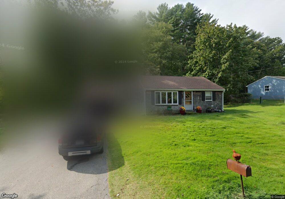
62 Pratt Place Hanson, MA 02341
Estimated Value: $410,000 - $438,000
2
Beds
1
Bath
804
Sq Ft
$535/Sq Ft
Est. Value
About This Home
This home is located at 62 Pratt Place, Hanson, MA 02341 and is currently estimated at $429,942, approximately $534 per square foot. 62 Pratt Place is a home located in Plymouth County.
Ownership History
Date
Name
Owned For
Owner Type
Purchase Details
Closed on
Aug 1, 2008
Sold by
Whitney Norman
Bought by
Delorenzo Francis P and Delorenzo Joyce M
Current Estimated Value
Home Financials for this Owner
Home Financials are based on the most recent Mortgage that was taken out on this home.
Original Mortgage
$189,000
Interest Rate
6.47%
Mortgage Type
Purchase Money Mortgage
Create a Home Valuation Report for This Property
The Home Valuation Report is an in-depth analysis detailing your home's value as well as a comparison with similar homes in the area
Home Values in the Area
Average Home Value in this Area
Purchase History
| Date | Buyer | Sale Price | Title Company |
|---|---|---|---|
| Delorenzo Francis P | $210,000 | -- |
Source: Public Records
Mortgage History
| Date | Status | Borrower | Loan Amount |
|---|---|---|---|
| Open | Delorenzo Francis P | $187,000 | |
| Closed | Delorenzo Francis P | $189,000 |
Source: Public Records
Tax History Compared to Growth
Tax History
| Year | Tax Paid | Tax Assessment Tax Assessment Total Assessment is a certain percentage of the fair market value that is determined by local assessors to be the total taxable value of land and additions on the property. | Land | Improvement |
|---|---|---|---|---|
| 2025 | $4,893 | $365,700 | $169,100 | $196,600 |
| 2024 | $4,751 | $355,100 | $164,200 | $190,900 |
| 2023 | $4,169 | $294,000 | $164,200 | $129,800 |
| 2022 | $4,071 | $269,800 | $149,300 | $120,500 |
| 2021 | $3,610 | $239,100 | $143,500 | $95,600 |
| 2020 | $3,556 | $232,900 | $138,700 | $94,200 |
| 2019 | $3,468 | $223,300 | $136,000 | $87,300 |
| 2018 | $3,426 | $216,400 | $130,800 | $85,600 |
| 2017 | $3,316 | $207,500 | $124,500 | $83,000 |
| 2016 | $3,376 | $204,000 | $124,500 | $79,500 |
| 2015 | $3,221 | $202,300 | $124,500 | $77,800 |
Source: Public Records
Map
Nearby Homes
- 52 Richard Rd
- 37 Brook St
- 456 Gorwin Dr
- Lot 2 Harvard Rd
- Lot 6 Way
- 248 E Washington St
- 57 Liberty St
- 418 E Washington St
- 134 Crescent St
- Lot 5 Princeton Way
- 842 E Washington St
- 269 Lakeside Rd
- 456 Maquan St
- 33 Tavern Way
- 166 Pine Grove Ave
- 168 Spring St
- 15 Elm Place
- Lot 22 Adams Cir
- 255 Holmes St
- 842 Whitman St