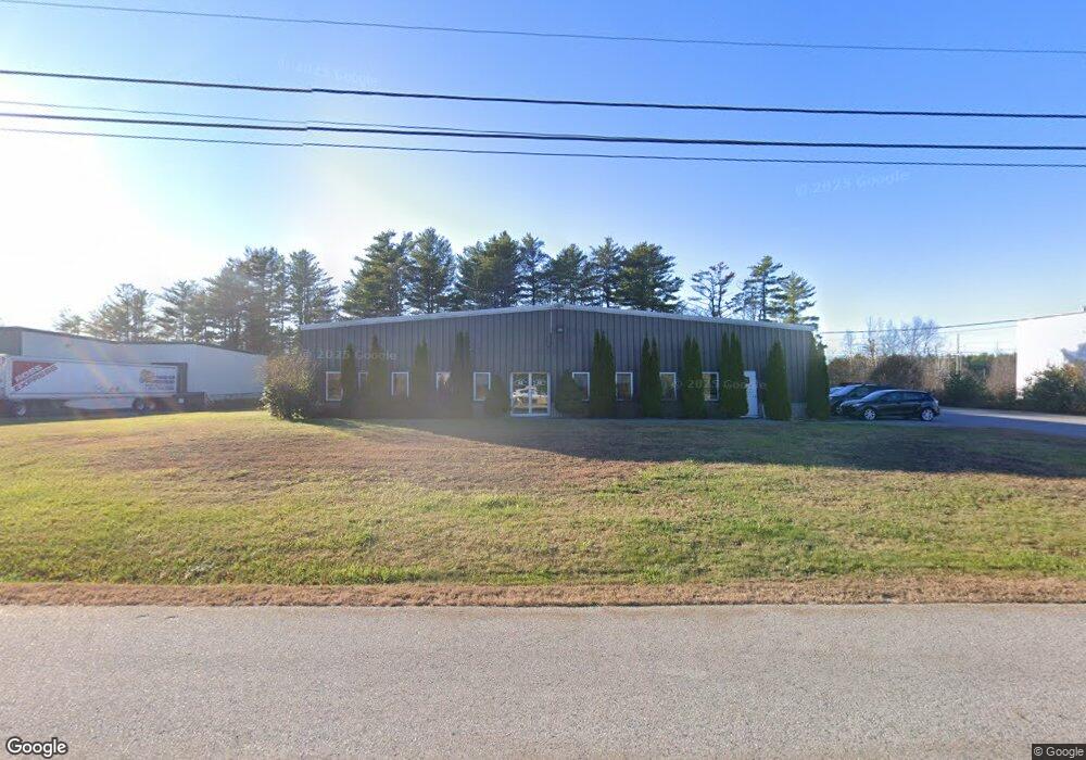
62 Sanford Dr Gorham, ME 04038
--
Bed
2
Baths
7,820
Sq Ft
1.35
Acres
About This Home
This home is located at 62 Sanford Dr, Gorham, ME 04038. 62 Sanford Dr is a home located in Cumberland County with nearby schools including Narragansett Elementary School, Gorham Middle School, and Gorham High School.
Ownership History
Date
Name
Owned For
Owner Type
Purchase Details
Closed on
Jun 24, 2021
Sold by
T & B Properties Llc
Bought by
Quartersawn Holdings Llc
Home Financials for this Owner
Home Financials are based on the most recent Mortgage that was taken out on this home.
Original Mortgage
$400,000
Outstanding Balance
$362,150
Interest Rate
2.9%
Mortgage Type
Purchase Money Mortgage
Purchase Details
Closed on
Aug 27, 2014
Sold by
New England Treads & Custom
Bought by
T & B Properties Llc
Home Financials for this Owner
Home Financials are based on the most recent Mortgage that was taken out on this home.
Original Mortgage
$440,000
Interest Rate
4.14%
Mortgage Type
Commercial
Create a Home Valuation Report for This Property
The Home Valuation Report is an in-depth analysis detailing your home's value as well as a comparison with similar homes in the area
Home Values in the Area
Average Home Value in this Area
Purchase History
| Date | Buyer | Sale Price | Title Company |
|---|---|---|---|
| Quartersawn Holdings Llc | -- | None Available | |
| T & B Properties Llc | -- | -- |
Source: Public Records
Mortgage History
| Date | Status | Borrower | Loan Amount |
|---|---|---|---|
| Open | Quartersawn Holdings Llc | $400,000 | |
| Previous Owner | T & B Properties Llc | $440,000 |
Source: Public Records
Tax History Compared to Growth
Tax History
| Year | Tax Paid | Tax Assessment Tax Assessment Total Assessment is a certain percentage of the fair market value that is determined by local assessors to be the total taxable value of land and additions on the property. | Land | Improvement |
|---|---|---|---|---|
| 2024 | $11,128 | $757,000 | $195,100 | $561,900 |
| 2023 | $10,409 | $757,000 | $195,100 | $561,900 |
| 2022 | $9,727 | $757,000 | $195,100 | $561,900 |
| 2021 | $11,006 | $567,300 | $154,900 | $412,400 |
| 2020 | $10,779 | $567,300 | $154,900 | $412,400 |
| 2019 | $10,750 | $567,300 | $154,900 | $412,400 |
| 2018 | $10,325 | $567,300 | $154,900 | $412,400 |
| 2017 | $10,173 | $594,900 | $154,900 | $440,000 |
| 2016 | $10,113 | $594,900 | $154,900 | $440,000 |
| 2015 | $9,697 | $594,900 | $154,900 | $440,000 |
| 2014 | $8,105 | $465,800 | $95,700 | $370,100 |
| 2013 | $8,058 | $465,800 | $95,700 | $370,100 |
Source: Public Records
Map
Nearby Homes
- 316 New Portland Rd
- 0 Cobb Rd
- Lot 18 Vista Dr
- 280 Longfellow St Unit 9
- 280 Longfellow St Unit 17
- 280 Longfellow St Unit 21
- 197 New Portland Rd
- 30 Palmer St
- 36 Arlington Ave
- 16 Nicklaus Ln
- 29 Joseph Dr
- Lot 10 Newton Dr
- 8 Stephen Ward Dr Unit 14
- 68 Huntress Ave Unit 2
- 11 New Gorham Rd
- 159 Lincoln St Unit 15
- 115 Saco St Unit 2
- 45 Emery St
- 345 Saco St Unit 4
- 345 Saco St Unit 35
- 310 New Portland Rd
- 307 New Portland Rd
- 309 New Portland Rd
- 320 New Portland Rd
- 313 New Portland Rd
- 257 New Portland Rd
- 17 Little Wing Ln
- 317 New Portland Rd
- 253 New Portland Rd
- 321 New Portland Rd
- 7 Rangeley Way
- 00 Bartlett Rd
- 7 Little Wing Ln
- 11 Rangeley Way
- 45 Bartlett Rd
- 245 New Portland Rd
- 59 Bartlett Rd
- 332 New Portland Rd
- 639 Main St
- 329 New Portland Rd