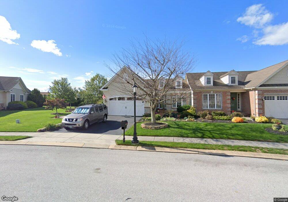
62 St Michaels Way Unit 3 Hanover, PA 17331
Estimated Value: $403,000 - $456,000
3
Beds
2
Baths
2,100
Sq Ft
$202/Sq Ft
Est. Value
About This Home
This home is located at 62 St Michaels Way Unit 3, Hanover, PA 17331 and is currently estimated at $423,852, approximately $201 per square foot. 62 St Michaels Way Unit 3 is a home located in Adams County with nearby schools including New Oxford Senior High School, St. Teresa of Calcutta Catholic School - McSherrystown Campus, and St. Teresa of Calcutta Catholic School - Conewago Campus.
Ownership History
Date
Name
Owned For
Owner Type
Purchase Details
Closed on
Mar 16, 2009
Sold by
Harvest Investment Group Llc
Bought by
Swindle Michael W and Swindle Linda D
Current Estimated Value
Home Financials for this Owner
Home Financials are based on the most recent Mortgage that was taken out on this home.
Original Mortgage
$300,000
Outstanding Balance
$188,625
Interest Rate
4.92%
Mortgage Type
New Conventional
Estimated Equity
$235,227
Create a Home Valuation Report for This Property
The Home Valuation Report is an in-depth analysis detailing your home's value as well as a comparison with similar homes in the area
Home Values in the Area
Average Home Value in this Area
Purchase History
| Date | Buyer | Sale Price | Title Company |
|---|---|---|---|
| Swindle Michael W | $375,000 | -- |
Source: Public Records
Mortgage History
| Date | Status | Borrower | Loan Amount |
|---|---|---|---|
| Open | Swindle Michael W | $300,000 |
Source: Public Records
Tax History Compared to Growth
Tax History
| Year | Tax Paid | Tax Assessment Tax Assessment Total Assessment is a certain percentage of the fair market value that is determined by local assessors to be the total taxable value of land and additions on the property. | Land | Improvement |
|---|---|---|---|---|
| 2025 | $7,860 | $328,200 | $58,600 | $269,600 |
| 2024 | $7,260 | $328,200 | $58,600 | $269,600 |
| 2023 | $6,992 | $328,200 | $58,600 | $269,600 |
| 2022 | $6,777 | $328,200 | $58,600 | $269,600 |
| 2021 | $6,604 | $328,200 | $58,600 | $269,600 |
| 2020 | $6,613 | $328,200 | $58,600 | $269,600 |
| 2019 | $6,317 | $328,200 | $58,600 | $269,600 |
| 2018 | $5,901 | $313,200 | $58,600 | $254,600 |
| 2017 | $5,658 | $313,200 | $58,600 | $254,600 |
| 2016 | -- | $313,200 | $58,600 | $254,600 |
| 2015 | -- | $313,200 | $58,600 | $254,600 |
| 2014 | -- | $313,200 | $58,600 | $254,600 |
Source: Public Records
Map
Nearby Homes
- 152 St Michaels Way Unit 18
- 51 Michael St Unit 6
- 124 Flint Dr Unit 61
- 105 Flint Dr
- 108 Flint Dr
- 5955 Hanover Rd
- 73 Flint Dr
- 11 Flint Dr
- 24 Red Stone Ln Unit 47
- 62 Flint Dr
- 11 Shawl Dr
- 54 Flint Dr
- 46 Flint Dr
- 84 Red Stone Ln Unit 41
- 92 Red Stone Ln Unit 40
- 3211 Centennial Rd
- 9 Westview Dr Unit 2A
- 49 North St
- 1 Sease Dr Unit 1
- 128 North St
- 2 St Michaels Way
- 56 St Michaels Way Unit 2
- 68 St Michaels Way Unit 4
- 74 St Michaels Way Unit 5
- 55 St Michaels Way
- 50 St Michaels Way Unit 1
- 50 St Michaels Way
- 55 Saint Michaels Way
- 77 St Michaels Way Unit 37
- 49 St Michaels Way Unit 35
- 49 St Michaels Way
- 80 St Michaels Way Unit 6
- 5562 Hanover Rd
- 49 Saint Michaels Way
- 95 Saint Michaels Way
- 95 St Michaels Way Unit 38
- 86 St Michaels Way Unit 7
- 86 Saint Michaels Way
- 36 Saint Michaels Way
- 0 Saint Michaels Way Unit AD7904406