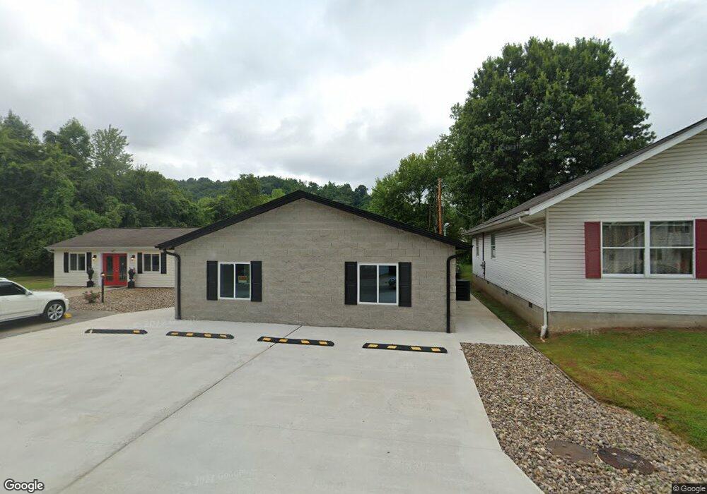
62 Twp Rd 1427 W South Point, OH 45680
Burlington NeighborhoodEstimated Value: $62,000 - $230,302
2
Beds
2
Baths
1,800
Sq Ft
$81/Sq Ft
Est. Value
About This Home
This home is located at 62 Twp Rd 1427 W, South Point, OH 45680 and is currently estimated at $146,151, approximately $81 per square foot. 62 Twp Rd 1427 W is a home with nearby schools including South Point High School and Grace Christian School.
Ownership History
Date
Name
Owned For
Owner Type
Purchase Details
Closed on
Jul 30, 2025
Sold by
Fuscardo Frank Nick
Bought by
Fuscardo Frank Nick and Tran Tam Thi
Current Estimated Value
Purchase Details
Closed on
Mar 16, 2021
Sold by
Tran Tam
Bought by
Fuscardo Frank
Purchase Details
Closed on
Jan 13, 2021
Sold by
Webb Sidney and Webb Sadie
Bought by
Tran Tam
Purchase Details
Closed on
Jul 11, 2016
Sold by
Edmond Connie
Bought by
Webb Sidney
Purchase Details
Closed on
Nov 25, 2014
Sold by
Evans Margaret I
Bought by
Edmond Connie and Webb Brenda
Purchase Details
Closed on
Jun 27, 1997
Sold by
Price Audrey
Bought by
Evans Margaret I
Create a Home Valuation Report for This Property
The Home Valuation Report is an in-depth analysis detailing your home's value as well as a comparison with similar homes in the area
Home Values in the Area
Average Home Value in this Area
Purchase History
| Date | Buyer | Sale Price | Title Company |
|---|---|---|---|
| Fuscardo Frank Nick | -- | None Listed On Document | |
| Fuscardo Frank Nick | -- | None Listed On Document | |
| Fuscardo Frank | $10,310 | None Available | |
| Tran Tam | $54,500 | None Available | |
| Webb Sidney | $5,500 | None Available | |
| Edmond Connie | $10,000 | None Available | |
| Evans Margaret I | $3,500 | -- |
Source: Public Records
Tax History Compared to Growth
Tax History
| Year | Tax Paid | Tax Assessment Tax Assessment Total Assessment is a certain percentage of the fair market value that is determined by local assessors to be the total taxable value of land and additions on the property. | Land | Improvement |
|---|---|---|---|---|
| 2024 | -- | $58,290 | $3,800 | $54,490 |
| 2023 | $1,795 | $58,290 | $3,800 | $54,490 |
| 2022 | $142 | $4,140 | $3,800 | $340 |
| 2021 | $133 | $3,610 | $3,330 | $280 |
| 2020 | $132 | $3,610 | $3,330 | $280 |
| 2019 | $132 | $3,610 | $3,330 | $280 |
| 2018 | $131 | $3,530 | $3,260 | $270 |
| 2017 | $131 | $3,530 | $3,260 | $270 |
| 2016 | $119 | $3,530 | $3,260 | $270 |
| 2015 | $127 | $3,710 | $3,260 | $450 |
| 2014 | $12 | $3,710 | $3,260 | $450 |
| 2013 | $12 | $3,710 | $3,260 | $450 |
Source: Public Records
Map
Nearby Homes
- 245 Township Rd
- 15 Township Rd
- 41 Township Rd
- 78 Township Road 1430
- 154 Township Road 1430
- 20 Private Drive 52 Unit F
- 71 B Private Drive 54
- 82 C Private Dr 54
- 82 Private Drive 54 Unit B
- 216 32nd St W
- 227 32nd St W
- 260 Kentucky St
- 2374 County Road 144
- 2730 Orchard Ave
- 1 Waverly Rd
- 161 Township Road 1020
- 4218 Auburn Rd
- 3203 Bradley Rd
- 524 27th St W
- 4132 Brandon Rd
- 46 Township Road 1427 W
- 38 Township Road 1427 W
- 31 Private Drive 211
- 47 Township Road 1427 W
- 37 Township Road 1427 W
- 52 Twp Rd 1427 W
- 65 Township Road 1428 W
- 13 Township Road 1427 W
- 49 Township Road 1428 W
- 203 County Road 276
- 29 Township Road 1428 W
- 8469 County Road 1
- 11 Township Road 1428 W
- 163 County Road 276
- 46 Township Road 1428 W
- 8453 County Road 1
- 54 Township Road 1428 W
- 64 Township Road 1428 W
- 30 Township Road 1428 W
- 188 County Road 276