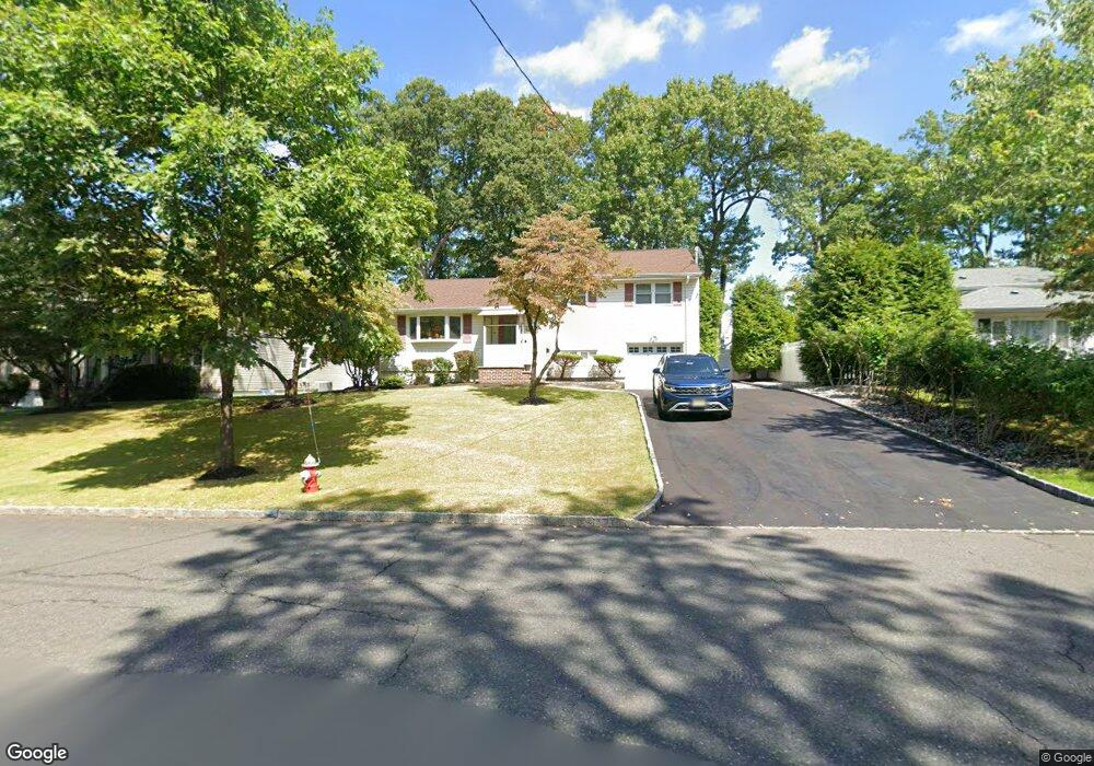
62 W Cedar St Livingston, NJ 07039
Estimated Value: $884,000 - $1,096,000
--
Bed
--
Bath
1,728
Sq Ft
$555/Sq Ft
Est. Value
About This Home
This home is located at 62 W Cedar St, Livingston, NJ 07039 and is currently estimated at $959,835, approximately $555 per square foot. 62 W Cedar St is a home located in Essex County with nearby schools including Livingston Sr High School and Aquinas Academy.
Ownership History
Date
Name
Owned For
Owner Type
Purchase Details
Closed on
Sep 17, 2004
Sold by
Youngman Catherine
Bought by
Chan Christina and Yee Deland
Current Estimated Value
Home Financials for this Owner
Home Financials are based on the most recent Mortgage that was taken out on this home.
Original Mortgage
$300,000
Outstanding Balance
$147,932
Interest Rate
5.81%
Estimated Equity
$811,903
Purchase Details
Closed on
Mar 22, 1996
Sold by
Maffei Christina
Bought by
Chae Hob and Chae Kay
Home Financials for this Owner
Home Financials are based on the most recent Mortgage that was taken out on this home.
Original Mortgage
$151,000
Interest Rate
7.39%
Create a Home Valuation Report for This Property
The Home Valuation Report is an in-depth analysis detailing your home's value as well as a comparison with similar homes in the area
Home Values in the Area
Average Home Value in this Area
Purchase History
| Date | Buyer | Sale Price | Title Company |
|---|---|---|---|
| Chan Christina | $375,000 | -- | |
| Chae Hob | $177,000 | -- |
Source: Public Records
Mortgage History
| Date | Status | Borrower | Loan Amount |
|---|---|---|---|
| Open | Chan Christina | $300,000 | |
| Previous Owner | Chae Hob | $151,000 |
Source: Public Records
Tax History Compared to Growth
Tax History
| Year | Tax Paid | Tax Assessment Tax Assessment Total Assessment is a certain percentage of the fair market value that is determined by local assessors to be the total taxable value of land and additions on the property. | Land | Improvement |
|---|---|---|---|---|
| 2025 | $11,469 | $483,500 | $285,300 | $198,200 |
| 2024 | $11,469 | $483,500 | $285,300 | $198,200 |
| 2022 | $11,280 | $483,500 | $285,300 | $198,200 |
| 2021 | $11,188 | $483,500 | $285,300 | $198,200 |
| 2020 | $10,980 | $483,500 | $285,300 | $198,200 |
| 2019 | $10,469 | $400,200 | $263,200 | $137,000 |
| 2018 | $10,329 | $400,200 | $263,200 | $137,000 |
| 2017 | $10,193 | $400,200 | $263,200 | $137,000 |
| 2016 | $10,005 | $400,200 | $263,200 | $137,000 |
| 2015 | $9,857 | $400,200 | $263,200 | $137,000 |
| 2014 | $9,537 | $400,200 | $263,200 | $137,000 |
Source: Public Records
Map
Nearby Homes
- 94 W Cedar St
- 35 Amelia Ave
- 35 Grand Terrace
- 74 Hillside Terrace
- 9 Spalding Dr
- 15 Highland Dr
- 21 Highland Dr
- 63 N Livingston Ave
- 61 Hazel Ave
- 22 Brookside Place
- 82 W Oakwood Ave
- 94 E Cedar St
- 106 Falcon Rd
- 44 Lincoln Ave
- 224 W Mount Pleasant Ave
- 23 Winans Rd
- 26 Bennington Rd
- 28 Lexington Dr
- 7 Rosedale Terrace
- 21 Maplewood Dr
- 60 W Cedar St
- 70 Virginia Ave
- 66 W Cedar St
- 68 Virginia Ave
- 56 W Cedar St
- 1 Hillside Terrace
- 66 Virginia Ave
- 61 W Cedar St
- 59 W Cedar St
- 54 W Cedar St
- 63 W Cedar St
- 69 Virginia Ave
- 64 Virginia Ave
- 53 S Mitchell Ave
- 5 Hillside Terrace
- 55 W Cedar St
- 65 W Cedar St
- 52 W Cedar St
- 67 Virginia Ave
- 70 W Cedar St