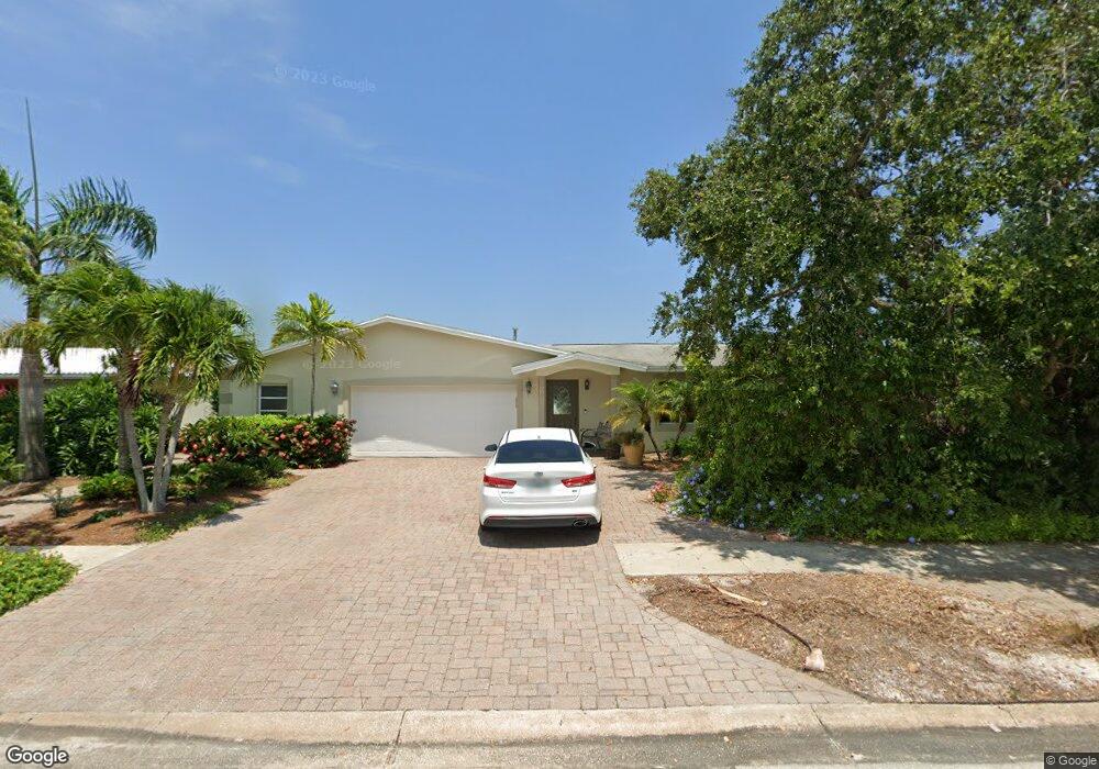
620 Albatross St Merritt Island, FL 32952
Estimated Value: $465,000 - $651,000
4
Beds
3
Baths
2,075
Sq Ft
$273/Sq Ft
Est. Value
About This Home
This home is located at 620 Albatross St, Merritt Island, FL 32952 and is currently estimated at $566,397, approximately $272 per square foot. 620 Albatross St is a home located in Brevard County with nearby schools including Audubon Elementary School, Thomas Jefferson Middle School, and Merritt Island High School.
Ownership History
Date
Name
Owned For
Owner Type
Purchase Details
Closed on
Nov 22, 2013
Sold by
Herrick Joan Tozer and Herrick Richard G
Bought by
Herrick Joan Tozer and Herrick Richard G
Current Estimated Value
Purchase Details
Closed on
May 2, 2006
Sold by
Herrick Joan Tozer and Herrick Richard G
Bought by
Herrick Joan Tozer
Home Financials for this Owner
Home Financials are based on the most recent Mortgage that was taken out on this home.
Original Mortgage
$178,000
Interest Rate
6.33%
Purchase Details
Closed on
Jan 20, 2005
Sold by
Herrick Joan T
Bought by
Herrick Joan Tozer
Create a Home Valuation Report for This Property
The Home Valuation Report is an in-depth analysis detailing your home's value as well as a comparison with similar homes in the area
Home Values in the Area
Average Home Value in this Area
Purchase History
| Date | Buyer | Sale Price | Title Company |
|---|---|---|---|
| Herrick Joan Tozer | -- | Attorney | |
| Herrick Joan Tozer | -- | Federal Title Ins Assoc Inc | |
| Herrick Joan Tozer | -- | -- |
Source: Public Records
Mortgage History
| Date | Status | Borrower | Loan Amount |
|---|---|---|---|
| Previous Owner | Herrick Joan Tozer | $178,000 |
Source: Public Records
Tax History Compared to Growth
Tax History
| Year | Tax Paid | Tax Assessment Tax Assessment Total Assessment is a certain percentage of the fair market value that is determined by local assessors to be the total taxable value of land and additions on the property. | Land | Improvement |
|---|---|---|---|---|
| 2025 | $699 | $241,440 | -- | -- |
| 2024 | $679 | $234,640 | -- | -- |
| 2023 | $679 | $227,810 | $0 | $0 |
| 2022 | $659 | $221,180 | $0 | $0 |
| 2021 | $638 | $214,740 | $0 | $0 |
| 2020 | $2,805 | $211,780 | $0 | $0 |
| 2019 | $2,822 | $207,020 | $0 | $0 |
| 2018 | $2,828 | $203,160 | $0 | $0 |
| 2017 | $2,853 | $198,990 | $0 | $0 |
| 2016 | $2,899 | $194,900 | $142,000 | $52,900 |
| 2015 | $2,979 | $193,550 | $142,000 | $51,550 |
| 2014 | $2,999 | $192,020 | $138,000 | $54,020 |
Source: Public Records
Map
Nearby Homes
- 1668 Oceana Dr
- 1675 Oceana Dr Unit 8
- 1545 Cunningham Ave
- 700 Milford Point Dr
- 1685 Savannah Dr
- 1515 Quince Ave
- 1510 Holly Ave
- 1585 Anchor Ln
- 1613 Dock St
- 397 Milford Point Dr
- 325 Simpson Cir
- 1455 Hannah Dr
- 1646 Fisherman's St
- 306 Mullet Ave
- 1395 Floral Ln
- 300 Waterfront Ave
- 365 Hula Cir
- 635 Barrett Dr
- 535 Barrett Dr
- 1425 Lester Ct
- 610 Albatross St
- 1705 Pelican Dr
- 1715 Pelican Dr
- 625 Albatross St
- 615 Albatross St
- 1700 Sandy Ct
- 605 Albatross St
- 1725 Pelican Dr
- 1665 Pelican Dr
- 1710 Sandy Ct
- 1665 Merrittana Dr
- 595 Albatross St
- 1690 Pelican Dr
- 1710 Pelican Dr
- 1680 Pelican Dr
- 1735 Pelican Dr
- 1720 Sandy Ct
- 1720 Pelican Dr
- 1670 Pelican Dr
- 1655 Pelican Dr