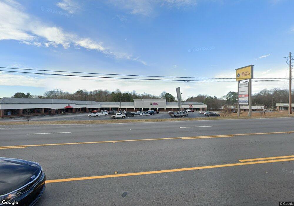
620 Big a Rd Toccoa, GA 30577
Estimated Value: $1,361,789
Studio
--
Bath
50,758
Sq Ft
$27/Sq Ft
Est. Value
About This Home
This home is located at 620 Big a Rd, Toccoa, GA 30577 and is currently estimated at $1,361,789, approximately $26 per square foot. 620 Big a Rd is a home located in Stephens County with nearby schools including Stephens County High School.
Ownership History
Date
Name
Owned For
Owner Type
Purchase Details
Closed on
Sep 21, 2018
Sold by
Fleming Drew
Bought by
Toccoa Plaza Llc
Current Estimated Value
Purchase Details
Closed on
May 18, 2016
Sold by
A & M Properties Llp
Bought by
Toccoa Ventures Llc
Purchase Details
Closed on
Aug 5, 2015
Sold by
Stephens Plaza E & A Llc
Bought by
A & M Properties Llp
Purchase Details
Closed on
Dec 23, 2014
Sold by
Cornerstone Bank
Bought by
A & M Properties Llp
Purchase Details
Closed on
May 29, 2008
Sold by
Brc Toccoa
Bought by
Bascomb Capital Llc
Purchase Details
Closed on
Oct 4, 2000
Sold by
Edens & Avant Financing Lp
Bought by
Stephens Plaza (E&A) Llc
Purchase Details
Closed on
Feb 11, 2000
Bought by
Stephens Plaza (E&A) Llc
Create a Home Valuation Report for This Property
The Home Valuation Report is an in-depth analysis detailing your home's value as well as a comparison with similar homes in the area
Purchase History
| Date | Buyer | Sale Price | Title Company |
|---|---|---|---|
| Toccoa Plaza Llc | $770,000 | -- | |
| Fleming Drew | -- | -- | |
| Toccoa Ventures Llc | -- | -- | |
| Toccoa Ventures Llc | $307,200 | -- | |
| A & M Properties Llp | -- | -- | |
| A & M Properties Llp | -- | -- | |
| Bascomb Capital Llc | $763,000 | -- | |
| Stephens Plaza (E&A) Llc | $1,335,500 | -- | |
| Stephens Plaza (E&A) Llc | -- | -- |
Source: Public Records
Tax History
| Year | Tax Paid | Tax Assessment Tax Assessment Total Assessment is a certain percentage of the fair market value that is determined by local assessors to be the total taxable value of land and additions on the property. | Land | Improvement |
|---|---|---|---|---|
| 2025 | $8,132 | $273,901 | $107,060 | $166,841 |
| 2024 | $9,765 | $273,901 | $107,060 | $166,841 |
| 2023 | $9,688 | $273,901 | $107,060 | $166,841 |
| 2022 | $8,154 | $273,901 | $107,060 | $166,841 |
| 2021 | $8,565 | $273,901 | $107,060 | $166,841 |
| 2020 | $8,650 | $273,901 | $107,060 | $166,841 |
| 2019 | $8,685 | $273,901 | $107,060 | $166,841 |
| 2018 | $6,308 | $198,943 | $107,060 | $91,883 |
Source: Public Records
Map
Nearby Homes
- 0 Hwy 17 Alt Unit 10577119
- 59 Sunset Ln
- 27 Hilltop Ln
- 481 Collins Rd
- 122 King St
- 45 Hayes St
- 9 Poplar St
- 229 Hilltop Ln
- 30 Moore Ave
- 0 Stephen Dr Unit 10662201
- 253 Stancil Dr
- 0 Valley Dr Unit 10600268
- 148 Moreland Dr
- 128 Branch St
- 109 Schaefer Ct
- 239 E Doyle St
- 43 Mountain View Dr
- 110 Valley Rd
- 29 Mountain View Dr
- 1168 Rosedale St
- 752 Big a Rd
- 335 Big a Rd
- 530 Skyview Ln
- 528 Skyview Ln
- 708 Big a Rd
- 506 Skyview Ln
- 655 Big a Rd Unit 669
- 655 Big a Rd
- 36 Alley St
- 525 Skyview Ln Unit PT Lts 39-41
- 525 Skyview Ln
- 748 Big a Rd
- 669 Big a Rd
- 486 Skyview Ln
- 605 Big a Rd
- 695 Big a Rd
- 509 Skyview Ln
- 468 Skyview Ln
- 718 Davis Ave
- 116 Norwood Ave
Your Personal Tour Guide
Ask me questions while you tour the home.