
Seller's Agent in 2025
Jeff Bockrath
RE/MAX
(419) 704-7373
4 in this area
195 Total Sales

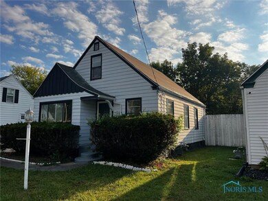
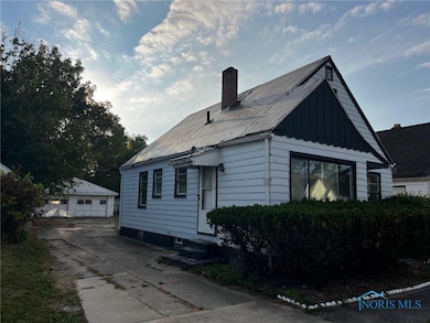
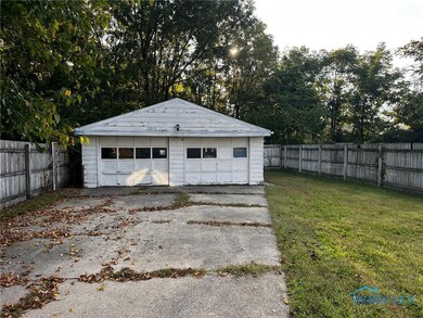
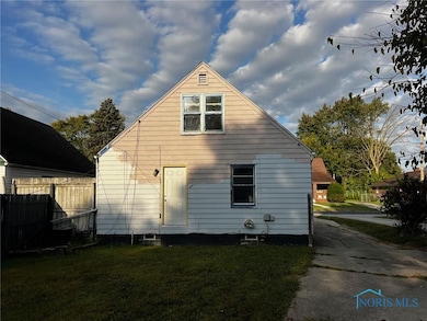
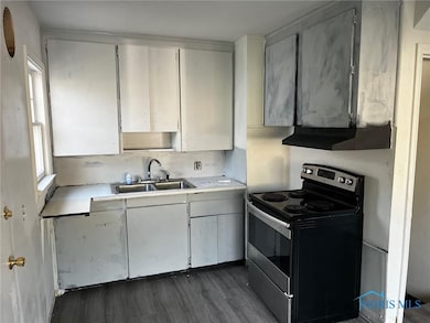
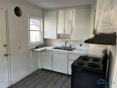
This 3-bedroom, 1-bath home with a full basement and 2-car garage is ready for your vision and improvements. The property offers solid potential with plenty of space to make it your own. Home is in need of updates, including a new roof (currently tarped). With some work, this could be the perfect home or a fantastic addition to your investment portfolio. First look period for owner occupied buyers, Investor offers will be entertained after 21 days.
Last Agent to Sell the Property
RE/MAX Preferred Associates License #2002009057 Listed on: 09/18/2025
| Date | Type | Sale Price | Title Company |
|---|---|---|---|
| Special Warranty Deed | $47,000 | Prl Title Trust | |
| Sheriffs Deed | $41,057 | None Listed On Document | |
| Interfamily Deed Transfer | -- | Attorney | |
| Deed | $33,500 | -- |
| Date | Status | Loan Amount | Loan Type |
|---|---|---|---|
| Previous Owner | $32,495 | New Conventional |
| Date | Event | Price | List to Sale | Price per Sq Ft |
|---|---|---|---|---|
| 10/22/2025 10/22/25 | Sold | $47,000 | -21.5% | $48 / Sq Ft |
| 10/15/2025 10/15/25 | Off Market | $59,900 | -- | -- |
| 10/10/2025 10/10/25 | Pending | -- | -- | -- |
| 10/09/2025 10/09/25 | Pending | -- | -- | -- |
| 09/18/2025 09/18/25 | For Sale | $59,900 | -- | $61 / Sq Ft |
| Year | Tax Paid | Tax Assessment Tax Assessment Total Assessment is a certain percentage of the fair market value that is determined by local assessors to be the total taxable value of land and additions on the property. | Land | Improvement |
|---|---|---|---|---|
| 2024 | $586 | $17,605 | $4,200 | $13,405 |
| 2023 | $971 | $13,650 | $2,310 | $11,340 |
| 2022 | $954 | $13,650 | $2,310 | $11,340 |
| 2021 | $987 | $13,650 | $2,310 | $11,340 |
| 2020 | $1,050 | $12,775 | $2,170 | $10,605 |
| 2019 | $1,018 | $12,775 | $2,170 | $10,605 |
| 2018 | $1,029 | $12,775 | $2,170 | $10,605 |
| 2017 | $1,023 | $12,495 | $2,135 | $10,360 |
| 2016 | $1,031 | $35,700 | $6,100 | $29,600 |
| 2015 | $1,042 | $35,700 | $6,100 | $29,600 |
| 2014 | $786 | $12,500 | $2,140 | $10,360 |
| 2013 | $786 | $12,500 | $2,140 | $10,360 |
Seller's Agent in 2025
Jeff Bockrath
RE/MAX
(419) 704-7373
4 in this area
195 Total Sales
W
Buyer's Agent in 2025
Whitney Barlow
Serenity Realty LLC
(419) 708-1618
5 in this area
108 Total Sales
Source: Northwest Ohio Real Estate Information Service (NORIS)
MLS Number: 6136000
APN: 20-54504
Disclaimer: Certain information contained herein is derived from information provided by parties other than Homes.com. All information provided is deemed reliable, but is not guaranteed to be accurate and should be independently verified.
![]() IDX information is provided exclusively for personal, non-commercial use, and may not be used for any purpose other than to identify prospective properties consumers may be interested in purchasing. Information is deemed reliable but not guaranteed. ©2025 NORIS. All rights reserved.
IDX information is provided exclusively for personal, non-commercial use, and may not be used for any purpose other than to identify prospective properties consumers may be interested in purchasing. Information is deemed reliable but not guaranteed. ©2025 NORIS. All rights reserved.