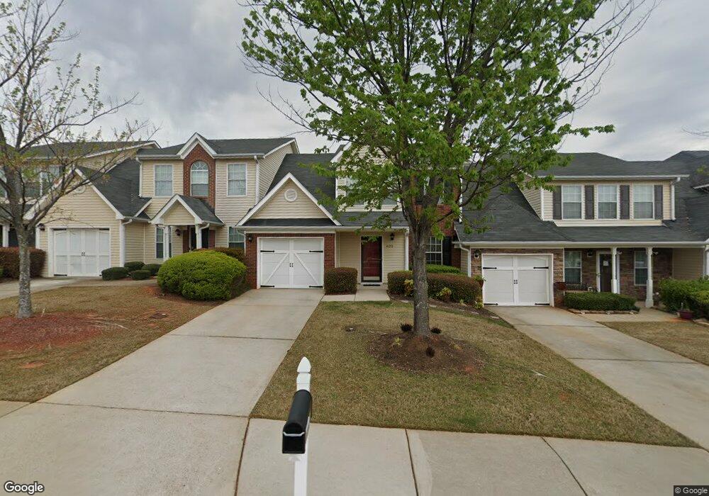
620 City Park Dr McDonough, GA 30252
Estimated Value: $232,000 - $250,000
3
Beds
3
Baths
1,860
Sq Ft
$129/Sq Ft
Est. Value
About This Home
This home is located at 620 City Park Dr, McDonough, GA 30252 and is currently estimated at $240,657, approximately $129 per square foot. 620 City Park Dr is a home located in Henry County with nearby schools including Tussahaw Elementary School, McDonough Middle School, and McDonough Methodist Academy.
Ownership History
Date
Name
Owned For
Owner Type
Purchase Details
Closed on
Apr 30, 2009
Sold by
Opteum Mtg Acceptance Corp 20
Bought by
Reynolds Terry Y
Current Estimated Value
Home Financials for this Owner
Home Financials are based on the most recent Mortgage that was taken out on this home.
Original Mortgage
$65,786
Outstanding Balance
$41,251
Interest Rate
4.79%
Mortgage Type
FHA
Estimated Equity
$199,406
Purchase Details
Closed on
Sep 2, 2008
Sold by
Kelly Cathy
Bought by
Opteum Mtg Acceptance Corp 20
Create a Home Valuation Report for This Property
The Home Valuation Report is an in-depth analysis detailing your home's value as well as a comparison with similar homes in the area
Home Values in the Area
Average Home Value in this Area
Purchase History
| Date | Buyer | Sale Price | Title Company |
|---|---|---|---|
| Reynolds Terry Y | $67,000 | -- | |
| Opteum Mtg Acceptance Corp 20 | $107,489 | -- |
Source: Public Records
Mortgage History
| Date | Status | Borrower | Loan Amount |
|---|---|---|---|
| Open | Reynolds Terry Y | $65,786 |
Source: Public Records
Tax History Compared to Growth
Tax History
| Year | Tax Paid | Tax Assessment Tax Assessment Total Assessment is a certain percentage of the fair market value that is determined by local assessors to be the total taxable value of land and additions on the property. | Land | Improvement |
|---|---|---|---|---|
| 2025 | $3,188 | $110,040 | $12,000 | $98,040 |
| 2024 | $3,188 | $101,080 | $10,000 | $91,080 |
| 2023 | $2,436 | $98,920 | $10,000 | $88,920 |
| 2022 | $2,552 | $81,200 | $10,000 | $71,200 |
| 2021 | $2,066 | $61,400 | $10,000 | $51,400 |
| 2020 | $1,942 | $56,480 | $8,000 | $48,480 |
| 2019 | $1,900 | $53,480 | $9,600 | $43,880 |
| 2018 | $1,593 | $44,680 | $4,800 | $39,880 |
| 2016 | $1,254 | $35,800 | $4,000 | $31,800 |
| 2015 | $1,020 | $29,280 | $4,000 | $25,280 |
| 2014 | $864 | $25,960 | $4,000 | $21,960 |
Source: Public Records
Map
Nearby Homes
- 720 City Park Dr
- 1910 Towne Park Dr Unit 1
- 935 City Park Dr
- 4120 Springvale Way
- 5155 Towne Park Dr
- 1750 Courtyard Ln
- 8145 Chapman Terrace
- 7085 Duncan Walk
- 7055 Duncan Walk
- 1805 Midcourt Way Unit 3
- 0 Racetrack Rd Unit 8856448
- 1330 Lafayette Square
- 1765 Neighborhood Walk
- 6195 Winston Trace
- Braddock Plan at Anderson Point - Estates
- Liston Plan at Anderson Point - Estates
- Tunney Plan at Anderson Point - Estates
- Dempsey Plan at Anderson Point - Estates
- Frazier Plan at Anderson Point - Estates
- 2075 Tussahaw Crossing
- 610 City Park Dr
- 630 City Park Dr
- 600 City Park Dr
- 650 City Park Dr Unit 83
- 650 City Park Dr
- 540 City Park Dr
- 3020 Village Run Dr
- 3010 Village Run Dr
- 3030 Village Run Dr
- 3000 Village Run Dr
- 3000 Village Run Dr Unit 167
- 3040 Village Run Dr
- 3040 Village Run Dr
- 700 City Park Dr
- 3050 Village Run Dr
- 2050 Village Run Dr
- 520 City Park Dr
- 710 City Park Dr
- 2040 Village Run Dr Unit 68
- 2040 Village Run Dr