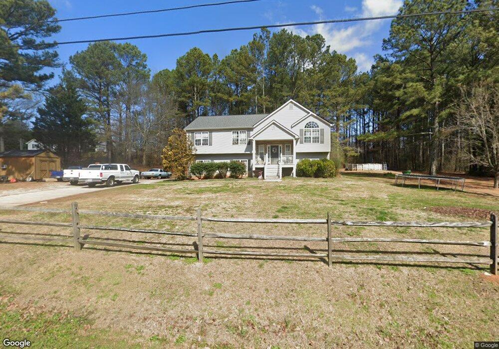
620 Cown Rd Temple, GA 30179
Estimated Value: $268,022 - $306,000
3
Beds
2
Baths
1,553
Sq Ft
$185/Sq Ft
Est. Value
About This Home
This home is located at 620 Cown Rd, Temple, GA 30179 and is currently estimated at $287,006, approximately $184 per square foot. 620 Cown Rd is a home located in Carroll County with nearby schools including Providence Elementary School, Temple Middle School, and Temple High School.
Ownership History
Date
Name
Owned For
Owner Type
Purchase Details
Closed on
Aug 1, 2007
Sold by
Collier Bruce D
Bought by
Gill Peggy S
Current Estimated Value
Home Financials for this Owner
Home Financials are based on the most recent Mortgage that was taken out on this home.
Original Mortgage
$153,600
Outstanding Balance
$107,127
Interest Rate
6.56%
Mortgage Type
New Conventional
Estimated Equity
$179,879
Purchase Details
Closed on
May 18, 2006
Sold by
Not Provided
Bought by
Gill Peggy S
Purchase Details
Closed on
Jul 24, 2003
Sold by
Collier Bruce D
Bought by
Collier Bruce D and Collier Belinda F
Purchase Details
Closed on
Mar 1, 2002
Sold by
Xanadu Homes Inc
Bought by
Collier Bruce D
Purchase Details
Closed on
Sep 26, 2001
Sold by
Westbrook R Te
Bought by
Xanadu Homes Inc
Purchase Details
Closed on
Aug 21, 2001
Sold by
Xanadu Homes Inc
Bought by
Xanadu Homes Inc
Create a Home Valuation Report for This Property
The Home Valuation Report is an in-depth analysis detailing your home's value as well as a comparison with similar homes in the area
Home Values in the Area
Average Home Value in this Area
Purchase History
| Date | Buyer | Sale Price | Title Company |
|---|---|---|---|
| Gill Peggy S | $151,300 | -- | |
| Gill Peggy S | -- | -- | |
| Collier Bruce D | -- | -- | |
| Collier Bruce D | $121,000 | -- | |
| Xanadu Homes Inc | $17,000 | -- | |
| Xanadu Homes Inc | -- | -- |
Source: Public Records
Mortgage History
| Date | Status | Borrower | Loan Amount |
|---|---|---|---|
| Open | Gill Peggy S | $153,600 |
Source: Public Records
Tax History
| Year | Tax Paid | Tax Assessment Tax Assessment Total Assessment is a certain percentage of the fair market value that is determined by local assessors to be the total taxable value of land and additions on the property. | Land | Improvement |
|---|---|---|---|---|
| 2025 | $1,927 | $107,877 | $7,108 | $100,769 |
| 2024 | $1,949 | $107,877 | $7,108 | $100,769 |
| 2023 | $1,949 | $97,986 | $5,686 | $92,300 |
| 2022 | $1,602 | $77,830 | $3,791 | $74,039 |
| 2021 | $1,437 | $66,486 | $3,033 | $63,453 |
| 2020 | $1,318 | $59,825 | $2,757 | $57,068 |
| 2019 | $1,239 | $54,915 | $2,757 | $52,158 |
| 2018 | $1,140 | $48,581 | $2,577 | $46,004 |
| 2017 | $1,143 | $48,581 | $2,577 | $46,004 |
| 2016 | $1,144 | $48,581 | $2,577 | $46,004 |
| 2015 | $1,114 | $43,822 | $6,800 | $37,022 |
| 2014 | $1,118 | $43,822 | $6,800 | $37,022 |
Source: Public Records
Map
Nearby Homes
- 147 Camp Godwin Rd
- 139 Clover Ct
- 101 Robindale Ln
- 133 Pebblebrook Way
- 1021 Cown Rd
- 18 Holder Rd
- 604 Meadows Ct
- 732 Newport Dr
- 380 River Trace Dr
- 180 Labelle Rd
- 480 Taylors Gin Rd
- 413 Remington Ct
- 10 Leslie Ln
- 118 Raven Rd
- 204 Winchester Dr
- 1162 E Highway 78
- 10 S Villa Rd
- 158 N Villa Rd
- 122 Wesley Chapel Ln
- 126 Old Villa Rica Rd
- 0 Long Branch Rd Unit 7551869
- 650 Cown Rd
- 604 Cown Rd
- 668 Cown Rd
- 545 Miller Agan Rd
- 637 Cown Rd
- 589 Cown Rd
- 588 Cown Rd
- 568 Miller Agan Rd
- 493 Miller Agan Rd
- 493 Miller Agan Rd
- 486 Long Branch Rd
- 684 Cown Rd
- 679 Cown Rd
- 698 Cown Rd
- 462 Long Branch Rd
- 430 Long Branch Rd
- 705 Cown Rd
- 421 Long Branch Rd
- 460 Miller Agan Rd
Your Personal Tour Guide
Ask me questions while you tour the home.