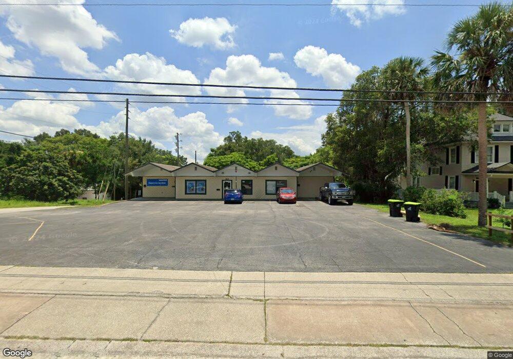
620 E New York Ave Deland, FL 32724
Estimated Value: $436,101
--
Bed
3
Baths
3,008
Sq Ft
$145/Sq Ft
Est. Value
About This Home
This home is located at 620 E New York Ave, Deland, FL 32724 and is currently estimated at $436,101, approximately $144 per square foot. 620 E New York Ave is a home located in Volusia County with nearby schools including Blue Lake Elementary School, Deland High School, and Deland Middle School.
Ownership History
Date
Name
Owned For
Owner Type
Purchase Details
Closed on
Nov 19, 2020
Sold by
Skolfield Donald
Bought by
Jackman Diane and Strout Amy
Current Estimated Value
Purchase Details
Closed on
Dec 31, 2017
Sold by
Di Don Llc
Bought by
Skolfield Donald
Purchase Details
Closed on
Oct 17, 2016
Sold by
Swallows Levi Sanders
Bought by
Di Don Llc
Purchase Details
Closed on
Nov 26, 2008
Sold by
Swallows Levi S and Swallows Mary Lois
Bought by
Swallows Levi Sanders and Swallows Family Trust
Purchase Details
Closed on
Dec 15, 1978
Bought by
Swallows Levi Sanders Tr
Create a Home Valuation Report for This Property
The Home Valuation Report is an in-depth analysis detailing your home's value as well as a comparison with similar homes in the area
Home Values in the Area
Average Home Value in this Area
Purchase History
| Date | Buyer | Sale Price | Title Company |
|---|---|---|---|
| Jackman Diane | -- | None Available | |
| Skolfield Donald | -- | Coast Title Of West Volusia | |
| Di Don Llc | $225,000 | Coast Title Of West Volusia | |
| Swallows Levi Sanders | -- | Attorney | |
| Swallows Levi Sanders Tr | $45,000 | -- |
Source: Public Records
Tax History Compared to Growth
Tax History
| Year | Tax Paid | Tax Assessment Tax Assessment Total Assessment is a certain percentage of the fair market value that is determined by local assessors to be the total taxable value of land and additions on the property. | Land | Improvement |
|---|---|---|---|---|
| 2025 | $5,307 | $324,978 | $46,283 | $278,695 |
| 2024 | $5,307 | $311,023 | $46,283 | $264,740 |
| 2023 | $5,307 | $295,018 | $45,441 | $249,577 |
| 2022 | $4,879 | $262,180 | $44,600 | $217,580 |
| 2021 | $4,723 | $229,889 | $42,917 | $186,972 |
| 2020 | $4,797 | $232,787 | $42,917 | $189,870 |
| 2019 | $4,714 | $218,363 | $39,551 | $178,812 |
| 2018 | $4,799 | $213,179 | $37,868 | $175,311 |
| 2017 | $4,408 | $189,032 | $37,868 | $151,164 |
| 2016 | $1,808 | $78,719 | $0 | $0 |
| 2015 | $1,780 | $75,045 | $0 | $0 |
| 2014 | $1,797 | $74,006 | $0 | $0 |
Source: Public Records
Map
Nearby Homes
- 139 N Boston Ave
- 524 E Church St
- 502 E Howry Ave
- 135 S Arlington Ave
- 449 E Church St
- 455 E Church St
- 443, 449 & 455 E Church St
- 322 N Frankfort Ave
- 330 E Wisconsin Ave
- 1301 E Wisconsin Ave
- 137 S Chandler Ave
- 0 E Wisconsin Ave Unit MFRO6190518
- 230 S Chandler Ave
- 141 N McDonald Ave
- 345 E Church St
- 406 N Kentucky Ave
- 419 N Frankfort Ave
- 706 E Minnesota Ave Unit C
- 708 E Walts Ave
- 701 Boston Ct
- 610 E New York Ave
- 638 E New York Ave
- 115 S Frankfort Ave
- 619 E New York Ave
- 625 E New York Ave
- 613 E New York Ave
- 646 E New York Ave
- 127 S Frankfort Ave
- 131 S Frankfort Ave
- 118 S Boston Ave
- 120 S Boston Ave
- 614 E Indiana Ave
- 618 E Indiana Ave
- 622 E Indiana Ave
- 606 E Indiana Ave
- 135 S Frankfort Ave
- 626 E Indiana Ave
- 130 S Boston Ave
- 133 N Kentucky Ave
- 0 E Georgia Ave