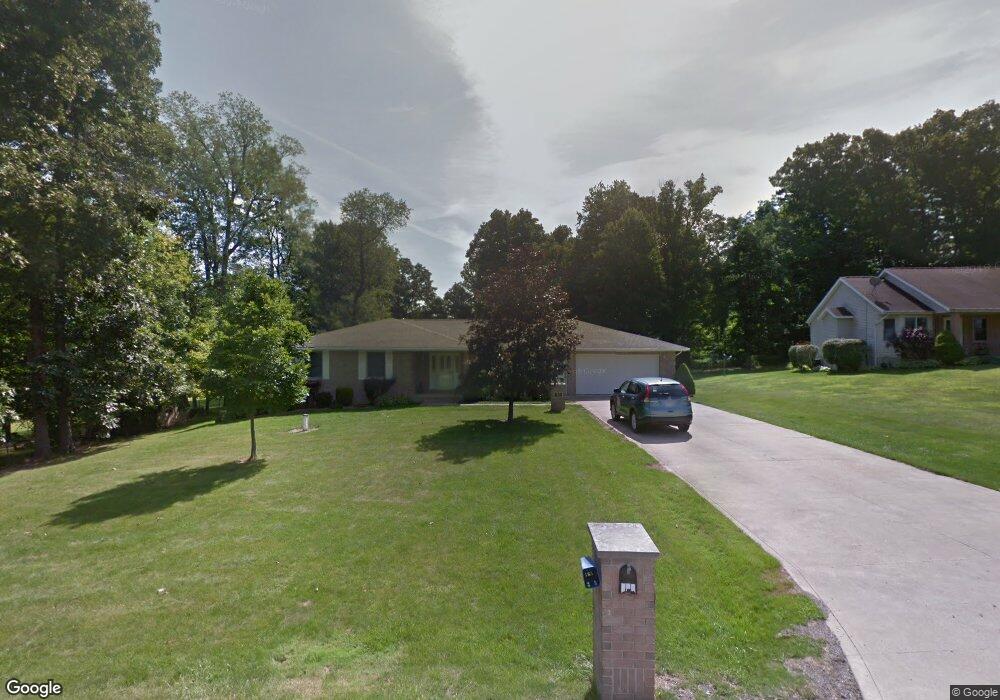
620 Inwood Dr Mansfield, OH 44903
Estimated Value: $226,000 - $322,000
3
Beds
3
Baths
1,763
Sq Ft
$157/Sq Ft
Est. Value
About This Home
This home is located at 620 Inwood Dr, Mansfield, OH 44903 and is currently estimated at $276,282, approximately $156 per square foot. 620 Inwood Dr is a home located in Richland County with nearby schools including Madison High School, St. Mary Catholic School, and Temple-Christian School.
Ownership History
Date
Name
Owned For
Owner Type
Purchase Details
Closed on
Mar 8, 2012
Sold by
Shade Vicky L
Bought by
Shade Danny E
Current Estimated Value
Purchase Details
Closed on
Aug 13, 2003
Sold by
Shade Danny E and Shade Vicky L
Bought by
Shade Danny E and Shade Vicky L
Purchase Details
Closed on
Jun 3, 2002
Sold by
Bauer William A
Bought by
Shade Danny E
Home Financials for this Owner
Home Financials are based on the most recent Mortgage that was taken out on this home.
Original Mortgage
$100,000
Interest Rate
7%
Mortgage Type
Balloon
Create a Home Valuation Report for This Property
The Home Valuation Report is an in-depth analysis detailing your home's value as well as a comparison with similar homes in the area
Home Values in the Area
Average Home Value in this Area
Purchase History
| Date | Buyer | Sale Price | Title Company |
|---|---|---|---|
| Shade Danny E | -- | None Available | |
| Shade Danny E | -- | -- | |
| Shade Danny E | $166,000 | -- |
Source: Public Records
Mortgage History
| Date | Status | Borrower | Loan Amount |
|---|---|---|---|
| Closed | Shade Danny E | $100,000 |
Source: Public Records
Tax History Compared to Growth
Tax History
| Year | Tax Paid | Tax Assessment Tax Assessment Total Assessment is a certain percentage of the fair market value that is determined by local assessors to be the total taxable value of land and additions on the property. | Land | Improvement |
|---|---|---|---|---|
| 2024 | $4,741 | $72,620 | $13,070 | $59,550 |
| 2023 | $4,515 | $72,620 | $13,070 | $59,550 |
| 2022 | $4,336 | $64,680 | $12,750 | $51,930 |
| 2021 | $4,202 | $64,680 | $12,750 | $51,930 |
| 2020 | $3,274 | $64,680 | $12,750 | $51,930 |
| 2019 | $2,725 | $54,820 | $10,800 | $44,020 |
| 2018 | $2,702 | $54,820 | $10,800 | $44,020 |
| 2017 | $2,400 | $54,820 | $10,800 | $44,020 |
| 2016 | $2,149 | $44,250 | $8,950 | $35,300 |
| 2015 | $2,114 | $44,250 | $8,950 | $35,300 |
| 2014 | $2,106 | $44,250 | $8,950 | $35,300 |
| 2012 | $1,070 | $48,090 | $9,720 | $38,370 |
Source: Public Records
Map
Nearby Homes
- 0 Satinwood Dr
- 598 Impala Dr
- 630 Impala Dr
- 2641 State Route 430
- 2495 Emma Ln
- 2750 Lutz Ave
- 2270 Lakecrest Dr Unit 2272
- 640 Running Brook Way
- 0 McBride Road Parcel # 1 Unit 9066028
- 609 Mcbride Rd
- 0 Peterson Rd
- 641 Laver Rd
- 1910 Crider Rd
- 1997 Hout Rd
- 76 Ford Rd N
- 76 Ford Rd N Unit 20
- 1806 Richard Dr
- 1951 Woodmont Rd
- 0 Mcelroy Rd
- 2331 Fleming Falls Rd
- 610 Inwood Dr
- 2492 Bryonaire Rd
- 2506 Bryonaire Rd
- 600 Inwood Dr
- 619 Inwood Dr
- 2480 Bryonaire Rd
- 2510 Bryonaire Rd
- 599 Inwood Dr
- 590 Inwood Dr
- 2472 Bryonaire Rd
- 2512 Bryonaire Rd
- 589 Inwood Dr
- 2507 Bryonaire Rd
- 2464 Bryonaire Rd
- 2501 Bryonaire Rd
- 2491 Bryonaire Rd
- 2511 Bryonaire Rd
- 2481 Bryonaire Rd
- 2514 Bryonaire Dr
- 2514 Bryonaire Rd