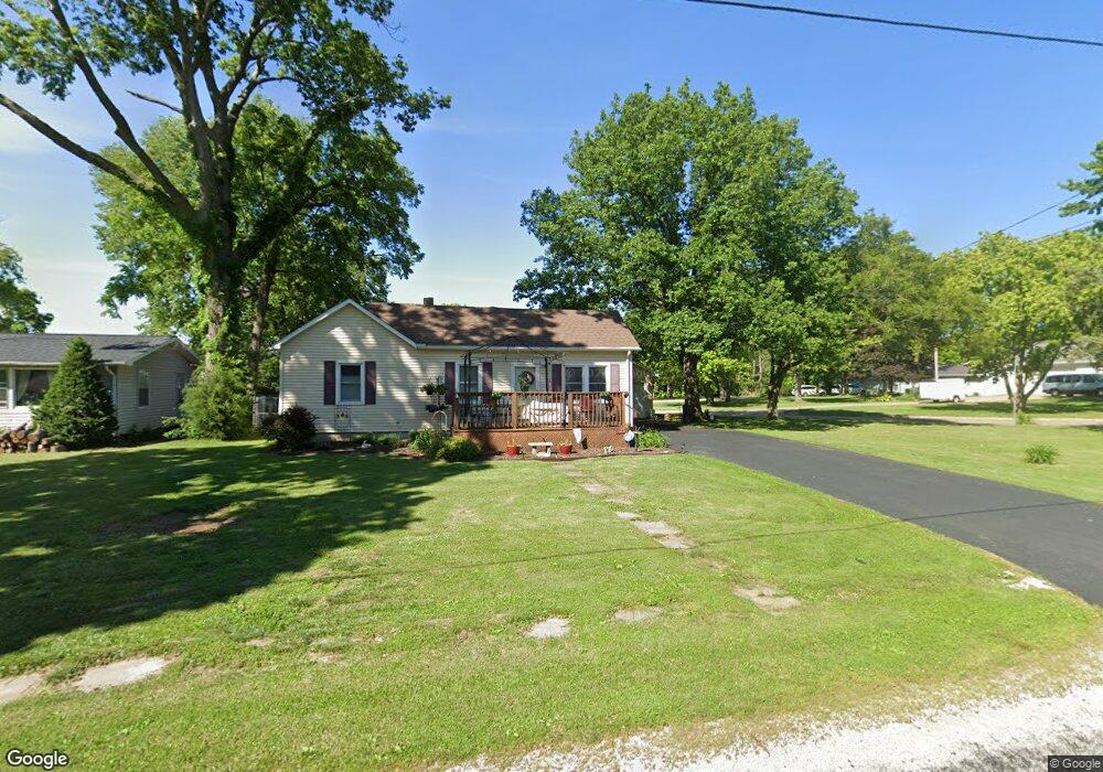
620 Maple St Mount Zion, IL 62549
Estimated Value: $119,716 - $153,000
Studio
--
Bath
1,232
Sq Ft
$115/Sq Ft
Est. Value
About This Home
This home is located at 620 Maple St, Mount Zion, IL 62549 and is currently estimated at $141,179, approximately $114 per square foot. 620 Maple St is a home located in Macon County with nearby schools including McGaughey Elementary School, Mt. Zion Elementary School, and Mt. Zion Intermediate School.
Create a Home Valuation Report for This Property
The Home Valuation Report is an in-depth analysis detailing your home's value as well as a comparison with similar homes in the area
Home Values in the Area
Average Home Value in this Area
Tax History
| Year | Tax Paid | Tax Assessment Tax Assessment Total Assessment is a certain percentage of the fair market value that is determined by local assessors to be the total taxable value of land and additions on the property. | Land | Improvement |
|---|---|---|---|---|
| 2024 | $2,287 | $35,304 | $4,839 | $30,465 |
| 2023 | $2,191 | $32,835 | $4,501 | $28,334 |
| 2022 | $2,081 | $31,143 | $4,269 | $26,874 |
| 2021 | $1,999 | $29,177 | $4,000 | $25,177 |
| 2020 | $503 | $11,895 | $3,868 | $8,027 |
| 2019 | $503 | $11,895 | $3,868 | $8,027 |
| 2018 | $476 | $11,591 | $3,769 | $7,822 |
| 2017 | $460 | $11,369 | $3,697 | $7,672 |
| 2016 | $448 | $11,172 | $3,633 | $7,539 |
| 2015 | $428 | $11,061 | $3,597 | $7,464 |
| 2014 | $416 | $11,061 | $3,597 | $7,464 |
| 2013 | $418 | $11,061 | $3,597 | $7,464 |
Source: Public Records
Map
Nearby Homes
- 210 Bell Ct
- 524 Elm St
- 635 Mill St
- 300 South Dr
- 355 S Henderson St
- 645 Pearl Ct
- 625 Fawn Ct
- Lot 20 Jeffrey Ln
- 645 S Antler Dr
- 1065 Country Manor
- 1354 Kays Ct
- 3930 S Mount Zion Rd
- 9 Blakeridge Place
- 1820 Buckhead Ln
- 3335 S Mount Zion Rd
- Lot 32 Janine Way
- Lot 3 Fletcher Ln
- Lot 1 Fletcher Ln
- 1935 Buckhead Ct
- 2110 Buckhead Ln
Your Personal Tour Guide
Ask me questions while you tour the home.