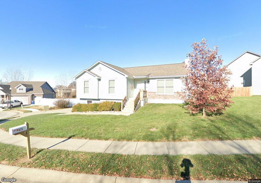
620 Patrick Dr Excelsior Springs, MO 64024
Estimated Value: $267,000 - $307,000
3
Beds
2
Baths
1,337
Sq Ft
$216/Sq Ft
Est. Value
About This Home
This home is located at 620 Patrick Dr, Excelsior Springs, MO 64024 and is currently estimated at $289,027, approximately $216 per square foot. 620 Patrick Dr is a home located in Clay County with nearby schools including Excelsior Springs High School.
Ownership History
Date
Name
Owned For
Owner Type
Purchase Details
Closed on
Oct 24, 2006
Sold by
Turner Larry E and Turner Sandra J
Bought by
Clevenger Charles J and Clevenger Staci D
Current Estimated Value
Home Financials for this Owner
Home Financials are based on the most recent Mortgage that was taken out on this home.
Original Mortgage
$139,410
Outstanding Balance
$82,959
Interest Rate
6.41%
Mortgage Type
Purchase Money Mortgage
Estimated Equity
$206,068
Purchase Details
Closed on
Feb 5, 2004
Sold by
North Valley Homes Inc
Bought by
Turner Larry E and Bledsoe Sandra J
Home Financials for this Owner
Home Financials are based on the most recent Mortgage that was taken out on this home.
Original Mortgage
$111,120
Interest Rate
3.75%
Mortgage Type
Purchase Money Mortgage
Purchase Details
Closed on
Jan 17, 2003
Sold by
Pursell Holdings Llc
Bought by
North Valley Homes Inc
Home Financials for this Owner
Home Financials are based on the most recent Mortgage that was taken out on this home.
Original Mortgage
$129,700
Interest Rate
6%
Mortgage Type
Construction
Create a Home Valuation Report for This Property
The Home Valuation Report is an in-depth analysis detailing your home's value as well as a comparison with similar homes in the area
Home Values in the Area
Average Home Value in this Area
Purchase History
| Date | Buyer | Sale Price | Title Company |
|---|---|---|---|
| Clevenger Charles J | -- | Chicago Title | |
| Turner Larry E | -- | United Title Company Inc | |
| North Valley Homes Inc | -- | United Title Company Inc |
Source: Public Records
Mortgage History
| Date | Status | Borrower | Loan Amount |
|---|---|---|---|
| Open | Clevenger Charles J | $139,410 | |
| Previous Owner | Turner Larry E | $111,120 | |
| Previous Owner | North Valley Homes Inc | $129,700 |
Source: Public Records
Tax History Compared to Growth
Tax History
| Year | Tax Paid | Tax Assessment Tax Assessment Total Assessment is a certain percentage of the fair market value that is determined by local assessors to be the total taxable value of land and additions on the property. | Land | Improvement |
|---|---|---|---|---|
| 2025 | $2,699 | $42,690 | -- | -- |
| 2024 | $2,699 | $38,490 | -- | -- |
| 2023 | $2,683 | $38,490 | $0 | $0 |
| 2022 | $2,284 | $32,240 | $0 | $0 |
| 2021 | $2,293 | $32,243 | $3,800 | $28,443 |
| 2020 | $2,166 | $29,600 | $0 | $0 |
| 2019 | $2,164 | $29,600 | $0 | $0 |
| 2018 | $2,066 | $28,180 | $0 | $0 |
| 2017 | $1,966 | $27,490 | $4,180 | $23,310 |
| 2016 | $1,966 | $27,490 | $4,180 | $23,310 |
| 2015 | $1,984 | $27,490 | $4,180 | $23,310 |
| 2014 | $2,002 | $27,490 | $4,180 | $23,310 |
Source: Public Records
Map
Nearby Homes
- 606 Patrick Dr
- 0 Mccleary Rd Unit HMS2499816
- 1801 Rainbow Dr
- 1701 Birch St
- 2407 Merlot Place
- 2210 Piedmont Place
- 2305 Arbor Ln
- 1219 Paton St
- 2021 Riverstone Dr
- 12409 Morgan St
- 220 Rock Bridge Pkwy
- 240 Rock Bridge Pkwy
- 2081 Rock Bridge Pkwy
- 125 Crown Hill Rd
- 12111 County Fair Cir
- 130 Kevin St
- 206 Crest Dr
- 111 Collette St
- 106 Sunset Ln
- 117 Kevin St
- 618 Patrick Dr
- 616 Patrick Dr
- 614 Caitlin Ct
- 624 Patrick Dr
- 619 Patrick Dr
- 615 Patrick Dr
- 617 Patrick Dr
- 613 Patrick Dr
- 611 Patrick Dr
- 609 Patrick Dr
- 608 Patrick Dr
- 607 Patrick Dr
- 2023 Buckeye Ct
- 2025 Buckeye Ct
- 605 Patrick Dr
- 2013 W Springs Way
- 2019 W Springs Way
- 603 Patrick Dr
- 2001 W Springs Way
- 2005 W Springs Way