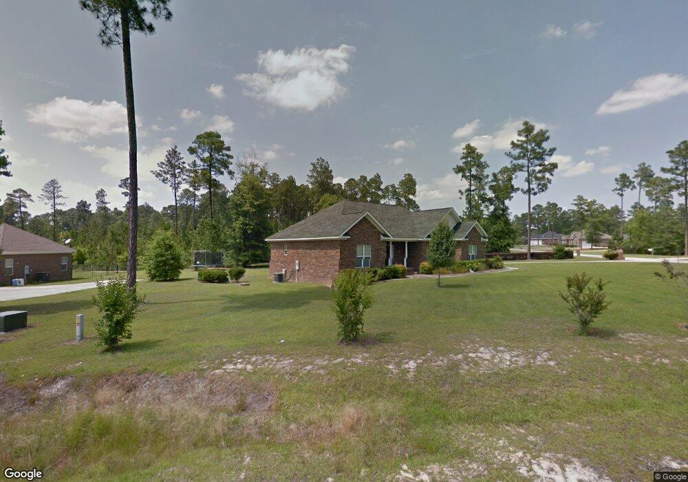
620 Patrick Way Statesboro, GA 30458
Estimated Value: $367,000 - $388,000
3
Beds
2
Baths
2,268
Sq Ft
$166/Sq Ft
Est. Value
About This Home
This home is located at 620 Patrick Way, Statesboro, GA 30458 and is currently estimated at $375,773, approximately $165 per square foot. 620 Patrick Way is a home located in Bulloch County with nearby schools including Julia P. Bryant Elementary School, Statesboro High School, and William James Middle School.
Ownership History
Date
Name
Owned For
Owner Type
Purchase Details
Closed on
May 10, 2006
Sold by
Not Provided
Bought by
Crapse Fred J and Crapse Carol A
Current Estimated Value
Home Financials for this Owner
Home Financials are based on the most recent Mortgage that was taken out on this home.
Original Mortgage
$86,000
Outstanding Balance
$49,836
Interest Rate
6.41%
Mortgage Type
New Conventional
Estimated Equity
$325,937
Purchase Details
Closed on
Mar 1, 2003
Bought by
Martin Builders
Create a Home Valuation Report for This Property
The Home Valuation Report is an in-depth analysis detailing your home's value as well as a comparison with similar homes in the area
Home Values in the Area
Average Home Value in this Area
Purchase History
| Date | Buyer | Sale Price | Title Company |
|---|---|---|---|
| Crapse Fred J | -- | -- | |
| Martin Builders | -- | -- |
Source: Public Records
Mortgage History
| Date | Status | Borrower | Loan Amount |
|---|---|---|---|
| Open | Crapse Fred J | $86,000 |
Source: Public Records
Tax History Compared to Growth
Tax History
| Year | Tax Paid | Tax Assessment Tax Assessment Total Assessment is a certain percentage of the fair market value that is determined by local assessors to be the total taxable value of land and additions on the property. | Land | Improvement |
|---|---|---|---|---|
| 2024 | $2,894 | $137,840 | $20,000 | $117,840 |
| 2023 | $2,887 | $126,280 | $12,000 | $114,280 |
| 2022 | $2,274 | $110,262 | $10,600 | $99,662 |
| 2021 | $1,991 | $95,114 | $10,600 | $84,514 |
| 2020 | $1,914 | $91,268 | $10,600 | $80,668 |
| 2019 | $2,039 | $91,950 | $11,160 | $80,790 |
| 2018 | $2,083 | $90,402 | $11,160 | $79,242 |
| 2017 | $2,028 | $87,129 | $11,160 | $75,969 |
| 2016 | $2,016 | $84,606 | $11,160 | $73,446 |
| 2015 | $1,992 | $83,461 | $11,160 | $72,301 |
| 2014 | $1,845 | $83,461 | $11,160 | $72,301 |
Source: Public Records
Map
Nearby Homes
- 214 Surrey Ln
- 458 Founders Cir
- 0 Surrey Ln Unit 10441906
- 1001 Monarch Cir
- 101 Remington Way
- 103 Sunset Dr
- 105 Oak Ridge Dr
- 225 Wellington Cir
- 202 Plantation Trail
- 127 Turkey Trail
- 324 Farmington Rd
- 135 Avalon Lot 18 Trace
- 116 Evergreen Dr
- 2581 Old Riggs Mill Rd
- 222 Aunt Bee Blvd
- 474 Sandbar Ln
- 472 Sandbar Ln
- 470 Sandbar Ln
- 468 Sandbar Ln
- 466 Sandbar Ln
- 218 Surrey Ln
- 618 Patrick Way
- 613 Patrick Way
- 216 Surrey Ln
- 219 Surrey Ln
- 616 Patrick Way
- 221 Surrey Ln
- 217 Surrey Ln
- 224 Surrey Ln
- 223 Surrey Ln
- 611 Patrick Way
- 614 Patrick Way
- 0 Palomino Path
- 0 Palomino Path Unit 8353227
- 0 Palomino Path Unit 8366869
- 225 Surrey Ln
- 215 Surrey Ln
- 226 Surrey Ln
- 233 Surrey Ln Unit 69
- 210 Surrey Ln Unit 26