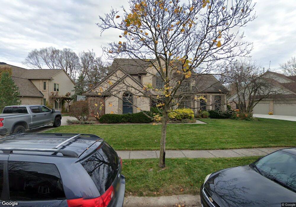
620 Sandalwood Rd Canton, MI 48188
Estimated Value: $613,140 - $633,000
4
Beds
3
Baths
3,086
Sq Ft
$203/Sq Ft
Est. Value
About This Home
This home is located at 620 Sandalwood Rd, Canton, MI 48188 and is currently estimated at $626,035, approximately $202 per square foot. 620 Sandalwood Rd is a home located in Wayne County with nearby schools including Canton High School, Plymouth High School, and Salem High School.
Ownership History
Date
Name
Owned For
Owner Type
Purchase Details
Closed on
Sep 5, 2024
Sold by
Jana Donald T and Jana Shawn E
Bought by
Jana Trust and Jana
Current Estimated Value
Purchase Details
Closed on
Aug 10, 2021
Sold by
Gaston Patricia L and Meeking Linnie
Bought by
Meeking Linnie and Gaston Patricia L
Home Financials for this Owner
Home Financials are based on the most recent Mortgage that was taken out on this home.
Original Mortgage
$151,200
Interest Rate
2.8%
Mortgage Type
New Conventional
Purchase Details
Closed on
Aug 26, 2010
Sold by
Murray Dawn L and Murray Mark A
Bought by
Jana David and Jana Shawn E
Create a Home Valuation Report for This Property
The Home Valuation Report is an in-depth analysis detailing your home's value as well as a comparison with similar homes in the area
Home Values in the Area
Average Home Value in this Area
Purchase History
| Date | Buyer | Sale Price | Title Company |
|---|---|---|---|
| Jana Trust | -- | None Listed On Document | |
| Meeking Linnie | -- | Servicelink | |
| Jana David | $295,000 | Nations Title Agency |
Source: Public Records
Mortgage History
| Date | Status | Borrower | Loan Amount |
|---|---|---|---|
| Previous Owner | Meeking Linnie | $151,200 |
Source: Public Records
Tax History Compared to Growth
Tax History
| Year | Tax Paid | Tax Assessment Tax Assessment Total Assessment is a certain percentage of the fair market value that is determined by local assessors to be the total taxable value of land and additions on the property. | Land | Improvement |
|---|---|---|---|---|
| 2025 | $3,593 | $283,900 | $0 | $0 |
| 2024 | $3,593 | $245,500 | $0 | $0 |
| 2023 | $3,426 | $236,700 | $0 | $0 |
| 2022 | $7,400 | $210,600 | $0 | $0 |
| 2021 | $4,016 | $210,000 | $0 | $0 |
| 2020 | $7,091 | $202,800 | $0 | $0 |
| 2019 | $6,959 | $195,350 | $0 | $0 |
| 2018 | $2,912 | $186,710 | $0 | $0 |
| 2017 | $7,002 | $183,500 | $0 | $0 |
| 2016 | $6,320 | $185,400 | $0 | $0 |
| 2015 | $15,997 | $163,370 | $0 | $0 |
| 2013 | $15,498 | $167,970 | $0 | $0 |
| 2010 | -- | $140,830 | $66,448 | $74,382 |
Source: Public Records
Map
Nearby Homes
- 51026 Meadowlands
- 241 Country Club Ln
- 47078 Bing Dr
- 316 Queen Anne Dr
- 1564 Crowndale Ln
- 48030 Cherry Hill Rd
- 48416 Manhattan Cir
- 47671 Vistas Circle Dr N
- 1861 Stonebridge Way
- 47631 Scenic Circle Dr N
- 47815 Vistas Circle Dr S
- 1938 Scenic Dr
- 300 E Canford Park Unit 30
- 45400 William Ct
- 48859 Garden Ln
- 45801 Henley Dr
- 1273 Kennebec
- 2498 Cleveland Way
- 2304 Cleveland Way
- 1752 Thistle Dr
- 594 Sandalwood Rd
- 652 Sandalwood Rd
- 607 Sandalwood Rd
- 566 Sandalwood Rd
- 583 Sandalwood Rd
- 631 Sandalwood Rd
- 46990 Mornington Rd
- 47008 Mornington Rd
- 653 Sandalwood Rd
- 548 Sandalwood Ct
- 538 Sandalwood Rd
- 675 Sandalwood Rd
- 46972 Mornington Rd
- 47026 Mornington Rd
- 626 Sandalwood Ct
- 654 Sandalwood Ct
- 590 Sandalwood Ct
- 704 Sandalwood Rd
- 688 Sandalwood Ct
- 502 Sandalwood Rd