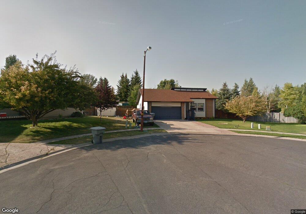
620 Saunders Cir Evanston, WY 82930
Estimated Value: $375,246 - $489,000
4
Beds
3
Baths
1,260
Sq Ft
$322/Sq Ft
Est. Value
About This Home
This home is located at 620 Saunders Cir, Evanston, WY 82930 and is currently estimated at $405,812, approximately $322 per square foot. 620 Saunders Cir is a home located in Uinta County with nearby schools including Evanston High School and Evanston Child Development Center.
Ownership History
Date
Name
Owned For
Owner Type
Purchase Details
Closed on
Jul 3, 2008
Sold by
Gmac Global Relocation Services Llc
Bought by
Horrocks Kurtis R and Horrocks Camille H
Current Estimated Value
Home Financials for this Owner
Home Financials are based on the most recent Mortgage that was taken out on this home.
Original Mortgage
$217,043
Outstanding Balance
$139,452
Interest Rate
5.99%
Mortgage Type
FHA
Estimated Equity
$266,360
Purchase Details
Closed on
Apr 19, 2008
Sold by
Schelling Steven E and Schelling Robin L
Bought by
Gmac Global Relocation Services Llc
Create a Home Valuation Report for This Property
The Home Valuation Report is an in-depth analysis detailing your home's value as well as a comparison with similar homes in the area
Home Values in the Area
Average Home Value in this Area
Purchase History
| Date | Buyer | Sale Price | Title Company |
|---|---|---|---|
| Horrocks Kurtis R | -- | None Available | |
| Gmac Global Relocation Services Llc | -- | None Available |
Source: Public Records
Mortgage History
| Date | Status | Borrower | Loan Amount |
|---|---|---|---|
| Open | Horrocks Kurtis R | $217,043 |
Source: Public Records
Tax History Compared to Growth
Tax History
| Year | Tax Paid | Tax Assessment Tax Assessment Total Assessment is a certain percentage of the fair market value that is determined by local assessors to be the total taxable value of land and additions on the property. | Land | Improvement |
|---|---|---|---|---|
| 2025 | $2,116 | $24,065 | $5,756 | $18,309 |
| 2024 | $2,116 | $31,133 | $7,674 | $23,459 |
| 2023 | $2,046 | $30,247 | $7,674 | $22,573 |
| 2022 | $1,938 | $28,474 | $6,416 | $22,058 |
| 2021 | $1,572 | $23,057 | $6,293 | $16,764 |
| 2020 | $1,555 | $22,822 | $6,293 | $16,529 |
| 2019 | $1,535 | $22,568 | $6,293 | $16,275 |
| 2018 | $555 | $20,768 | $5,235 | $15,533 |
| 2017 | $1,329 | $19,563 | $4,766 | $14,797 |
| 2016 | $1,286 | $18,908 | $4,766 | $14,142 |
| 2015 | -- | $18,246 | $4,766 | $13,480 |
| 2014 | -- | $18,175 | $0 | $0 |
Source: Public Records
Map
Nearby Homes
- 479 Twin Ridge Ave
- 223 Barber Ave
- 221 Barber Ave
- 427 Thayer Cir
- 405, 411, & 419 Burns Ave
- 413 Crane Ave
- 405 Burns Ave Unit 3,4,5
- 3925 Yellow Creek Rd
- 3893 Yellow Creek Rd
- 3861 Yellow Creek Rd
- 3827 Yellow Creek Rd
- 113 Tower Rd
- 116 Peak Rd
- 115 Peak Rd
- 824 9th St
- 633 9th St
- 525 8th St
- 819 Walton Ave
- 310 Ottley Dr
- 46 City View Dr
- 618 Saunders Cir
- 211 Florence Ave
- 623 Saunders Cir
- 215 Florence Ave
- 207 Florence Ave
- 219 Florence Ave
- 614 Saunders Cir
- 203 Florence Ave
- 619 Saunders Cir
- 208 Dean Ave
- 619 Twin Ridge Ave
- 619 Twin Ridge Ave Unit Yellow Creek
- 204 Dean Ave
- 615 Saunders Cir
- 223 Florence Ave
- 622 Stahley Ave
- 212 Florence Ave
- 629 Twin Ridge Ave
- 208 Florence Ave
- 224 Dean Ave