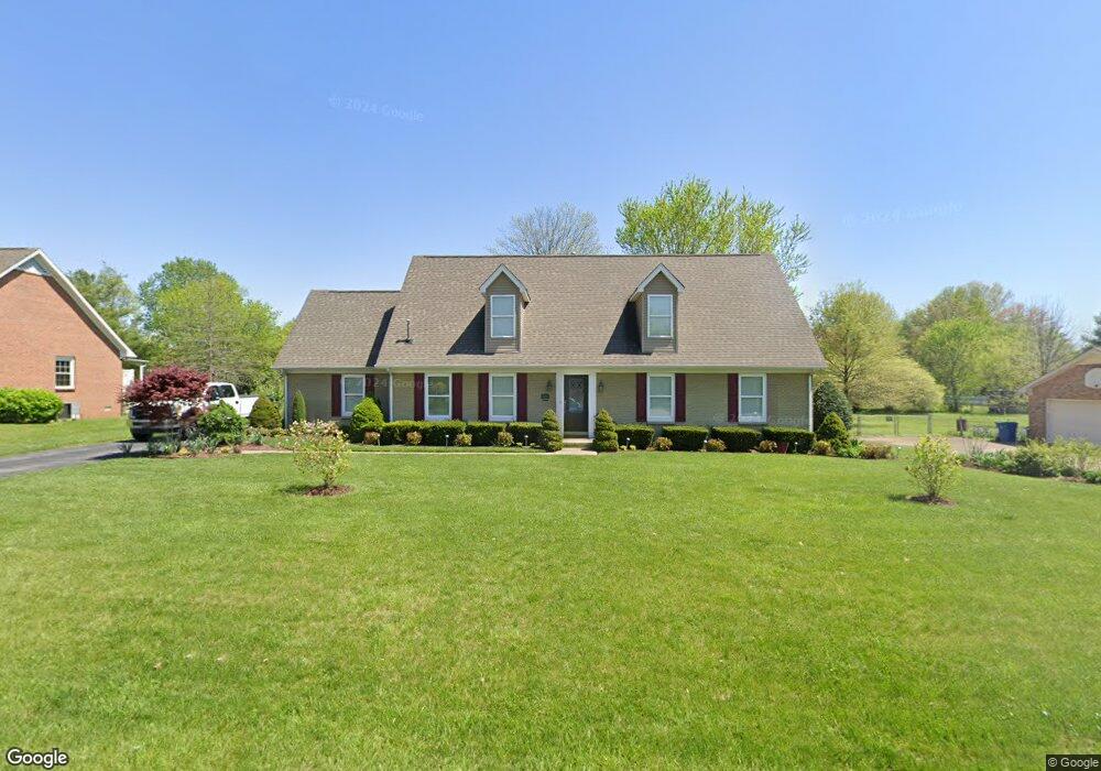
620 Spike Trail Murfreesboro, TN 37129
Estimated Value: $483,294 - $556,000
Studio
2
Baths
2,991
Sq Ft
$169/Sq Ft
Est. Value
About This Home
This home is located at 620 Spike Trail, Murfreesboro, TN 37129 and is currently estimated at $504,824, approximately $168 per square foot. 620 Spike Trail is a home located in Rutherford County with nearby schools including Blackman Elementary School, Blackman Middle School, and Blackman High School.
Ownership History
Date
Name
Owned For
Owner Type
Purchase Details
Closed on
Sep 11, 2015
Sold by
Saverance Eddie G
Bought by
Ray Roy Lisa
Current Estimated Value
Purchase Details
Closed on
Oct 28, 2009
Sold by
Davis Gary L
Bought by
Saverance Eddie G
Home Financials for this Owner
Home Financials are based on the most recent Mortgage that was taken out on this home.
Original Mortgage
$123,000
Interest Rate
4.93%
Purchase Details
Closed on
Apr 29, 2009
Sold by
Dycus Mark E
Bought by
Davis Gary L
Purchase Details
Closed on
Apr 27, 1995
Sold by
Randall Smith
Bought by
Dycus Mark E
Create a Home Valuation Report for This Property
The Home Valuation Report is an in-depth analysis detailing your home's value as well as a comparison with similar homes in the area
Home Values in the Area
Average Home Value in this Area
Purchase History
We collect this data history from publicly available records. To have your information removed, we recommend requesting removal directly through your county’s website.
| Date | Buyer | Sale Price | Title Company |
|---|---|---|---|
| Ray Roy Lisa | $249,900 | -- | |
| Saverance Eddie G | $160,000 | -- | |
| Davis Gary L | $30,000 | -- | |
| Davis Gary L | $30,000 | -- | |
| Dycus Mark E | $95,000 | -- |
Source: Public Records
Mortgage History
We collect this data history from publicly available records. To have your information removed, we recommend requesting removal directly through your county’s website.
| Date | Status | Borrower | Loan Amount |
|---|---|---|---|
| Previous Owner | Dycus Mark E | $123,000 |
Source: Public Records
Tax History
| Year | Tax Paid | Tax Assessment Tax Assessment Total Assessment is a certain percentage of the fair market value that is determined by local assessors to be the total taxable value of land and additions on the property. | Land | Improvement |
|---|---|---|---|---|
| 2025 | $1,806 | $91,500 | $13,750 | $77,750 |
| 2024 | $1,717 | $91,500 | $13,750 | $77,750 |
| 2023 | $1,717 | $91,500 | $13,750 | $77,750 |
| 2022 | $1,479 | $91,500 | $13,750 | $77,750 |
| 2021 | $1,561 | $70,350 | $9,250 | $61,100 |
| 2020 | $1,561 | $70,350 | $9,250 | $61,100 |
| 2019 | $1,561 | $70,350 | $9,250 | $61,100 |
| 2018 | $1,477 | $70,350 | $0 | $0 |
| 2017 | $1,637 | $61,075 | $0 | $0 |
| 2016 | $1,637 | $61,075 | $0 | $0 |
| 2015 | $1,154 | $41,800 | $0 | $0 |
| 2014 | $1,039 | $41,800 | $0 | $0 |
| 2013 | -- | $39,525 | $0 | $0 |
Source: Public Records
Map
Nearby Homes
- 3714 Alchemy Ct
- 3718 Alchemy Ct
- 3719 Red Willow Ct
- 1011 Wolves Den Place
- 1038 Sitting Bull Crossing
- 913 Sitting Bull Crossing
- 3737 Southbend Dr
- 920 Shaman Crossing
- 845 Kaylee Cir
- 840 Kanatak Ln
- 3939 Cannonsgate Ln
- 4063 Cannonsgate Ln
- 945 Manson Crossing Dr
- 510 Nightcap Ln
- 3520 Boxelder Way
- 4134 Sunday Silence Way
- 524 Gresham Ln
- 520 Gresham Ln
- 555 Gresham Ln Unit 2 D
- 2718 Willowoak Trail Unit 2901
Your Personal Tour Guide
Ask me questions while you tour the home.