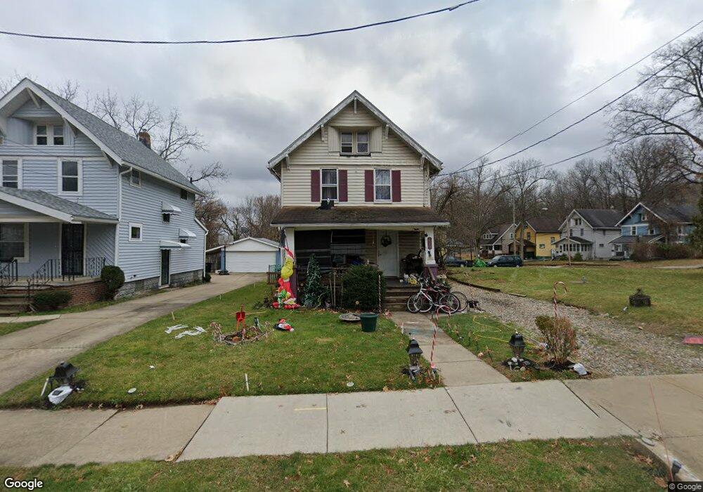
620 W Thornton St Akron, OH 44307
Sherbondy Hill NeighborhoodEstimated Value: $49,000 - $74,000
3
Beds
1
Bath
1,320
Sq Ft
$49/Sq Ft
Est. Value
About This Home
This home is located at 620 W Thornton St, Akron, OH 44307 and is currently estimated at $64,709, approximately $49 per square foot. 620 W Thornton St is a home located in Summit County with nearby schools including Emmanuel Christian Academy and St. Bernard-St. Mary Elementary School.
Ownership History
Date
Name
Owned For
Owner Type
Purchase Details
Closed on
Nov 29, 2018
Sold by
Flip My City Investors Llc
Bought by
Montanez Properties Llc
Current Estimated Value
Purchase Details
Closed on
Nov 14, 2014
Sold by
Donihoo Gary W
Bought by
Flip My City Investors Llc
Purchase Details
Closed on
Jul 21, 2005
Sold by
Jones Paul L and Jones Anna C
Bought by
Donihoo Gary W
Create a Home Valuation Report for This Property
The Home Valuation Report is an in-depth analysis detailing your home's value as well as a comparison with similar homes in the area
Home Values in the Area
Average Home Value in this Area
Purchase History
| Date | Buyer | Sale Price | Title Company |
|---|---|---|---|
| Montanez Properties Llc | $10,000 | American Patriot Title | |
| Flip My City Investors Llc | $7,500 | None Available | |
| Donihoo Gary W | $40,000 | First American Title Ins Co |
Source: Public Records
Tax History Compared to Growth
Tax History
| Year | Tax Paid | Tax Assessment Tax Assessment Total Assessment is a certain percentage of the fair market value that is determined by local assessors to be the total taxable value of land and additions on the property. | Land | Improvement |
|---|---|---|---|---|
| 2025 | $1,436 | $11,795 | $3,178 | $8,617 |
| 2024 | $707 | $11,795 | $3,178 | $8,617 |
| 2023 | $1,436 | $11,795 | $3,178 | $8,617 |
| 2022 | $591 | $6,937 | $1,869 | $5,068 |
| 2021 | $591 | $6,937 | $1,869 | $5,068 |
| 2020 | $684 | $6,940 | $1,870 | $5,070 |
| 2019 | $693 | $6,430 | $2,570 | $3,860 |
| 2018 | $587 | $6,430 | $2,570 | $3,860 |
| 2017 | $613 | $6,430 | $2,570 | $3,860 |
| 2016 | $1,200 | $6,540 | $2,570 | $3,970 |
| 2015 | $613 | $6,540 | $2,570 | $3,970 |
| 2014 | $559 | $6,540 | $2,570 | $3,970 |
| 2013 | $595 | $7,200 | $2,570 | $4,630 |
Source: Public Records
Map
Nearby Homes
- 702 W Thornton St
- 1001 Celina Ave
- 1132 Bristol Terrace
- 1174 La Croix Ave
- 738 Longview Ave
- 699 Fultz St
- 721 Vernon Odom Blvd
- 737 Vernon Odom Blvd
- 776 Krause Ct
- 985 Diana Ave
- 677 Vernon Odom Blvd
- 1063 Raymond St
- 949 Raymond St
- 794 Ruth Ave
- 385 Campbell St
- 955 Fess Ave
- 364 Campbell St
- 0 East Ave
- 817 Raymond St
- 639 Bellevue Ave
- 616 W Thornton St
- 624 W Thornton St
- 1047 La Croix Ave
- 612 W Thornton St
- 1051 La Croix Ave
- 608 W Thornton St
- 625 W Thornton St
- 619 W Thornton St
- 1055 La Croix Ave
- 640 W Thornton St
- 617 W Thornton St
- 604 W Thornton St
- 619 Blanche St
- 609 W Thornton St
- 1059 La Croix Ave
- 633 W Thornton St
- 600 W Thornton St
- 623 Blanche St
- 1048 La Croix Ave
- 644 W Thornton St