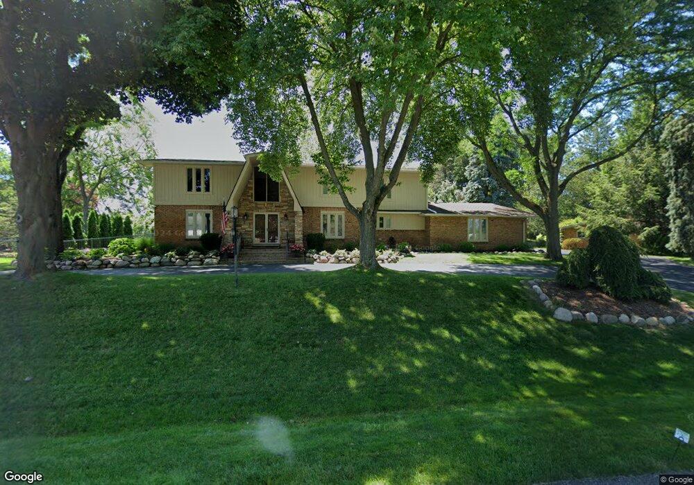
6200 Northfield Rd West Bloomfield, MI 48322
Estimated Value: $545,605 - $605,000
4
Beds
5
Baths
3,370
Sq Ft
$173/Sq Ft
Est. Value
About This Home
This home is located at 6200 Northfield Rd, West Bloomfield, MI 48322 and is currently estimated at $582,401, approximately $172 per square foot. 6200 Northfield Rd is a home located in Oakland County with nearby schools including Sheiko Elementary School, West Bloomfield Middle School, and Bloomfield Maples Montessori.
Ownership History
Date
Name
Owned For
Owner Type
Purchase Details
Closed on
Mar 16, 2009
Sold by
Cyrlin Marshall N and Cyrlin Alita R
Bought by
Cyrlin Marshall N
Current Estimated Value
Home Financials for this Owner
Home Financials are based on the most recent Mortgage that was taken out on this home.
Original Mortgage
$220,000
Interest Rate
5.11%
Mortgage Type
New Conventional
Create a Home Valuation Report for This Property
The Home Valuation Report is an in-depth analysis detailing your home's value as well as a comparison with similar homes in the area
Home Values in the Area
Average Home Value in this Area
Purchase History
| Date | Buyer | Sale Price | Title Company |
|---|---|---|---|
| Cyrlin Marshall N | -- | Bell Title Company |
Source: Public Records
Mortgage History
| Date | Status | Borrower | Loan Amount |
|---|---|---|---|
| Closed | Cyrlin Marshall N | $220,000 |
Source: Public Records
Tax History Compared to Growth
Tax History
| Year | Tax Paid | Tax Assessment Tax Assessment Total Assessment is a certain percentage of the fair market value that is determined by local assessors to be the total taxable value of land and additions on the property. | Land | Improvement |
|---|---|---|---|---|
| 2024 | $3,354 | $209,850 | $0 | $0 |
| 2022 | $3,211 | $178,970 | $40,050 | $138,920 |
| 2021 | $4,964 | $170,370 | $0 | $0 |
| 2020 | $3,201 | $162,690 | $40,050 | $122,640 |
| 2018 | $4,786 | $156,580 | $38,900 | $117,680 |
| 2015 | -- | $136,800 | $0 | $0 |
| 2014 | -- | $125,070 | $0 | $0 |
| 2011 | -- | $117,990 | $0 | $0 |
Source: Public Records
Map
Nearby Homes
- 6564 Alderley Way
- 6545 Post Oak Dr
- 5764 Bloomfield Glens Rd
- 5780 Swan Lake Ct
- 5622 Powder Horn Dr
- 6151 Orchard Lake Rd Unit 103
- 6145 Orchard Lake Rd Unit 204
- 3865 Stonecrest Rd
- 3104 Spring St
- 6882 Post Oak Dr
- 5815 Bloomfield Glens Rd
- 6843 Leslee Crest Dr
- 5415 Fairway Ln
- 6322 Pepper Hill St Unit 62
- 6222 Pepper Hill St
- 5321 Fairway Ln Unit 7
- 4161 Breckenridge Dr
- 5881 Naneva Ct
- 5312 Cambourne Place
- 5946 Cherry Crest Dr
- 6172 Northfield Rd
- 6222 Northfield Rd
- 6261 Saint James Ct
- 6205 Northfield Rd
- 6277 Saint James Ct
- 6185 Northfield Rd
- 6144 Northfield Rd
- 6233 Northfield Rd
- 6256 Northfield Rd
- 6169 Northfield Rd
- 6251 Saint James Ct
- 6072 Wynford Dr
- 6054 Wynford Dr
- 6090 Wynford Dr
- 6145 Northfield Rd
- 6291 Saint James Ct
- 6036 Wynford Dr
- 6265 Northfield Rd
- 6108 Wynford Dr
- 6301 Saint James Dr