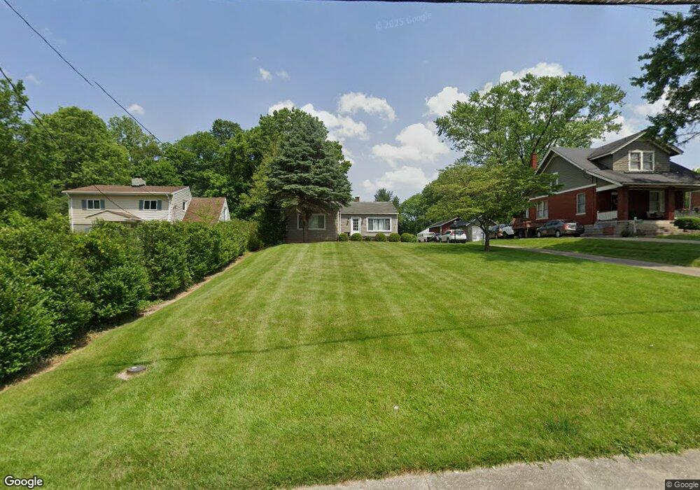
6200 Plainfield Rd Cincinnati, OH 45213
Estimated Value: $215,000 - $290,000
3
Beds
2
Baths
1,133
Sq Ft
$216/Sq Ft
Est. Value
About This Home
This home is located at 6200 Plainfield Rd, Cincinnati, OH 45213 and is currently estimated at $244,584, approximately $215 per square foot. 6200 Plainfield Rd is a home located in Hamilton County with nearby schools including Silverton Paideia Elementary School, Shroder High School, and Clark Montessori High School.
Ownership History
Date
Name
Owned For
Owner Type
Purchase Details
Closed on
Dec 29, 2010
Sold by
Trainor Patricia H
Bought by
Piening Lawrence A and Piening Nancy L
Current Estimated Value
Home Financials for this Owner
Home Financials are based on the most recent Mortgage that was taken out on this home.
Original Mortgage
$48,000
Interest Rate
4.5%
Mortgage Type
Unknown
Create a Home Valuation Report for This Property
The Home Valuation Report is an in-depth analysis detailing your home's value as well as a comparison with similar homes in the area
Home Values in the Area
Average Home Value in this Area
Purchase History
| Date | Buyer | Sale Price | Title Company |
|---|---|---|---|
| Piening Lawrence A | -- | Chicago Title Insurance Co |
Source: Public Records
Mortgage History
| Date | Status | Borrower | Loan Amount |
|---|---|---|---|
| Closed | Piening Lawrence A | $48,000 |
Source: Public Records
Tax History
| Year | Tax Paid | Tax Assessment Tax Assessment Total Assessment is a certain percentage of the fair market value that is determined by local assessors to be the total taxable value of land and additions on the property. | Land | Improvement |
|---|---|---|---|---|
| 2025 | $3,786 | $60,687 | $25,718 | $34,969 |
| 2024 | $3,467 | $60,687 | $25,718 | $34,969 |
| 2023 | $3,544 | $60,687 | $25,718 | $34,969 |
| 2022 | $2,686 | $38,913 | $19,432 | $19,481 |
| 2021 | $2,616 | $38,913 | $19,432 | $19,481 |
| 2020 | $2,657 | $38,913 | $19,432 | $19,481 |
| 2019 | $2,893 | $38,151 | $19,051 | $19,100 |
| 2018 | $2,898 | $38,151 | $19,051 | $19,100 |
| 2017 | $2,768 | $38,151 | $19,051 | $19,100 |
| 2016 | $2,505 | $33,873 | $17,297 | $16,576 |
| 2015 | $2,266 | $33,873 | $17,297 | $16,576 |
| 2014 | $2,280 | $33,873 | $17,297 | $16,576 |
| 2013 | $2,574 | $37,636 | $19,219 | $18,417 |
Source: Public Records
Map
Nearby Homes
- 3962 S Fordham Place
- 3946 Cedarwood Place
- 3964 Zinsle Ave
- 3921 Cedarwood Place
- 3906 Standish Ave
- 6097 W Fordham Place
- 3824 Standish Ave
- 3765 Iona Ave
- 6656 Plainfield Rd
- 6705 Elwynne Dr
- 6207 Coleridge Ave
- 6508 Coleridge Ave
- 6501 Coleridge Ave
- 5800 Cherokee Dr
- 6829 Alpine Ave
- 3625 Zinsle Ave
- 6218 Kennedy Ave
- 6460 Mchugh Place
- 6201 Kennedy Ave
- 5635 Euclid Rd
- 6204 Plainfield Rd
- 6130 Plainfield Rd
- 6206 Plainfield Rd
- 6126 Plainfield Rd
- 6124 Plainfield Rd
- 3964 Brandonburg Ln
- 4002 Tamworth Cir
- 6210 Plainfield Rd
- 4004 Tamworth Cir
- 6300 Plainfield Rd
- 6122 Plainfield Rd
- 6133 Plainfield Rd
- 4006 Tamworth Cir
- 6129 Plainfield Rd
- 3956 Brandonburg Ln
- 4008 Tamworth Cir
- 3963 Brandonburg Ln
- 4010 Tamworth Cir
- 6223 Plainfield Rd
- 3974 N Fordham Place
Your Personal Tour Guide
Ask me questions while you tour the home.