Estimated Value: $154,000 - $189,000
3
Beds
1
Bath
1,120
Sq Ft
$153/Sq Ft
Est. Value
About This Home
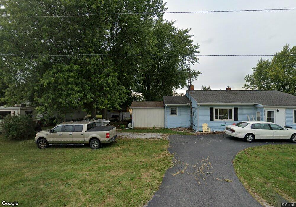
This home is located at 6200 State Route 196, Lima, OH 45806 and is currently estimated at $171,064, approximately $152 per square foot. 6200 State Route 196 is a home located in Allen County with nearby schools including Allen East Elementary School, Allen East Middle School, and Allen East High School.
Ownership History
Date
Name
Owned For
Owner Type
Purchase Details
Closed on
Aug 16, 2006
Sold by
Ward Basil and Ward Nancy Marie
Bought by
Cornett Anna and Cornett Smith Martha
Current Estimated Value
Home Financials for this Owner
Home Financials are based on the most recent Mortgage that was taken out on this home.
Original Mortgage
$86,000
Outstanding Balance
$56,453
Interest Rate
8.55%
Mortgage Type
Assumption
Estimated Equity
$114,611
Purchase Details
Closed on
Jan 1, 1990
Bought by
Ward Basil
Create a Home Valuation Report for This Property
The Home Valuation Report is an in-depth analysis detailing your home's value as well as a comparison with similar homes in the area
Home Values in the Area
Average Home Value in this Area
Purchase History
| Date | Buyer | Sale Price | Title Company |
|---|---|---|---|
| Cornett Anna | $86,000 | None Available | |
| Ward Basil | -- | -- |
Source: Public Records
Mortgage History
| Date | Status | Borrower | Loan Amount |
|---|---|---|---|
| Open | Cornett Anna | $86,000 |
Source: Public Records
Tax History Compared to Growth
Tax History
| Year | Tax Paid | Tax Assessment Tax Assessment Total Assessment is a certain percentage of the fair market value that is determined by local assessors to be the total taxable value of land and additions on the property. | Land | Improvement |
|---|---|---|---|---|
| 2024 | $1,397 | $40,290 | $7,140 | $33,150 |
| 2023 | $1,236 | $31,750 | $5,640 | $26,110 |
| 2022 | $1,206 | $31,370 | $5,640 | $25,730 |
| 2021 | $1,206 | $31,370 | $5,640 | $25,730 |
| 2020 | $1,096 | $27,860 | $5,110 | $22,750 |
| 2019 | $1,096 | $27,860 | $5,110 | $22,750 |
| 2018 | $1,062 | $27,860 | $5,110 | $22,750 |
| 2017 | $1,032 | $24,080 | $5,110 | $18,970 |
| 2016 | $1,027 | $24,080 | $5,110 | $18,970 |
| 2015 | $1,197 | $24,190 | $5,110 | $19,080 |
| 2014 | $1,197 | $27,480 | $4,800 | $22,680 |
| 2013 | $1,168 | $27,480 | $4,800 | $22,680 |
Source: Public Records
Map
Nearby Homes
- 8150 Amherst Rd
- 5065 Amherst Rd
- 7165 Faulkner Rd
- 6616 Bellefontaine Rd
- 22275 Buckland Holden Rd
- 6381 McPheron Rd
- 105 Guthrie St
- 202 W Mulberry St
- 25836 Ohio 67
- 5600 E Hanthorn Rd
- E Hanthorn Rd
- 4160 E Hanthorn Rd
- 1855 S Cool Rd
- 200 S Main St
- 3080 E Hanthorn Rd
- 4080 Bellefontaine Rd
- 20630 State Route 67
- 3 House Package
- 0 Harding Hwy Unit 307187
- 303 Pinewood Cir
- 6200 Waynesfield Rd
- 6895 Amherst Rd
- 6900 Amherst Rd
- 6821 Amherst Rd
- 6787 Amherst Rd
- 6753 Amherst Rd
- 6100 State Route 196
- 6100 Waynesfield Rd
- 6427 State Route 196
- 6042 State Route 196
- 6042 Waynesfield Rd
- 6664 Amherst Rd
- 6396 State Route 196
- 6396 Waynesfield Rd
- 6016 State Route 196
- 6016 Waynesfield Rd
- 6440 State Route 196
- 6440 Waynesfield Rd
- 6677 Amherst Rd
- 6620 Amherst Rd