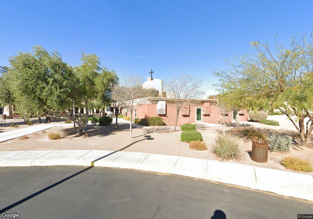
6200 W Lone Mountain Rd Las Vegas, NV 89130
North Cheyenne NeighborhoodEstimated Value: $565,000 - $10,489,884
6
Beds
5
Baths
4,000
Sq Ft
$1,382/Sq Ft
Est. Value
About This Home
This home is located at 6200 W Lone Mountain Rd, Las Vegas, NV 89130 and is currently estimated at $5,527,442, approximately $1,381 per square foot. 6200 W Lone Mountain Rd is a home with nearby schools including Ernest May Elementary School, Theron L Swainston Middle School, and Shadow Ridge High School.
Ownership History
Date
Name
Owned For
Owner Type
Purchase Details
Closed on
Dec 10, 2003
Sold by
Jacobson Lillian and Jacobson Alice L
Bought by
Canyon Ridge Christian Church Inc
Current Estimated Value
Purchase Details
Closed on
Dec 8, 2003
Sold by
Torres Trevor
Bought by
Jacobson Alice L
Purchase Details
Closed on
Apr 15, 2002
Sold by
Jacobson Curtis L
Bought by
Jacobson Alice L
Create a Home Valuation Report for This Property
The Home Valuation Report is an in-depth analysis detailing your home's value as well as a comparison with similar homes in the area
Home Values in the Area
Average Home Value in this Area
Purchase History
| Date | Buyer | Sale Price | Title Company |
|---|---|---|---|
| Canyon Ridge Christian Church Inc | $320,000 | Nevada Title Company | |
| Jacobson Alice L | -- | Nevada Title Company | |
| Jacobson Alice L | -- | -- |
Source: Public Records
Tax History Compared to Growth
Tax History
| Year | Tax Paid | Tax Assessment Tax Assessment Total Assessment is a certain percentage of the fair market value that is determined by local assessors to be the total taxable value of land and additions on the property. | Land | Improvement |
|---|---|---|---|---|
| 2025 | -- | $5,203,187 | $1,912,138 | $3,291,049 |
| 2024 | -- | $5,203,187 | $1,912,138 | $3,291,049 |
| 2023 | $0 | $4,994,432 | $1,882,720 | $3,111,712 |
| 2022 | $0 | $4,663,700 | $1,823,885 | $2,839,815 |
| 2021 | $0 | $4,204,049 | $1,482,642 | $2,721,407 |
| 2020 | $153,279 | $4,675,704 | $1,959,206 | $2,716,498 |
| 2019 | $128,013 | $3,904,972 | $1,217,885 | $2,687,087 |
| 2018 | $135,406 | $4,130,484 | $1,482,642 | $2,647,842 |
| 2017 | $137,230 | $4,186,134 | $1,482,642 | $2,703,492 |
| 2016 | -- | $3,878,543 | $1,176,700 | $2,701,843 |
| 2015 | $69 | $3,573,340 | $882,525 | $2,690,815 |
| 2014 | $61 | $3,492,022 | $823,690 | $2,668,332 |
Source: Public Records
Map
Nearby Homes
- 6225 Minerva Dr
- 6105 Sadler Dr
- 5900 Red Umber Ave
- 6256 Hill Haven Ave
- 6277 Kraft Ave
- 4521 Night Dance Ct
- 4517 Carbine Chapel St
- 4505 Mollison Mesa Ct
- 5812 Ventana Dr
- 4505 Truscott Ct
- 6300 W La Madre Way
- 5605 Bay Shore Cir
- 5144 Maverick St
- 5620 N Jones Blvd
- 5005 Chambliss Dr
- 5600 Segolilly Cir
- 5260 N Jones Blvd
- 6505 Quantum Ln
- 4905 Ocean Shores Way
- 5041 Peaceful Paradise St
- 6120 Minerva Dr
- 6124 Minerva Dr
- 6116 Minerva Dr
- 6128 Minerva Dr
- 6108 Minerva Dr
- 6200 Minerva Dr
- 6204 Minerva Dr
- 6104 Minerva Dr
- 6208 Minerva Dr
- 4724 Bannister Ln
- 6121 Minerva Dr
- 6117 Minerva Dr
- 6113 Minerva Dr
- 6100 Minerva Dr
- 6212 Minerva Dr
- 6109 Minerva Dr
- 6201 Minerva Dr
- 4720 Bannister Ln
- 6105 Minerva Dr