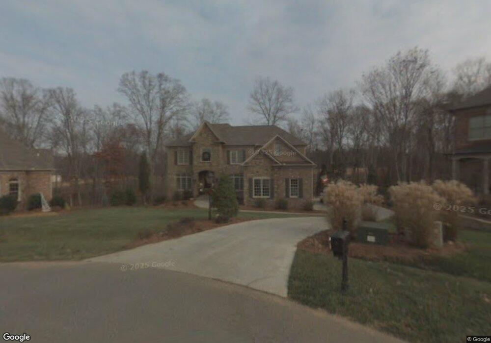
6201 Calendula Ct Summerfield, NC 27358
Estimated Value: $830,000 - $1,277,000
4
Beds
5
Baths
3,773
Sq Ft
$275/Sq Ft
Est. Value
About This Home
This home is located at 6201 Calendula Ct, Summerfield, NC 27358 and is currently estimated at $1,039,124, approximately $275 per square foot. 6201 Calendula Ct is a home located in Guilford County with nearby schools including Summerfield Elementary School, Northern Guilford Middle School, and Northern Guilford High School.
Ownership History
Date
Name
Owned For
Owner Type
Purchase Details
Closed on
Mar 15, 2006
Sold by
Pruitt Homes Inc
Bought by
Brondolo Thomas F and Brondolo Elizabeth W
Current Estimated Value
Home Financials for this Owner
Home Financials are based on the most recent Mortgage that was taken out on this home.
Original Mortgage
$320,000
Outstanding Balance
$181,064
Interest Rate
6.19%
Mortgage Type
Fannie Mae Freddie Mac
Estimated Equity
$858,060
Create a Home Valuation Report for This Property
The Home Valuation Report is an in-depth analysis detailing your home's value as well as a comparison with similar homes in the area
Purchase History
We collect this data history from publicly available records. To have your information removed, we recommend requesting removal directly through your county’s website.
| Date | Buyer | Sale Price | Title Company |
|---|---|---|---|
| Brondolo Thomas F | $620,000 | None Available |
Source: Public Records
Mortgage History
We collect this data history from publicly available records. To have your information removed, we recommend requesting removal directly through your county’s website.
| Date | Status | Borrower | Loan Amount |
|---|---|---|---|
| Open | Brondolo Thomas F | $320,000 |
Source: Public Records
Tax History
| Year | Tax Paid | Tax Assessment Tax Assessment Total Assessment is a certain percentage of the fair market value that is determined by local assessors to be the total taxable value of land and additions on the property. | Land | Improvement |
|---|---|---|---|---|
| 2025 | $6,123 | $688,700 | $88,000 | $600,700 |
| 2024 | $6,123 | $688,700 | $88,000 | $600,700 |
| 2023 | $6,123 | $688,700 | $88,000 | $600,700 |
| 2022 | $6,123 | $688,700 | $88,000 | $600,700 |
| 2021 | $5,202 | $585,200 | $89,000 | $496,200 |
| 2020 | $5,202 | $585,200 | $89,000 | $496,200 |
| 2019 | $5,202 | $585,200 | $0 | $0 |
| 2018 | $5,176 | $585,200 | $0 | $0 |
| 2017 | $5,176 | $585,200 | $0 | $0 |
| 2016 | $5,257 | $575,500 | $0 | $0 |
| 2015 | $5,286 | $575,500 | $0 | $0 |
| 2014 | $5,344 | $575,500 | $0 | $0 |
Source: Public Records
Map
Nearby Homes
- 7626 Henson Forest Dr
- 6304 Autumn Crest Ct
- 6324 Autumn Crest Ct
- 7521 Henson Forest Dr
- 6988 Bethesda Ct
- 3801 Oak Ridge Rd
- 6307 Alley Ridge Way
- 7819 Wilson Farm Rd
- 7008 Westfield Village Cir
- 5603 Monk Ct
- 7585 Dubach Rd
- 7203 Saint Crispins Way
- 6239 Stanback Ct
- 7418 Moores Mill Rd
- 6998 Colleen Ct
- 3301 Seven Springs Ct
- 7513 Greenlawn Dr
- 7410 Dickinben Dr
- 7336 Henson Forest Dr
- 8000 Laffin Ct
- 6203 Calendula Ct
- 6200 Calendula Ct
- 6202 Calendula Ct
- 6205 Calendula Ct
- 7640 Henson Forest Dr
- 7628 Henson Forest Dr
- 7635 Henson Forest Dr
- 7642 Henson Forest Dr
- 7633 Henson Forest Dr
- 7631 Henson Forest Dr
- 7620 Henson Forest Dr
- 7644 Henson Forest Dr
- 7629 Henson Forest Dr
- 6334 Blue Aster Trace
- 7641 Deboe Rd
- 7624 Henson Forest Dr
- 7665 Deboe Rd
- 6332 Blue Aster Trace
- 7627 Henson Forest Dr
- 7646 Henson Forest Dr
Your Personal Tour Guide
Ask me questions while you tour the home.