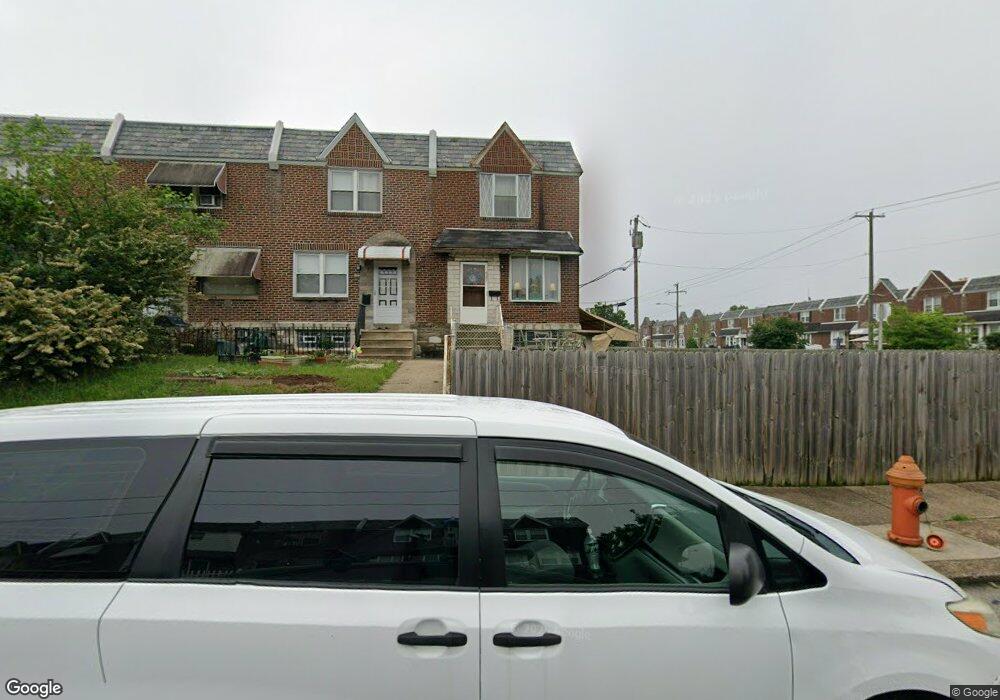
6201 Cardiff St Philadelphia, PA 19149
Mayfair NeighborhoodEstimated Value: $216,951 - $231,000
3
Beds
2
Baths
1,152
Sq Ft
$195/Sq Ft
Est. Value
About This Home
This home is located at 6201 Cardiff St, Philadelphia, PA 19149 and is currently estimated at $224,738, approximately $195 per square foot. 6201 Cardiff St is a home located in Philadelphia County with nearby schools including Lincoln High School, Ethan Allen School, and Blessed Trinity Regional Catholic School.
Ownership History
Date
Name
Owned For
Owner Type
Purchase Details
Closed on
May 24, 2004
Sold by
Hain Daniel J
Bought by
Wu Cheng En and Lin Bi Yun
Current Estimated Value
Home Financials for this Owner
Home Financials are based on the most recent Mortgage that was taken out on this home.
Original Mortgage
$60,500
Interest Rate
6.12%
Mortgage Type
Purchase Money Mortgage
Purchase Details
Closed on
Dec 9, 1996
Sold by
Czarnik John and Czarnik Joann
Bought by
Hain Daniel J
Create a Home Valuation Report for This Property
The Home Valuation Report is an in-depth analysis detailing your home's value as well as a comparison with similar homes in the area
Home Values in the Area
Average Home Value in this Area
Purchase History
| Date | Buyer | Sale Price | Title Company |
|---|---|---|---|
| Wu Cheng En | $94,000 | -- | |
| Hain Daniel J | $69,900 | Penn Title Insurance Co |
Source: Public Records
Mortgage History
| Date | Status | Borrower | Loan Amount |
|---|---|---|---|
| Previous Owner | Wu Cheng En | $60,500 |
Source: Public Records
Tax History Compared to Growth
Tax History
| Year | Tax Paid | Tax Assessment Tax Assessment Total Assessment is a certain percentage of the fair market value that is determined by local assessors to be the total taxable value of land and additions on the property. | Land | Improvement |
|---|---|---|---|---|
| 2025 | $2,443 | $213,000 | $42,600 | $170,400 |
| 2024 | $2,443 | $213,000 | $42,600 | $170,400 |
| 2023 | $2,443 | $174,500 | $34,900 | $139,600 |
| 2022 | $1,802 | $174,500 | $34,900 | $139,600 |
| 2021 | $1,802 | $0 | $0 | $0 |
| 2020 | $1,802 | $0 | $0 | $0 |
| 2019 | $1,729 | $0 | $0 | $0 |
| 2018 | $1,659 | $0 | $0 | $0 |
| 2017 | $1,659 | $0 | $0 | $0 |
| 2016 | $1,659 | $0 | $0 | $0 |
| 2015 | $1,588 | $0 | $0 | $0 |
| 2014 | -- | $118,500 | $29,233 | $89,267 |
| 2012 | -- | $14,048 | $2,310 | $11,738 |
Source: Public Records
Map
Nearby Homes
- 6233 Cardiff St
- 6200 Cardiff St
- 6204 Mershon St
- 6333 Mershon St
- 2133 Mckinley St
- 2140 Stevens St
- 2112 Robbins Ave
- 2916 Levick St
- 3007 Mckinley St
- 2687 Levick St
- 6340 Calvert St
- 2910 Passmore St
- 2052 Devereaux Ave
- 6306 Leonard St
- 2818 Hellerman St
- 2911 Passmore St
- 4007 Higbee St
- 2019 Devereaux Ave
- 2818 Gilham St
- 4623 Hawthorne St
- 6203 Cardiff St
- 6205 Cardiff St
- 6209 Cardiff St
- 6202 Mershon St
- 6200 Mershon St
- 6211 Cardiff St
- 6206 Mershon St
- 6213 Cardiff St
- 6208 Mershon St
- 6215 Cardiff St
- 6210 Mershon St
- 6217 Cardiff St
- 6212 Mershon St
- 6219 Cardiff St
- 6202 Cardiff St
- 2822 Devereaux Ave
- 6204 Cardiff St
- 6214 Mershon St
- 2818 Devereaux Ave
- 2820 Devereaux Ave