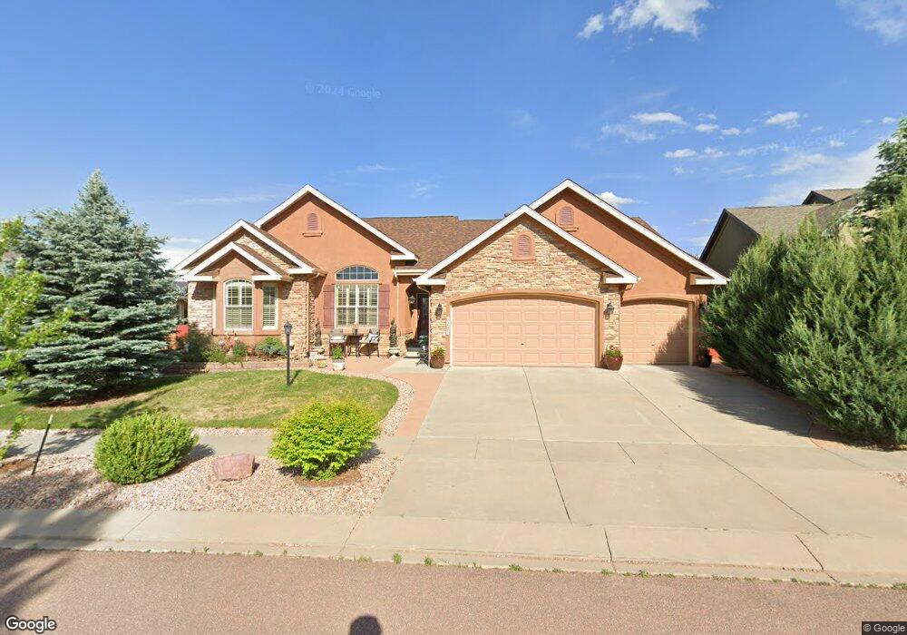
6201 Gunslinger Dr Colorado Springs, CO 80923
Ridgeview NeighborhoodEstimated Value: $694,167 - $744,000
5
Beds
4
Baths
2,354
Sq Ft
$303/Sq Ft
Est. Value
About This Home
This home is located at 6201 Gunslinger Dr, Colorado Springs, CO 80923 and is currently estimated at $713,042, approximately $302 per square foot. 6201 Gunslinger Dr is a home located in El Paso County with nearby schools including Stetson Elementary School, Skyview Middle School, and Sand Creek High School.
Ownership History
Date
Name
Owned For
Owner Type
Purchase Details
Closed on
Oct 11, 2007
Sold by
Elite Properties Of America Inc
Bought by
Hubbard Concesa
Current Estimated Value
Home Financials for this Owner
Home Financials are based on the most recent Mortgage that was taken out on this home.
Original Mortgage
$417,000
Outstanding Balance
$264,000
Interest Rate
6.48%
Mortgage Type
Unknown
Estimated Equity
$449,042
Create a Home Valuation Report for This Property
The Home Valuation Report is an in-depth analysis detailing your home's value as well as a comparison with similar homes in the area
Home Values in the Area
Average Home Value in this Area
Purchase History
| Date | Buyer | Sale Price | Title Company |
|---|---|---|---|
| Hubbard Concesa | $447,207 | Cb Title |
Source: Public Records
Mortgage History
| Date | Status | Borrower | Loan Amount |
|---|---|---|---|
| Open | Hubbard Concesa | $417,000 |
Source: Public Records
Tax History Compared to Growth
Tax History
| Year | Tax Paid | Tax Assessment Tax Assessment Total Assessment is a certain percentage of the fair market value that is determined by local assessors to be the total taxable value of land and additions on the property. | Land | Improvement |
|---|---|---|---|---|
| 2025 | $3,613 | $46,770 | -- | -- |
| 2024 | $3,259 | $46,890 | $7,400 | $39,490 |
| 2023 | $3,259 | $46,890 | $7,400 | $39,490 |
| 2022 | $3,203 | $35,220 | $6,670 | $28,550 |
| 2021 | $3,358 | $36,230 | $6,860 | $29,370 |
| 2020 | $2,915 | $33,530 | $5,720 | $27,810 |
| 2019 | $2,893 | $33,530 | $5,720 | $27,810 |
| 2018 | $2,694 | $30,850 | $4,840 | $26,010 |
| 2017 | $2,704 | $30,850 | $4,840 | $26,010 |
| 2016 | $3,063 | $35,620 | $4,710 | $30,910 |
| 2015 | $3,065 | $35,620 | $4,710 | $30,910 |
| 2014 | $2,624 | $30,070 | $4,460 | $25,610 |
Source: Public Records
Map
Nearby Homes
- 6016 Wild Bill Way
- 7199 Quiet Pond Place
- 7127 Indian River Dr
- 6380 Tenderfoot Dr
- 6292 Tenderfoot Dr
- 5918 Whiskey River Dr
- 6396 Tenderfoot Dr
- 6218 Escalade Point
- 7094 Red Sand Grove
- 6771 Sunny Alp St
- 6363 Sand Bar Point
- 6408 Butch Cassidy Blvd
- 5889 Brennan Ave
- 6524 Diamond Hitch Dr
- 5919 Brennan Ave
- 7647 Desert Wind Dr
- 6530 Van Winkle Dr
- 6513 Fowler Dr
- 6783 Balance Cir
- 7368 Prythania Park Dr
- 6189 Gunslinger Dr
- 6213 Gunslinger Dr
- 6124 High Noon Ave
- 6114 High Noon Ave
- 6177 Gunslinger Dr
- 6134 High Noon Ave
- 6094 High Noon Ave
- 6225 Gunslinger Dr
- 7175 Midnight Rose Dr
- 6188 Gunslinger Dr
- 6084 High Noon Ave
- 6144 High Noon Ave
- 6153 Gunslinger Dr
- 6176 Gunslinger Dr
- 6074 High Noon Ave
- 6123 High Noon Ave
- 6164 Gunslinger Dr
- 6113 High Noon Ave
- 6133 High Noon Ave
- 6103 High Noon Ave