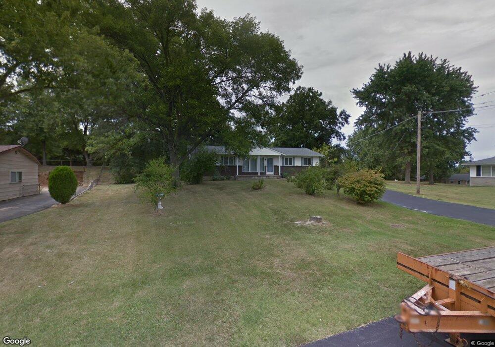
6201 James Dr Imperial, MO 63052
Estimated Value: $227,686 - $258,000
2
Beds
2
Baths
1,404
Sq Ft
$171/Sq Ft
Est. Value
About This Home
This home is located at 6201 James Dr, Imperial, MO 63052 and is currently estimated at $240,672, approximately $171 per square foot. 6201 James Dr is a home located in Jefferson County with nearby schools including Windsor High School, St. Joseph Catholic School, and St Johns Lutheran School.
Ownership History
Date
Name
Owned For
Owner Type
Purchase Details
Closed on
May 28, 2024
Sold by
Stinchcomb Matthew and Klumb Jennifer
Bought by
Klumb Jennifer
Current Estimated Value
Home Financials for this Owner
Home Financials are based on the most recent Mortgage that was taken out on this home.
Original Mortgage
$170,000
Outstanding Balance
$166,791
Interest Rate
5.95%
Mortgage Type
New Conventional
Estimated Equity
$73,881
Purchase Details
Closed on
Mar 26, 2014
Sold by
Sohn Joshua and Sohn Morgan
Bought by
Stinchcomb Matthew and Klumb Jennifer
Home Financials for this Owner
Home Financials are based on the most recent Mortgage that was taken out on this home.
Original Mortgage
$84,932
Interest Rate
4.25%
Mortgage Type
FHA
Create a Home Valuation Report for This Property
The Home Valuation Report is an in-depth analysis detailing your home's value as well as a comparison with similar homes in the area
Home Values in the Area
Average Home Value in this Area
Purchase History
| Date | Buyer | Sale Price | Title Company |
|---|---|---|---|
| Klumb Jennifer | -- | Touchstone Title & Abstract | |
| Stinchcomb Matthew | -- | None Available | |
| Stinchcomb Matthew | -- | None Available | |
| Stinchcomb Matthew | -- | None Available | |
| Stinchcomb Matthew | -- | None Available |
Source: Public Records
Mortgage History
| Date | Status | Borrower | Loan Amount |
|---|---|---|---|
| Open | Klumb Jennifer | $170,000 | |
| Previous Owner | Stinchcomb Matthew | $84,932 |
Source: Public Records
Tax History
| Year | Tax Paid | Tax Assessment Tax Assessment Total Assessment is a certain percentage of the fair market value that is determined by local assessors to be the total taxable value of land and additions on the property. | Land | Improvement |
|---|---|---|---|---|
| 2025 | $1,446 | $20,700 | $1,800 | $18,900 |
| 2024 | $1,446 | $18,900 | $1,800 | $17,100 |
| 2023 | $1,446 | $18,900 | $1,800 | $17,100 |
| 2022 | $1,436 | $18,900 | $1,800 | $17,100 |
| 2021 | $1,437 | $18,900 | $1,800 | $17,100 |
| 2020 | $1,293 | $16,700 | $1,400 | $15,300 |
| 2019 | $1,296 | $16,700 | $1,400 | $15,300 |
| 2018 | $1,549 | $20,200 | $1,400 | $18,800 |
| 2017 | $1,493 | $20,200 | $1,400 | $18,800 |
| 2016 | $1,288 | $18,700 | $1,600 | $17,100 |
Source: Public Records
Map
Nearby Homes
- 6027 Kensington Way
- 0 Unknown Unit MIS25074459
- 5863 Mayberry Dr
- 36 Huntleigh Woods
- 1615 Blueberry Dr
- 5832 Blackberry Dr
- 5829 Blackberry Dr
- 2110 Devonshire Dr
- 5757 Montebello Rd
- 1001 Willow Bend Rd
- 2338 Windsor Castle Dr
- 1660 Old State Road M
- 1433 Hoover Dr
- 0 Hwy Mm Unit MAR24032005
- 1675 Old State Road M
- 1082 Autumn Oaks Dr
- 1156 Oak Hollow Dr
- 2043 Grants Valley Ln
- 2162 Oakglen St
- 0 New Highway M Unit MAR25024234
- 1139 James Dr
- 6205 James Dr
- 238 Wolf Pack Dr
- 242 Wolf Pack Dr
- 234 Wolf Pack Dr
- 230 Wolf Pack Dr
- 6206 James Dr
- 226 Wolf Pack Dr
- 6209 James Dr
- 1124 Naes Dr
- 1120 Naes Dr
- 1131 James Dr
- 1132 James Dr
- 222 Wolf Pack Dr
- 235 Wolf Pack Dr
- 1118 Naes Dr
- 239 Wolf Pack Dr
- 243 Wolf Pack Dr
- 231 Wolf Pack Dr
- 6213 James Dr
Your Personal Tour Guide
Ask me questions while you tour the home.