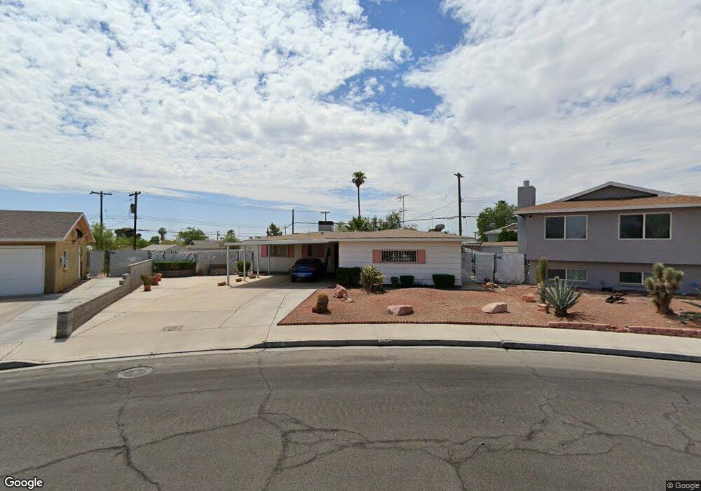
6201 Rassler Ave Las Vegas, NV 89107
Pittman NeighborhoodEstimated Value: $324,000 - $416,000
3
Beds
2
Baths
1,623
Sq Ft
$237/Sq Ft
Est. Value
About This Home
This home is located at 6201 Rassler Ave, Las Vegas, NV 89107 and is currently estimated at $385,000, approximately $237 per square foot. 6201 Rassler Ave is a home located in Clark County with nearby schools including Vail Pittman Elementary School, Frank F Garside Junior High School, and Western High School.
Ownership History
Date
Name
Owned For
Owner Type
Purchase Details
Closed on
Aug 17, 2011
Sold by
Brogden Joanne E
Bought by
Brogden Joanne E and Joanne E Brogden Living Trust
Current Estimated Value
Purchase Details
Closed on
Aug 23, 2006
Sold by
Christensen Vera H and Brogden Joanne E
Bought by
Brogden Joanne E and Christensen Vera H
Home Financials for this Owner
Home Financials are based on the most recent Mortgage that was taken out on this home.
Original Mortgage
$375,000
Interest Rate
6.57%
Mortgage Type
Credit Line Revolving
Create a Home Valuation Report for This Property
The Home Valuation Report is an in-depth analysis detailing your home's value as well as a comparison with similar homes in the area
Home Values in the Area
Average Home Value in this Area
Purchase History
| Date | Buyer | Sale Price | Title Company |
|---|---|---|---|
| Brogden Joanne E | -- | None Available | |
| Brogden Joanne E | -- | None Available | |
| Brogden Joanne E | -- | None Available |
Source: Public Records
Mortgage History
| Date | Status | Borrower | Loan Amount |
|---|---|---|---|
| Closed | Brogden Joanne E | $375,000 |
Source: Public Records
Tax History Compared to Growth
Tax History
| Year | Tax Paid | Tax Assessment Tax Assessment Total Assessment is a certain percentage of the fair market value that is determined by local assessors to be the total taxable value of land and additions on the property. | Land | Improvement |
|---|---|---|---|---|
| 2025 | $828 | $52,466 | $31,238 | $21,228 |
| 2024 | $805 | $52,466 | $31,238 | $21,228 |
| 2023 | $656 | $51,862 | $32,708 | $19,154 |
| 2022 | $781 | $44,670 | $27,563 | $17,107 |
| 2021 | $759 | $40,925 | $24,990 | $15,935 |
| 2020 | $734 | $37,885 | $22,418 | $15,467 |
| 2019 | $712 | $33,667 | $18,743 | $14,924 |
| 2018 | $692 | $29,782 | $15,803 | $13,979 |
| 2017 | $948 | $28,904 | $15,050 | $13,854 |
| 2016 | $656 | $24,572 | $11,200 | $13,372 |
| 2015 | $654 | $22,073 | $9,100 | $12,973 |
| 2014 | $634 | $18,778 | $5,250 | $13,528 |
Source: Public Records
Map
Nearby Homes
- 6121 Fawn Cir
- 6100 Fawn Cir
- 704 N Wallace Dr
- 6112 Denver Cir
- 6224 Fargo Ave
- 6244 Rassler Ave
- 5924 Iris Ave
- 6261 Rassler Ave
- 6299 W Washington Ave
- 6325 W Washington Ave
- 6229 Saginaw Dr
- 5720 Goldmount Ave
- 5816 Marka Dr
- 304 Orland St Unit 53
- 304 Orland St Unit 56
- 304 Orland St Unit 39
- 304 Orland St Unit 38
- 304 Orland St Unit 47
- 304 Orland St Unit 43
- 1116 N Jones Blvd
- 500 N Wallace Dr
- 6205 Rassler Ave
- 6204 Hobart Ave
- 6200 Hobart Ave
- 6124 Empire Cir
- 6125 Fawn Cir
- 504 N Wallace Dr
- 6209 Rassler Ave
- 6208 Hobart Ave
- 6120 Empire Cir
- 312 N Wallace Dr
- 501 N Wallace Dr
- 508 N Wallace Dr
- 6125 Empire Cir
- 6212 Hobart Ave
- 6213 Rassler Ave
- 6124 Fawn Cir
- 6204 Rassler Ave
- 6116 Empire Cir
- 6216 Hobart Ave