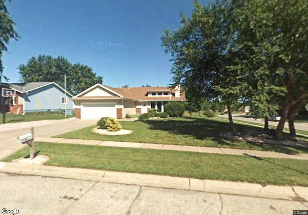
6201 S 29th Cir Lincoln, NE 68516
Estimated Value: $315,239 - $344,000
3
Beds
3
Baths
1,402
Sq Ft
$236/Sq Ft
Est. Value
About This Home
This home is located at 6201 S 29th Cir, Lincoln, NE 68516 and is currently estimated at $331,310, approximately $236 per square foot. 6201 S 29th Cir is a home located in Lancaster County with nearby schools including Rousseau Elementary School, Scott Middle School, and Southwest High School.
Ownership History
Date
Name
Owned For
Owner Type
Purchase Details
Closed on
Oct 31, 2007
Sold by
Cummins James D and Cummins Carolyn K
Bought by
Vanfossen Robb
Current Estimated Value
Home Financials for this Owner
Home Financials are based on the most recent Mortgage that was taken out on this home.
Original Mortgage
$137,600
Outstanding Balance
$86,620
Interest Rate
6.37%
Mortgage Type
Unknown
Estimated Equity
$244,690
Create a Home Valuation Report for This Property
The Home Valuation Report is an in-depth analysis detailing your home's value as well as a comparison with similar homes in the area
Home Values in the Area
Average Home Value in this Area
Purchase History
| Date | Buyer | Sale Price | Title Company |
|---|---|---|---|
| Vanfossen Robb | $172,000 | Dc Title |
Source: Public Records
Mortgage History
| Date | Status | Borrower | Loan Amount |
|---|---|---|---|
| Open | Vanfossen Robb | $137,600 |
Source: Public Records
Tax History Compared to Growth
Tax History
| Year | Tax Paid | Tax Assessment Tax Assessment Total Assessment is a certain percentage of the fair market value that is determined by local assessors to be the total taxable value of land and additions on the property. | Land | Improvement |
|---|---|---|---|---|
| 2025 | $4,165 | $314,100 | $64,800 | $249,300 |
| 2024 | $4,165 | $298,400 | $64,800 | $233,600 |
| 2023 | $4,745 | $283,100 | $64,800 | $218,300 |
| 2022 | $4,556 | $228,600 | $60,000 | $168,600 |
| 2021 | $4,310 | $228,600 | $60,000 | $168,600 |
| 2020 | $4,116 | $215,400 | $60,000 | $155,400 |
| 2019 | $4,116 | $215,400 | $60,000 | $155,400 |
| 2018 | $3,868 | $201,500 | $60,000 | $141,500 |
| 2017 | $3,903 | $201,500 | $60,000 | $141,500 |
| 2016 | $3,647 | $187,300 | $54,000 | $133,300 |
| 2015 | $3,622 | $187,300 | $54,000 | $133,300 |
| 2014 | $3,678 | $189,100 | $54,000 | $135,100 |
| 2013 | -- | $189,100 | $54,000 | $135,100 |
Source: Public Records
Map
Nearby Homes
- 6216 Briar Rosa Dr
- 2844 Jane Ln
- 6305 Benjamin Place
- 2941 Orwell St
- 3036 Laredo Dr
- 2905 Londonshire Ct
- 2716 Kipling Cir
- 5801 S 32nd St
- 5701 Briar Rosa Dr
- 2832 Shelley Cir
- 3119 Shelley St
- 6006 S 25th St
- 6418 Lone Tree Dr
- 6027 S 25th St
- 2930 Drawbridge Ct
- 6419 Lone Tree Dr
- 6528 Lone Tree Dr
- 2515 Ridge Rd
- 2355 Summertime Ct
- 2352 Summertime Ct
- 6207 S 29th Cir
- 6215 S 29th Cir
- 6200 S 29th Cir
- 6224 Briar Rosa Dr
- 6208 Briar Rosa Dr
- 6216 S 29th Cir
- 6230 Briar Rosa Dr
- 6221 S 29th Cir
- 6241 Briar Rosa Dr
- 6226 S 29th Cir
- 2821 Tennyson St
- 2801 Tennyson St
- 2831 Tennyson St
- 2811 Tennyson St
- 6227 S 29th Cir
- 2841 Tennyson St
- 6203 Benjamin Place
- 6232 S 29th Cir
- 6249 Briar Rosa Dr
- 2901 Tennyson St