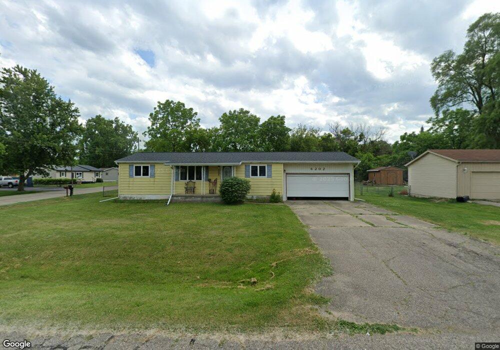
6202 Briggs Ave Burton, MI 48509
Estimated Value: $136,000 - $154,182
--
Bed
1
Bath
1,008
Sq Ft
$147/Sq Ft
Est. Value
About This Home
This home is located at 6202 Briggs Ave, Burton, MI 48509 and is currently estimated at $148,296, approximately $147 per square foot. 6202 Briggs Ave is a home located in Genesee County with nearby schools including Barhitte Elementary School, Waterbrook Christian Academy, and Genesee Christian School.
Ownership History
Date
Name
Owned For
Owner Type
Purchase Details
Closed on
Apr 29, 2025
Sold by
Silvernale Denise D and Silvernale William S
Bought by
Silvernale Denise D and Silvernale Mark
Current Estimated Value
Purchase Details
Closed on
Sep 26, 2001
Sold by
Kehoe Albert G and Kehoe Clara B
Bought by
Silvernale William S and Silvernale Denise D
Home Financials for this Owner
Home Financials are based on the most recent Mortgage that was taken out on this home.
Original Mortgage
$60,000
Interest Rate
6.8%
Create a Home Valuation Report for This Property
The Home Valuation Report is an in-depth analysis detailing your home's value as well as a comparison with similar homes in the area
Home Values in the Area
Average Home Value in this Area
Purchase History
| Date | Buyer | Sale Price | Title Company |
|---|---|---|---|
| Silvernale Denise D | -- | None Listed On Document | |
| Silvernale William S | $46,500 | Sargents Abstract & Title Co |
Source: Public Records
Mortgage History
| Date | Status | Borrower | Loan Amount |
|---|---|---|---|
| Previous Owner | Silvernale William S | $60,000 |
Source: Public Records
Tax History Compared to Growth
Tax History
| Year | Tax Paid | Tax Assessment Tax Assessment Total Assessment is a certain percentage of the fair market value that is determined by local assessors to be the total taxable value of land and additions on the property. | Land | Improvement |
|---|---|---|---|---|
| 2025 | $1,907 | $70,900 | $0 | $0 |
| 2024 | $1,448 | $72,500 | $0 | $0 |
| 2023 | $1,402 | $65,300 | $0 | $0 |
| 2022 | $715 | $54,100 | $0 | $0 |
| 2021 | $350 | $40,400 | $0 | $0 |
| 2020 | $1,359 | $40,900 | $0 | $0 |
| 2019 | $1,256 | $40,600 | $0 | $0 |
| 2018 | $1,562 | $39,200 | $0 | $0 |
| 2017 | $1,501 | $39,200 | $0 | $0 |
| 2016 | $1,486 | $37,800 | $0 | $0 |
| 2015 | $1,511 | $0 | $0 | $0 |
| 2012 | -- | $30,100 | $30,100 | $0 |
Source: Public Records
Map
Nearby Homes
- 1029 Adams Rd
- 1163 S Packard Ave
- 1056 Adams Rd
- 6123 Lapeer Rd
- 1264 Brabbs St
- 6088 Lapeer Rd
- 1147 Rinn St
- 6149 Roberta St
- 1220 S Belsay Rd
- 1.36 Acres E Court St S
- 6041 Roberta St
- 1450 Transue Ave
- 1345 Cutler St
- 1413 Martha Ave
- 5305 Lapeer Rd
- 5249 Lapeer Rd
- 0 Lapeer rd., Burton Lapeer Rd
- 1380 Audrey St
- 6175 Crabtree Ln
- 1130 Kra Nur Dr
- 6188 Briggs Ave
- 1095 Kettering St
- 1085 Lasalle Ave
- 6203 Briggs Ave
- 1095 Lasalle Ave
- 1107 Kettering St
- 6187 Briggs Ave
- 1103 Lasalle Ave
- 1067 Lasalle Ave
- 1057 Kettering St
- 1102 S Packard Ave
- 6166 Briggs Ave
- 1070 Kettering St
- 1115 Kettering St
- 1096 Kettering St
- 1112 S Packard Ave
- 1104 Kettering St
- 1119 Lasalle Ave
- 1058 Kettering St
- 1051 Kettering St