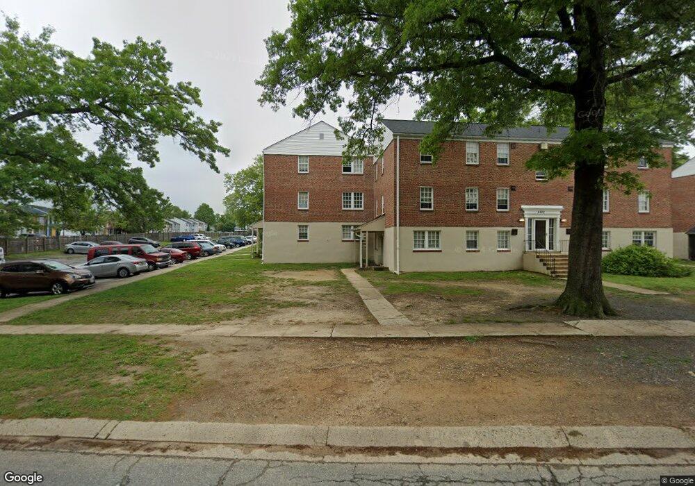
6202 Cedar Dr Unit D Edgewood, MD 21040
Estimated Value: $64,000 - $70,427
2
Beds
1
Bath
--
Sq Ft
43,560
Sq Ft Lot
About This Home
This home is located at 6202 Cedar Dr Unit D, Edgewood, MD 21040 and is currently estimated at $67,214. 6202 Cedar Dr Unit D is a home located in Harford County with nearby schools including Edgewood Elementary School, Edgewood Middle School, and Edgewood High School.
Ownership History
Date
Name
Owned For
Owner Type
Purchase Details
Closed on
Feb 27, 2004
Sold by
Bond Clarence Monroe
Bought by
Hutchins Richard C
Current Estimated Value
Purchase Details
Closed on
Sep 6, 1991
Sold by
Pearce Wilbur B
Bought by
Bond Clarence Monroe
Home Financials for this Owner
Home Financials are based on the most recent Mortgage that was taken out on this home.
Original Mortgage
$42,250
Interest Rate
9.14%
Purchase Details
Closed on
Dec 27, 1984
Sold by
Arsenal Limited Ptnshp
Bought by
Pearce Wilbur B
Home Financials for this Owner
Home Financials are based on the most recent Mortgage that was taken out on this home.
Original Mortgage
$27,900
Interest Rate
13.18%
Create a Home Valuation Report for This Property
The Home Valuation Report is an in-depth analysis detailing your home's value as well as a comparison with similar homes in the area
Home Values in the Area
Average Home Value in this Area
Purchase History
| Date | Buyer | Sale Price | Title Company |
|---|---|---|---|
| Hutchins Richard C | $37,156 | -- | |
| Bond Clarence Monroe | $41,500 | -- | |
| Pearce Wilbur B | $34,900 | -- |
Source: Public Records
Mortgage History
| Date | Status | Borrower | Loan Amount |
|---|---|---|---|
| Previous Owner | Bond Clarence Monroe | $42,250 | |
| Previous Owner | Pearce Wilbur B | $27,900 |
Source: Public Records
Tax History
| Year | Tax Paid | Tax Assessment Tax Assessment Total Assessment is a certain percentage of the fair market value that is determined by local assessors to be the total taxable value of land and additions on the property. | Land | Improvement |
|---|---|---|---|---|
| 2025 | $305 | $29,000 | $0 | $0 |
| 2024 | $305 | $28,000 | $0 | $0 |
| 2023 | $294 | $27,000 | $8,000 | $19,000 |
| 2022 | $294 | $27,000 | $8,000 | $19,000 |
| 2021 | $312 | $27,000 | $8,000 | $19,000 |
| 2020 | $312 | $27,000 | $8,000 | $19,000 |
| 2019 | $296 | $25,667 | $0 | $0 |
| 2018 | $278 | $24,333 | $0 | $0 |
| 2017 | $263 | $23,000 | $0 | $0 |
| 2016 | -- | $23,000 | $0 | $0 |
| 2015 | $389 | $23,000 | $0 | $0 |
| 2014 | $389 | $25,600 | $0 | $0 |
Source: Public Records
Map
Nearby Homes
- 2203 Willoughby Beach Rd
- 2020 Hanson Rd
- 2314 Rosewood Dr
- 503 Catalpa Ln
- 2000 Hanson Rd
- 2115 Nuttal Ave
- 1826 Hanson Rd
- 2113 Nuttal Ave
- 1918 Bayberry Rd
- 303 Purple Place
- 501 Arbor Ct
- 316 Purple Place
- 314 Purple Place
- 1921 Harewood Rd
- 1802 Larch Dr
- 730 Sequoia Dr
- 2613 Thornberry Dr
- 207 Tulip Ct
- 1907 Harewood Rd
- 304 Canoe Ln
- 6202 Cedar Dr Unit D
- 6202 Cedar Dr Unit A
- 6202 Cedar Dr Unit E
- 6202 Cedar Dr Unit B
- 6202 Cedar Dr Unit F
- 6202 Cedar Dr Unit C
- 6202 Cedar Dr Unit F
- 6202 Cedar Dr
- 6202-F Cedar Dr
- 6201-F Cedar Dr
- 6204A Baker Cir
- 6204 Baker Cir Unit E
- 6204 Baker Cir Unit F
- 6204 Baker Cir Unit A
- 6204 Baker Cir Unit C
- 6204 Baker Cir Unit B
- 6204 Baker Cir Unit D
- 6204 Baker Cir Unit A
- 6204 Baker Cir Unit B
- 6204 Baker Cir
Your Personal Tour Guide
Ask me questions while you tour the home.