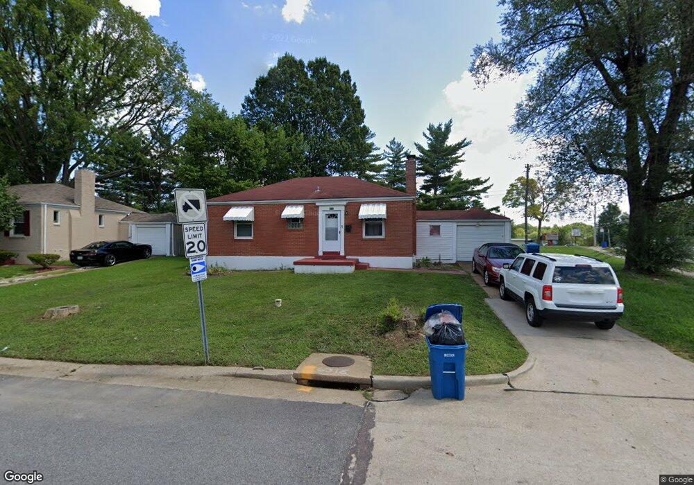
6202 Tyndall Dr Saint Louis, MO 63134
Estimated Value: $77,000 - $98,000
2
Beds
1
Bath
1,008
Sq Ft
$89/Sq Ft
Est. Value
About This Home
This home is located at 6202 Tyndall Dr, Saint Louis, MO 63134 and is currently estimated at $89,562, approximately $88 per square foot. 6202 Tyndall Dr is a home located in St. Louis County with nearby schools including Berkeley Elementary School, STEAM Academy at McCluer South-Berkeley High School, and Blessed Teresa of Calcutta Catholic School.
Ownership History
Date
Name
Owned For
Owner Type
Purchase Details
Closed on
Sep 11, 2009
Sold by
Lsf6 Mercury Reo Investments Trust Serie
Bought by
Property Acquisition & Holding Llc
Current Estimated Value
Home Financials for this Owner
Home Financials are based on the most recent Mortgage that was taken out on this home.
Original Mortgage
$37,350
Interest Rate
5.26%
Mortgage Type
Future Advance Clause Open End Mortgage
Purchase Details
Closed on
Feb 26, 2009
Sold by
Ringo Michael S
Bought by
Lsf6 Mercury Reo Investments Trust Serie
Create a Home Valuation Report for This Property
The Home Valuation Report is an in-depth analysis detailing your home's value as well as a comparison with similar homes in the area
Home Values in the Area
Average Home Value in this Area
Purchase History
| Date | Buyer | Sale Price | Title Company |
|---|---|---|---|
| Property Acquisition & Holding Llc | $20,500 | Nations Title Agency Mo Inc | |
| Lsf6 Mercury Reo Investments Trust Serie | $45,396 | None Available |
Source: Public Records
Mortgage History
| Date | Status | Borrower | Loan Amount |
|---|---|---|---|
| Closed | Property Acquisition & Holding Llc | $37,350 |
Source: Public Records
Tax History Compared to Growth
Tax History
| Year | Tax Paid | Tax Assessment Tax Assessment Total Assessment is a certain percentage of the fair market value that is determined by local assessors to be the total taxable value of land and additions on the property. | Land | Improvement |
|---|---|---|---|---|
| 2025 | $1,041 | $16,060 | $1,430 | $14,630 |
| 2024 | $1,041 | $13,490 | $1,060 | $12,430 |
| 2023 | $1,055 | $13,850 | $1,060 | $12,790 |
| 2022 | $802 | $9,120 | $1,060 | $8,060 |
| 2021 | $797 | $9,120 | $1,060 | $8,060 |
| 2020 | $635 | $6,710 | $1,100 | $5,610 |
| 2019 | $609 | $6,710 | $1,100 | $5,610 |
| 2018 | $502 | $4,940 | $1,140 | $3,800 |
| 2017 | $499 | $4,940 | $1,140 | $3,800 |
| 2016 | $517 | $4,940 | $1,140 | $3,800 |
| 2015 | $502 | $4,940 | $1,140 | $3,800 |
| 2014 | $1,036 | $10,490 | $1,980 | $8,510 |
Source: Public Records
Map
Nearby Homes
- 8306 Whitewater Dr
- 6106 Jackson Ave
- 6315 Washington Ave
- 6315 Jackson Ave
- 8219 Davenport Dr
- 8235 Zoe Dr
- 8140 Packard Ave
- 6029 Washington Ave
- 6153 Hancock Ave
- 8042 Patterson Dr
- 6029 Evergreen Blvd
- 5948 Madison Ave
- 6135 Shillington Dr
- 8027 Aline Ave
- 6349 Garfield Ave
- 6013 Garfield Ave
- 6005 Shillington Dr
- 6016 Shillington Dr
- 117 Henquin Dr
- 324 Newell Dr
- 6206 Tyndall Dr
- 6210 Tyndall Dr
- 6203 Tyndall Dr
- 6207 Tyndall Dr
- 6214 Tyndall Dr
- 6211 Tyndall Dr
- 8363 Airport Rd
- 6215 Tyndall Dr
- 6218 Tyndall Dr
- 8333 Whitewater Dr
- 6210 Jefferson Ave
- 8329 Whitewater Dr
- 8325 Whitewater Dr
- 8337 Whitewater Dr
- 6214 Jefferson Ave
- 8321 Whitewater Dr
- 6219 Tyndall Dr
- 8317 Whitewater Dr
- 6218 Jefferson Ave
- 6222 Tyndall Dr