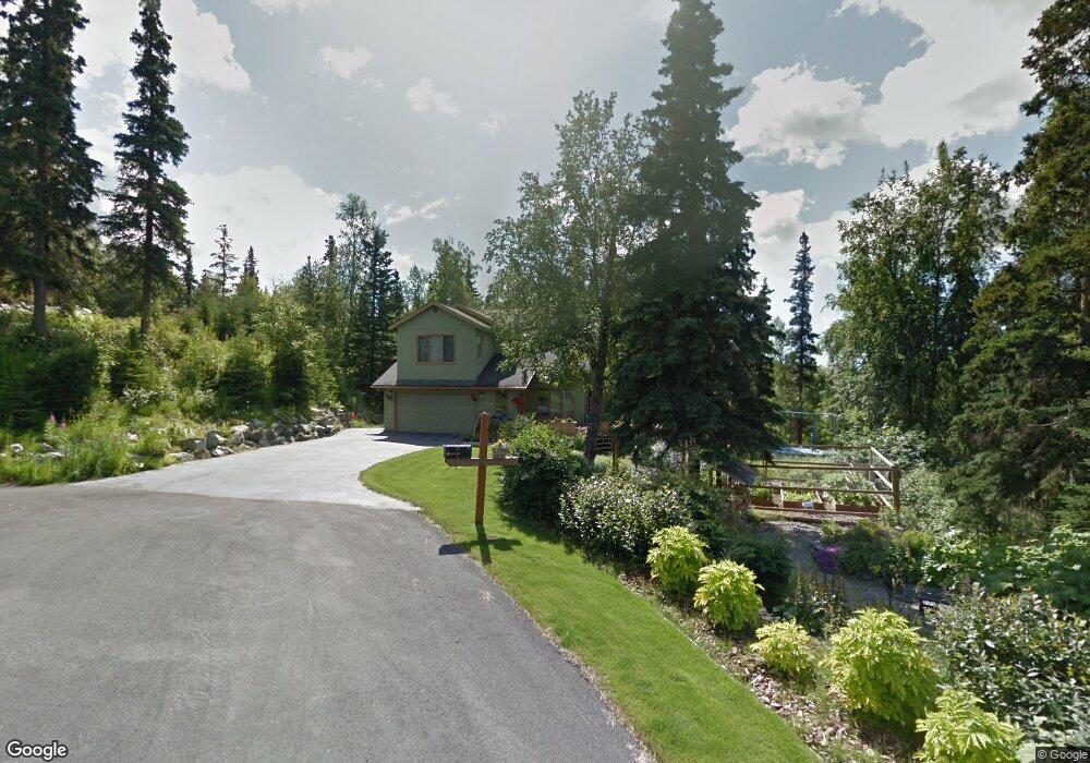
6203 Green Tree Cir Anchorage, AK 99507
Mid-Hillside NeighborhoodEstimated Value: $567,000 - $703,000
3
Beds
3
Baths
2,018
Sq Ft
$314/Sq Ft
Est. Value
About This Home
This home is located at 6203 Green Tree Cir, Anchorage, AK 99507 and is currently estimated at $634,187, approximately $314 per square foot. 6203 Green Tree Cir is a home located in Anchorage Municipality with nearby schools including O'Malley Elementary School, Hanshew Middle School, and Service High School.
Ownership History
Date
Name
Owned For
Owner Type
Purchase Details
Closed on
May 29, 2012
Sold by
Hunt Thomas K and Smith Sharon W
Bought by
Hunt Thomas K and Smith Sharon W
Current Estimated Value
Purchase Details
Closed on
Sep 28, 1995
Sold by
Brunner Kenneth J and Crow-Brunner Sheryl
Bought by
Smith Sharon W and Hunt Thomas K
Home Financials for this Owner
Home Financials are based on the most recent Mortgage that was taken out on this home.
Original Mortgage
$157,500
Outstanding Balance
$1,145
Interest Rate
7.97%
Mortgage Type
New Conventional
Estimated Equity
$633,042
Create a Home Valuation Report for This Property
The Home Valuation Report is an in-depth analysis detailing your home's value as well as a comparison with similar homes in the area
Home Values in the Area
Average Home Value in this Area
Purchase History
| Date | Buyer | Sale Price | Title Company |
|---|---|---|---|
| Hunt Thomas K | -- | None Available | |
| Smith Sharon W | -- | -- |
Source: Public Records
Mortgage History
| Date | Status | Borrower | Loan Amount |
|---|---|---|---|
| Open | Smith Sharon W | $157,500 |
Source: Public Records
Tax History Compared to Growth
Tax History
| Year | Tax Paid | Tax Assessment Tax Assessment Total Assessment is a certain percentage of the fair market value that is determined by local assessors to be the total taxable value of land and additions on the property. | Land | Improvement |
|---|---|---|---|---|
| 2025 | $8,727 | $632,200 | $130,800 | $501,400 |
| 2024 | $8,727 | $582,400 | $124,200 | $458,200 |
| 2023 | $7,917 | $509,100 | $112,900 | $396,200 |
| 2022 | $7,899 | $503,100 | $112,000 | $391,100 |
| 2021 | $7,816 | $463,300 | $112,000 | $351,300 |
| 2020 | $6,737 | $449,100 | $112,000 | $337,100 |
| 2019 | $6,077 | $451,100 | $112,000 | $339,100 |
| 2018 | $5,977 | $444,800 | $128,000 | $316,800 |
| 2017 | $6,332 | $446,700 | $128,000 | $318,700 |
| 2016 | $5,439 | $454,600 | $128,000 | $326,600 |
| 2015 | $5,439 | $424,600 | $123,500 | $301,100 |
| 2014 | $5,439 | $416,200 | $116,600 | $299,600 |
Source: Public Records
Map
Nearby Homes
- 5900 Orth Cir
- 6411 Ridge Tree Cir
- 6460 Limestone Cir
- 6815 Double Tree Ct
- L3 Totem Rd
- 0 Rd
- 10960 Totem Rd
- 000 Valley View Dr
- 6550 Rockridge Dr
- 9203 Strutz Ave
- L7 Panorama Dr
- L13 Panorama Dr
- L3 Panorama Dr
- L6 Panorama Dr
- L11 Panorama Dr
- L2 Panorama Dr
- L10 Panorama Dr
- 4715 E 112th Ave
- 11840 Coughlan Way
- 0000 E 113th Ave
- 6202 Green Tree Cir
- 6243 Green Tree Cir
- 6222 Green Tree Cir
- 6301 Brown Tree Cir
- 6242 Green Tree Cir
- 6201 W Tree Dr
- 6201 West Tree Dr
- 6300 Brown Tree Cir
- 10110 Lone Tree Dr
- 6321 Brown Tree Cir
- 6151 West Tree Dr
- 10210 Lone Tree Dr
- 6151 W Tree Dr
- 6211 West Tree Dr
- 6211 W Tree Dr
- 10181 Craig Creek Cir
- 6141 W Tree Dr
- 6141 West Tree Dr
- 10100 Lone Tree Dr
- 6320 Brown Tree Cir