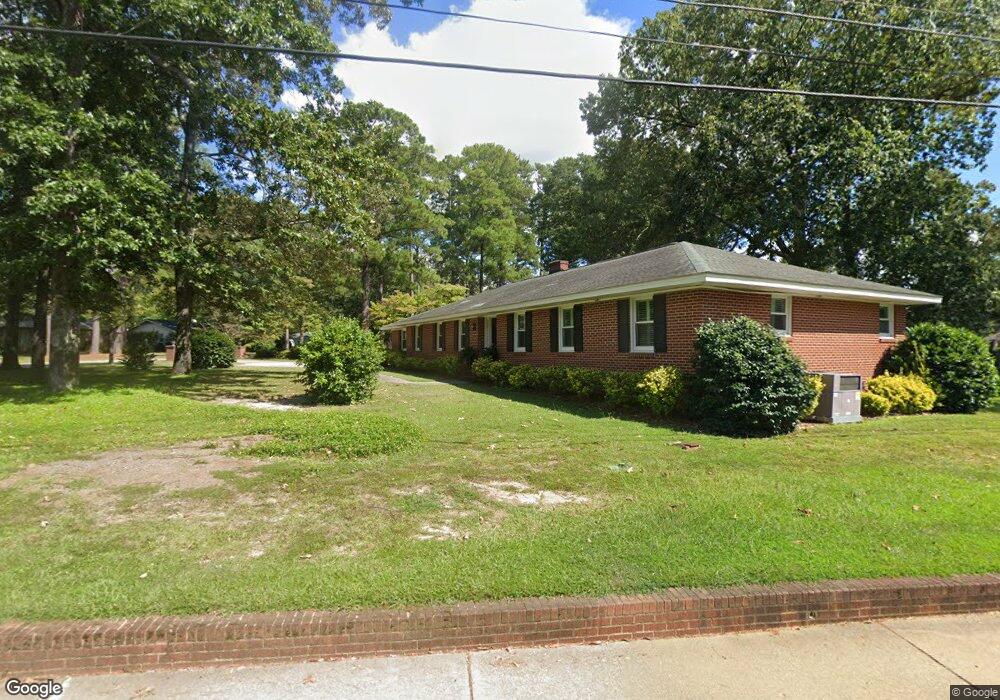
6204 Macon Rd Columbia, SC 29209
The Hamptons NeighborhoodEstimated Value: $338,000 - $412,000
3
Beds
2
Baths
2,503
Sq Ft
$151/Sq Ft
Est. Value
About This Home
This home is located at 6204 Macon Rd, Columbia, SC 29209 and is currently estimated at $377,980, approximately $151 per square foot. 6204 Macon Rd is a home located in Richland County with nearby schools including Meadowfield Elementary School, Hand Middle School, and Dreher High School.
Ownership History
Date
Name
Owned For
Owner Type
Purchase Details
Closed on
Apr 30, 2021
Sold by
Burnside Blakely H
Bought by
Burnside Mary Blakely Hemiricks and Burnside David B
Current Estimated Value
Purchase Details
Closed on
Jan 7, 2014
Sold by
Fuller Matthew R and Fuller Abigail Rush
Bought by
Burnside Marion T and Burnside Blakely H
Purchase Details
Closed on
Aug 19, 2009
Sold by
Rush Carl S
Bought by
Fuller Abigail Rush and Fuller Matthew R
Create a Home Valuation Report for This Property
The Home Valuation Report is an in-depth analysis detailing your home's value as well as a comparison with similar homes in the area
Home Values in the Area
Average Home Value in this Area
Purchase History
| Date | Buyer | Sale Price | Title Company |
|---|---|---|---|
| Burnside Mary Blakely Hemiricks | -- | None Available | |
| Burnside Marion T | $169,950 | None Available | |
| Fuller Abigail Rush | $25,000 | -- |
Source: Public Records
Tax History Compared to Growth
Tax History
| Year | Tax Paid | Tax Assessment Tax Assessment Total Assessment is a certain percentage of the fair market value that is determined by local assessors to be the total taxable value of land and additions on the property. | Land | Improvement |
|---|---|---|---|---|
| 2024 | $1,884 | $272,900 | $0 | $0 |
| 2023 | $1,884 | $9,492 | $0 | $0 |
| 2022 | $1,720 | $237,300 | $39,900 | $197,400 |
| 2021 | $1,402 | $9,490 | $0 | $0 |
| 2020 | $1,479 | $9,490 | $0 | $0 |
| 2019 | $1,887 | $9,490 | $0 | $0 |
| 2018 | $1,559 | $7,660 | $0 | $0 |
| 2017 | $1,518 | $7,660 | $0 | $0 |
| 2016 | $1,464 | $7,660 | $0 | $0 |
| 2015 | $1,464 | $7,660 | $0 | $0 |
| 2014 | $1,357 | $177,800 | $0 | $0 |
| 2013 | -- | $10,670 | $0 | $0 |
Source: Public Records
Map
Nearby Homes
- 405 Black Friars Rd
- 6603 Christie Rd
- 6400 Saye Cut
- 604 Hampton Trace Ln
- 6627 Christie Rd
- 497 Galway Ln
- 109 Rosebank Dr
- 104 Preserve Ln
- 513 Knollwood Dr
- 444 Cami Forest Ln
- 416 Tamarack Dr
- 622 Chimney Hill Rd
- 821 Walters Ln
- 9 Ansley Ct
- 918 Cedar Terrace
- 1126 S Beltline Blvd
- 811 Rockwood Rd
- 1511 Tall Pines Cir
- 509 Burnside Dr
- 1825 Tall Pines Cir
- 6210 Macon Rd
- 516 Old Woodlands Rd
- 6148 Rutledge Hill Rd
- 6216 Macon Rd
- 6209 Macon Rd
- 524 Old Woodlands Rd
- 6155 Hampton Ridge Rd
- 6211 Dublin Rd
- 6215 Macon Rd
- 6149 Rutledge Hill Rd
- 6222 Macon Rd
- 6223 Dublin Rd
- 6221 Macon Rd
- 6142 Rutledge Hill Rd
- 6149 Hampton Ridge Rd
- 6204 Olde Knight Pkwy
- 528 Old Woodlands Rd
- 6208 Olde Knight Pkwy
- 6143 Rutledge Hill Rd
- 6202 Dublin Rd