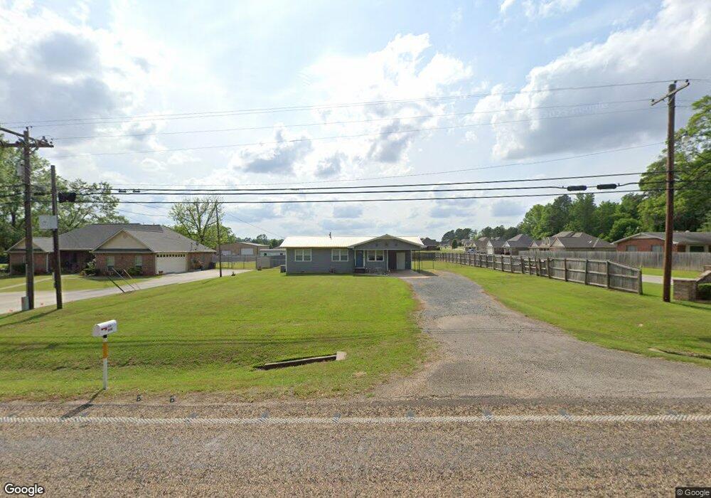
6205 Buchanan Loop Rd Texarkana, TX 75501
Estimated Value: $131,972 - $212,000
--
Bed
--
Bath
912
Sq Ft
$178/Sq Ft
Est. Value
About This Home
This home is located at 6205 Buchanan Loop Rd, Texarkana, TX 75501 and is currently estimated at $161,993, approximately $177 per square foot. 6205 Buchanan Loop Rd is a home located in Bowie County with nearby schools including Liberty-Eylau Early Childhood Center, Liberty-Eylau C.K. Bender Elementary Campus, and Liberty-Eylau Primary School.
Ownership History
Date
Name
Owned For
Owner Type
Purchase Details
Closed on
May 15, 2019
Sold by
Allgor Stewart V and Allgor Shannon R
Bought by
Harbo Properties Llc
Current Estimated Value
Purchase Details
Closed on
Dec 6, 2007
Sold by
Guillot Bryan and Guillot Michael J
Bought by
Allgor Stewart and Allgor Shannon R
Home Financials for this Owner
Home Financials are based on the most recent Mortgage that was taken out on this home.
Original Mortgage
$60,500
Interest Rate
6.4%
Mortgage Type
New Conventional
Create a Home Valuation Report for This Property
The Home Valuation Report is an in-depth analysis detailing your home's value as well as a comparison with similar homes in the area
Home Values in the Area
Average Home Value in this Area
Purchase History
| Date | Buyer | Sale Price | Title Company |
|---|---|---|---|
| Harbo Properties Llc | $60,500 | None Available | |
| Allgor Stewart | $60,500 | None Available |
Source: Public Records
Mortgage History
| Date | Status | Borrower | Loan Amount |
|---|---|---|---|
| Previous Owner | Allgor Stewart | $60,500 |
Source: Public Records
Tax History Compared to Growth
Tax History
| Year | Tax Paid | Tax Assessment Tax Assessment Total Assessment is a certain percentage of the fair market value that is determined by local assessors to be the total taxable value of land and additions on the property. | Land | Improvement |
|---|---|---|---|---|
| 2025 | $1,714 | $136,019 | $16,000 | $120,019 |
| 2024 | $1,714 | $116,024 | $16,000 | $100,024 |
| 2023 | $1,623 | $108,616 | $16,000 | $92,616 |
| 2022 | $1,700 | $98,691 | $16,000 | $82,691 |
| 2021 | $1,128 | $61,586 | $14,500 | $47,086 |
| 2020 | $1,095 | $59,343 | $14,500 | $44,843 |
| 2019 | $1,111 | $57,207 | $14,500 | $42,707 |
| 2018 | $1,079 | $55,561 | $14,500 | $41,061 |
| 2017 | $1,079 | $55,775 | $14,500 | $41,275 |
| 2016 | $1,079 | $55,775 | $14,500 | $41,275 |
| 2015 | $785 | $55,363 | $14,500 | $40,863 |
| 2014 | $785 | $55,067 | $14,500 | $40,567 |
Source: Public Records
Map
Nearby Homes
- 101 Redwood Dr
- 194 W Starlite Dr
- 280 Patriot Way
- 6 Southridge St
- 6514 Buchanan Loop Rd
- 403 Brookfield St
- 144 Joe Tyl Rd
- 2043 Randall Rd
- 7689 Us-59
- 6815 Buchanan Loop Rd
- 6606 Us-59
- 6606 Us Highway 59 S
- 7685 State Highway 59
- 0 Randall Rd
- lot15 B2 Quail Brook
- lot15 B1 Quail Brook
- lot14 B2 Quail Brook
- Lot 1 B2 Quail Brook
- 39 Quail Brook Dr
- 206 Fm 3244
- 6203 Buchanan Loop Rd
- 6207 Buchanan Loop Rd
- 45 Patriot Way
- 50 Patriot Way
- 6201 Buchanan Loop Rd
- 38 W Starlite Dr
- 102 Maryland Dr
- 101 1/2 Starlite Dr
- 101 Starlite Dr
- 62 Patriot Way
- 6301 Buchanan Loop Rd
- 96 W Starlite Dr
- 104 Maryland Dr
- 82 Patriot Way
- 6105 Buchanan Loop Rd
- 103 Maryland Dr
- 106 Maryland Dr
- 104 W Starlite Dr
- 103 Starlite Dr
- 88 W Starlite Dr