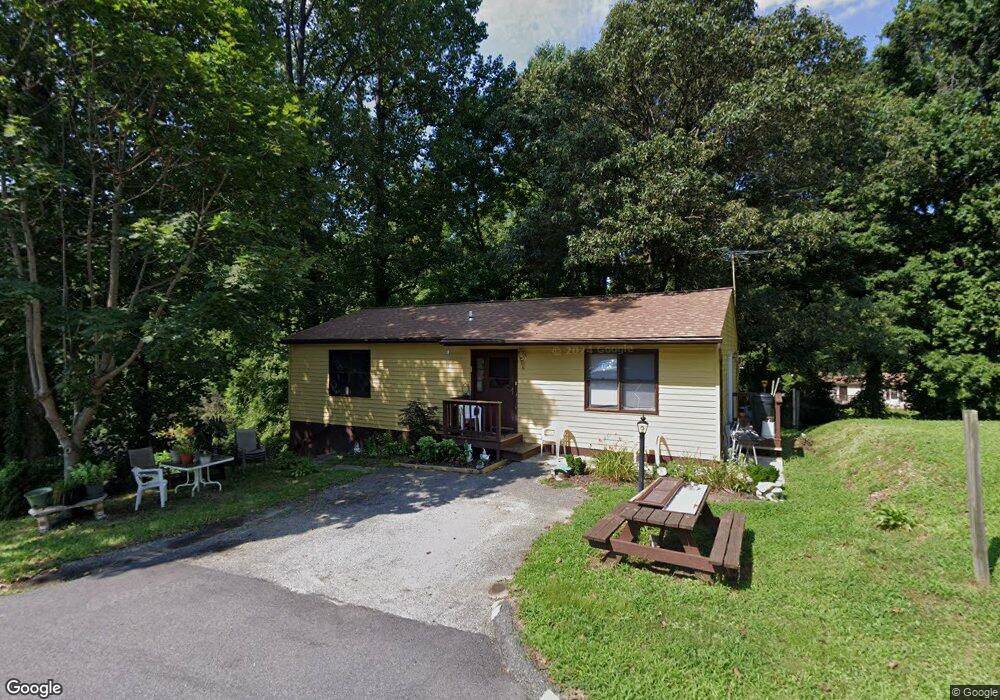
6206 5th St Chesapeake Beach, MD 20732
Estimated Value: $278,424 - $324,000
--
Bed
2
Baths
1,056
Sq Ft
$291/Sq Ft
Est. Value
About This Home
This home is located at 6206 5th St, Chesapeake Beach, MD 20732 and is currently estimated at $307,106, approximately $290 per square foot. 6206 5th St is a home located in Calvert County with nearby schools including Plum Point Elementary School, Windy Hill Middle School, and Huntingtown High School.
Ownership History
Date
Name
Owned For
Owner Type
Purchase Details
Closed on
Dec 8, 1995
Sold by
Harrod Larry L and Harrod Phyllis D
Bought by
Harrod Phyllis B
Current Estimated Value
Purchase Details
Closed on
Mar 23, 1992
Sold by
Derco Enterprise Inc
Bought by
Harrod Larry L and Harrod Phyllis D
Home Financials for this Owner
Home Financials are based on the most recent Mortgage that was taken out on this home.
Original Mortgage
$105,000
Interest Rate
9.03%
Purchase Details
Closed on
Aug 6, 1990
Sold by
Lange Jane Howell
Bought by
Derco Enterprise Inc
Home Financials for this Owner
Home Financials are based on the most recent Mortgage that was taken out on this home.
Original Mortgage
$4,000
Interest Rate
9.84%
Create a Home Valuation Report for This Property
The Home Valuation Report is an in-depth analysis detailing your home's value as well as a comparison with similar homes in the area
Home Values in the Area
Average Home Value in this Area
Purchase History
| Date | Buyer | Sale Price | Title Company |
|---|---|---|---|
| Harrod Phyllis B | -- | -- | |
| Harrod Larry L | $105,000 | -- | |
| Derco Enterprise Inc | $7,500 | -- |
Source: Public Records
Mortgage History
| Date | Status | Borrower | Loan Amount |
|---|---|---|---|
| Previous Owner | Harrod Larry L | $105,000 | |
| Previous Owner | Derco Enterprise Inc | $4,000 |
Source: Public Records
Tax History Compared to Growth
Tax History
| Year | Tax Paid | Tax Assessment Tax Assessment Total Assessment is a certain percentage of the fair market value that is determined by local assessors to be the total taxable value of land and additions on the property. | Land | Improvement |
|---|---|---|---|---|
| 2025 | $2,445 | $216,700 | $75,000 | $141,700 |
| 2024 | $2,445 | $206,500 | $0 | $0 |
| 2023 | $2,254 | $196,300 | $0 | $0 |
| 2022 | $2,145 | $186,100 | $75,000 | $111,100 |
| 2021 | $2,102 | $183,900 | $0 | $0 |
| 2020 | $2,102 | $181,700 | $0 | $0 |
| 2019 | $2,085 | $179,500 | $75,000 | $104,500 |
| 2018 | $2,030 | $175,500 | $0 | $0 |
| 2017 | $2,011 | $171,500 | $0 | $0 |
| 2016 | -- | $167,500 | $0 | $0 |
| 2015 | $2,086 | $167,500 | $0 | $0 |
| 2014 | $2,086 | $167,500 | $0 | $0 |
Source: Public Records
Map
Nearby Homes
- 6130 4th St
- 6122 6th St
- 6231 8th St
- 6212 8th St
- 6245 3rd St
- 4327 Dalrymple Rd
- 6405 2nd St
- 6445 Old Bayside Rd
- 4000 Chesapeake Ave
- 3664 Brookeside Dr
- 3671 Dory Brooks Rd
- 7129 Chesapeake Village Blvd
- 6520 18th St
- 6510 18th St
- 6852 Old Bayside Rd
- 3164 Dalrymple Rd
- 5209 Larchmont Dr
- 0 10th St
- 7410 Dakota Ave
- 5150 Lenoir Dr