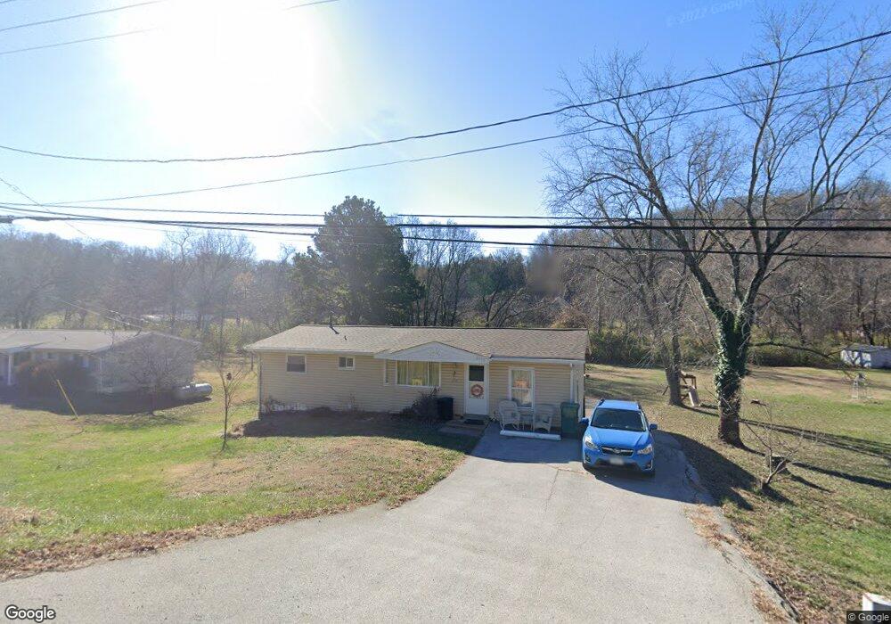
6208 Highway Pp High Ridge, MO 63049
Estimated Value: $190,000 - $238,000
2
Beds
--
Bath
1,104
Sq Ft
$194/Sq Ft
Est. Value
About This Home
This home is located at 6208 Highway Pp, High Ridge, MO 63049 and is currently estimated at $214,386, approximately $194 per square foot. 6208 Highway Pp is a home located in Jefferson County with nearby schools including Northwest High School and St. Anthony School.
Ownership History
Date
Name
Owned For
Owner Type
Purchase Details
Closed on
Jun 17, 2020
Sold by
Mcwilliams Pamela
Bought by
Clemonds Vermilia Kaye
Current Estimated Value
Home Financials for this Owner
Home Financials are based on the most recent Mortgage that was taken out on this home.
Original Mortgage
$128,800
Outstanding Balance
$114,171
Interest Rate
3.2%
Mortgage Type
New Conventional
Estimated Equity
$100,215
Purchase Details
Closed on
Aug 14, 2017
Sold by
Brown James A and Brown Carolyn F
Bought by
Mcwilliams Pamela
Home Financials for this Owner
Home Financials are based on the most recent Mortgage that was taken out on this home.
Original Mortgage
$113,520
Interest Rate
3.96%
Mortgage Type
New Conventional
Purchase Details
Closed on
Mar 16, 2009
Sold by
Moss Benjamin A and Moss Amber
Bought by
Brown James A and Brown Carolyn F
Home Financials for this Owner
Home Financials are based on the most recent Mortgage that was taken out on this home.
Original Mortgage
$104,395
Interest Rate
5.21%
Mortgage Type
FHA
Purchase Details
Closed on
Mar 24, 2006
Sold by
Gentry Leslie and Gentry Sheryl
Bought by
Moss Benjamin A and Moss Amber
Home Financials for this Owner
Home Financials are based on the most recent Mortgage that was taken out on this home.
Original Mortgage
$136,000
Interest Rate
6.24%
Mortgage Type
Fannie Mae Freddie Mac
Purchase Details
Closed on
Mar 16, 2005
Sold by
Cachet Realty & Management Corp
Bought by
Gentry Leslie and Gentry Sheryl
Home Financials for this Owner
Home Financials are based on the most recent Mortgage that was taken out on this home.
Original Mortgage
$115,000
Interest Rate
5.66%
Mortgage Type
Credit Line Revolving
Purchase Details
Closed on
Mar 9, 2005
Sold by
Prater Berta Fay
Bought by
Cachet Realty & Management Corp
Home Financials for this Owner
Home Financials are based on the most recent Mortgage that was taken out on this home.
Original Mortgage
$115,000
Interest Rate
5.66%
Mortgage Type
Credit Line Revolving
Create a Home Valuation Report for This Property
The Home Valuation Report is an in-depth analysis detailing your home's value as well as a comparison with similar homes in the area
Home Values in the Area
Average Home Value in this Area
Purchase History
| Date | Buyer | Sale Price | Title Company |
|---|---|---|---|
| Clemonds Vermilia Kaye | -- | None Available | |
| Mcwilliams Pamela | -- | None Available | |
| Brown James A | -- | Assured Title Company | |
| Moss Benjamin A | -- | Ust | |
| Gentry Leslie | -- | Commonwealth Land Title | |
| Cachet Realty & Management Corp | -- | Investors Title Company |
Source: Public Records
Mortgage History
| Date | Status | Borrower | Loan Amount |
|---|---|---|---|
| Open | Clemonds Vermilia Kaye | $128,800 | |
| Previous Owner | Mcwilliams Pamela | $113,520 | |
| Previous Owner | Brown James A | $104,395 | |
| Previous Owner | Moss Benjamin A | $136,000 | |
| Previous Owner | Gentry Leslie | $115,000 | |
| Previous Owner | Cachet Realty & Management Corp | $66,300 |
Source: Public Records
Tax History Compared to Growth
Tax History
| Year | Tax Paid | Tax Assessment Tax Assessment Total Assessment is a certain percentage of the fair market value that is determined by local assessors to be the total taxable value of land and additions on the property. | Land | Improvement |
|---|---|---|---|---|
| 2025 | $1,011 | $15,100 | $1,800 | $13,300 |
| 2024 | $1,011 | $14,000 | $1,800 | $12,200 |
| 2023 | $1,011 | $14,000 | $1,800 | $12,200 |
| 2022 | $1,000 | $14,000 | $1,800 | $12,200 |
| 2021 | $1,000 | $14,000 | $1,800 | $12,200 |
| 2020 | $900 | $12,300 | $1,400 | $10,900 |
| 2019 | $899 | $12,300 | $1,400 | $10,900 |
| 2018 | $911 | $12,300 | $1,400 | $10,900 |
| 2017 | $832 | $12,300 | $1,400 | $10,900 |
| 2016 | $765 | $11,200 | $1,500 | $9,700 |
| 2015 | $786 | $11,200 | $1,500 | $9,700 |
| 2013 | -- | $10,500 | $1,500 | $9,000 |
Source: Public Records
Map
Nearby Homes
- 6152 Franks Rd
- 6752 Walnut Valley Dr
- 5800 5800 St Rd Pp
- 0 High Ridge Manor Resub Lot 6 Unit MIS25065011
- 0 High Ridge Manor Resub Lot 6 Unit MIS25049757
- 0 High Ridge Manor Resub Lot 7 Unit MAR25011806
- 2905 Carol Ln
- 2909 Hilgert Dr
- 0 Old Gravois Rd
- 5707 Werner Dr
- 2715 Royal Oak Dr
- 3008 High Ridge Dr
- 5916 Roger Rd
- 45 Rd
- 2801 High Ridge Blvd
- 3717 Carol Park Rd
- 192 Bobwhite Ln Unit 192
- 6302 Upper Byrnes Mill Rd
- 0 Manor Crest Dr Unit MIS25054810
- 2460 Huntress Hill Ln
- 6208 Missouri Pp
- 6208 Pp
- 6204 Highway Pp
- 6212 Highway Pp
- 6213 Carolyn Sue Dr
- 3100 Willow Ln
- 3104 Willow Ln
- 6209 Carolyn Sue Dr
- 6195 Carolyn Sue Dr
- 6155 Highway Pp
- 6196 Carolyn Sue Dr
- 3105 Willow Ln
- 6204 Carolyn Sue Dr
- 6228 State Road Pp
- 6228 Highway Pp
- 6228 State Hwy Pp
- 6208 Carolyn Sue Dr
- 6153 Highway Pp
- 6212 Julia Ln
- 6173 Franks Rd