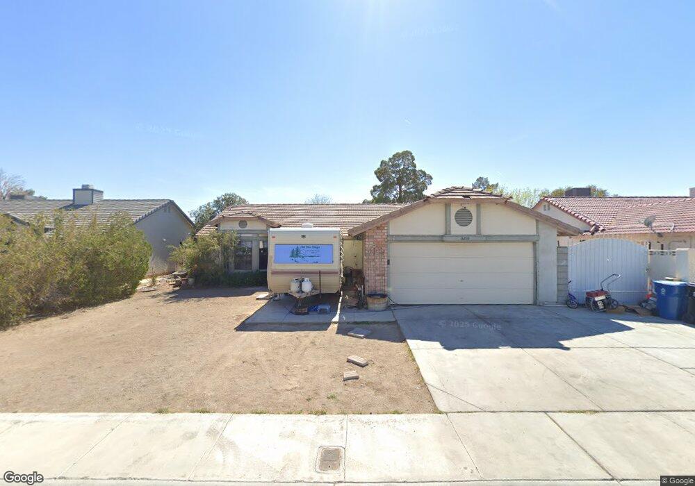
6209 Budnick Cir Las Vegas, NV 89130
North Cheyenne NeighborhoodEstimated Value: $389,726 - $412,000
3
Beds
2
Baths
1,446
Sq Ft
$278/Sq Ft
Est. Value
About This Home
This home is located at 6209 Budnick Cir, Las Vegas, NV 89130 and is currently estimated at $401,432, approximately $277 per square foot. 6209 Budnick Cir is a home located in Clark County with nearby schools including Ernest May Elementary School, Theron L Swainston Middle School, and Cheyenne High School.
Ownership History
Date
Name
Owned For
Owner Type
Purchase Details
Closed on
May 29, 2012
Sold by
Kiser Rick D
Bought by
Kiser Tessa Anne
Current Estimated Value
Purchase Details
Closed on
Aug 21, 2003
Sold by
Adras Paul J and Adras Susan A
Bought by
Kiser Rick D and Kiser Tessa A
Home Financials for this Owner
Home Financials are based on the most recent Mortgage that was taken out on this home.
Original Mortgage
$134,800
Outstanding Balance
$62,073
Interest Rate
6.25%
Mortgage Type
Unknown
Estimated Equity
$339,359
Create a Home Valuation Report for This Property
The Home Valuation Report is an in-depth analysis detailing your home's value as well as a comparison with similar homes in the area
Home Values in the Area
Average Home Value in this Area
Purchase History
| Date | Buyer | Sale Price | Title Company |
|---|---|---|---|
| Kiser Tessa Anne | -- | None Available | |
| Kiser Rick D | $168,500 | First American Title Company |
Source: Public Records
Mortgage History
| Date | Status | Borrower | Loan Amount |
|---|---|---|---|
| Open | Kiser Rick D | $134,800 | |
| Closed | Kiser Rick D | $33,700 |
Source: Public Records
Tax History Compared to Growth
Tax History
| Year | Tax Paid | Tax Assessment Tax Assessment Total Assessment is a certain percentage of the fair market value that is determined by local assessors to be the total taxable value of land and additions on the property. | Land | Improvement |
|---|---|---|---|---|
| 2025 | $1,403 | $73,057 | $32,200 | $40,857 |
| 2024 | $1,362 | $73,057 | $32,200 | $40,857 |
| 2023 | $1,362 | $71,701 | $32,200 | $39,501 |
| 2022 | $1,323 | $63,008 | $26,600 | $36,408 |
| 2021 | $1,284 | $59,473 | $24,500 | $34,973 |
| 2020 | $1,244 | $57,055 | $22,050 | $35,005 |
| 2019 | $1,208 | $54,063 | $19,250 | $34,813 |
| 2018 | $1,173 | $52,990 | $19,250 | $33,740 |
| 2017 | $1,622 | $49,484 | $15,050 | $34,434 |
| 2016 | $1,111 | $46,465 | $11,550 | $34,915 |
| 2015 | $1,108 | $39,631 | $8,750 | $30,881 |
| 2014 | $1,076 | $31,843 | $8,750 | $23,093 |
Source: Public Records
Map
Nearby Homes
- 6105 Sadler Dr
- 4521 Night Dance Ct
- 4505 Mollison Mesa Ct
- 6225 Minerva Dr
- 6256 Hill Haven Ave
- 4517 Carbine Chapel St
- 4505 Truscott Ct
- 6277 Kraft Ave
- 5812 Ventana Dr
- 5774 Smithsonian Way
- 4302 Eagle Island St
- 6106 Castle Gardens Ave
- 6300 W La Madre Way
- 4401 Inez Dr
- 6425 Wheelbarrow Peak Dr
- 5605 Bay Shore Cir
- 6421 Doby Peak Dr
- 5005 Chambliss Dr
- 4178 Eagle Island St
- 6505 Quantum Ln
- 6213 Budnick Cir
- 6205 Budnick Cir
- 6208 Burnt Hills Dr
- 6212 Burnt Hills Dr
- 6204 Burnt Hills Dr
- 6201 Budnick Cir
- 6217 Budnick Cir
- 6208 Budnick Cir
- 6204 Budnick Cir
- 6212 Budnick Cir
- 6200 Burnt Hills Dr
- 6221 Budnick Cir
- 6220 Burnt Hills Dr
- 6216 Budnick Cir
- 6209 Sadler Dr
- 6209 Burnt Hills Dr
- 6205 Sadler Dr
- 6213 Burnt Hills Dr
- 6213 Sadler Dr