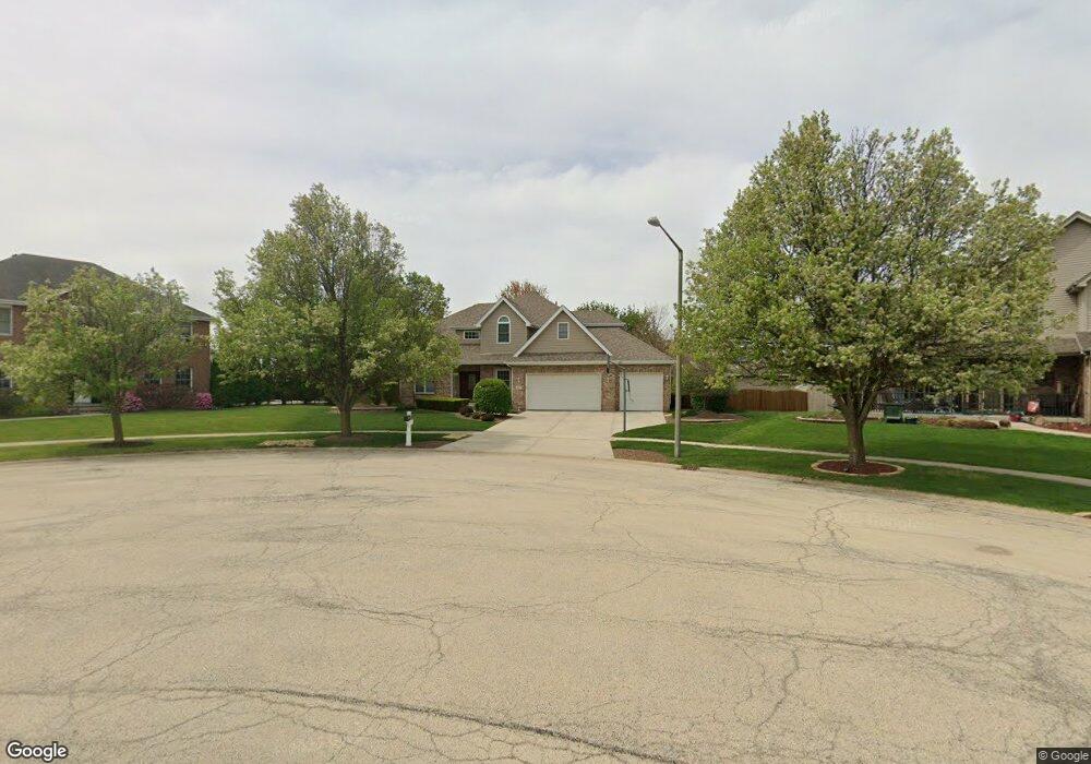
621 Borman Dr New Lenox, IL 60451
Estimated Value: $484,000 - $518,000
--
Bed
--
Bath
--
Sq Ft
0.33
Acres
About This Home
This home is located at 621 Borman Dr, New Lenox, IL 60451 and is currently estimated at $503,132. 621 Borman Dr is a home located in Will County with nearby schools including Nelson Prairie School, Lincoln Way West, and St. Jude School.
Ownership History
Date
Name
Owned For
Owner Type
Purchase Details
Closed on
May 18, 2022
Sold by
Madl Kevin L and Madl Kristen D
Bought by
Kevin L Madl And Kristen D Madl Living Trust
Current Estimated Value
Purchase Details
Closed on
Mar 11, 2003
Sold by
Nlsb
Bought by
Madl Kevin L and Madl Kristen D
Home Financials for this Owner
Home Financials are based on the most recent Mortgage that was taken out on this home.
Original Mortgage
$229,350
Interest Rate
5.96%
Mortgage Type
Purchase Money Mortgage
Create a Home Valuation Report for This Property
The Home Valuation Report is an in-depth analysis detailing your home's value as well as a comparison with similar homes in the area
Home Values in the Area
Average Home Value in this Area
Purchase History
| Date | Buyer | Sale Price | Title Company |
|---|---|---|---|
| Kevin L Madl And Kristen D Madl Living Trust | -- | Zapolis & Associates | |
| Madl Kevin L | $287,000 | Millennium Title Group |
Source: Public Records
Mortgage History
| Date | Status | Borrower | Loan Amount |
|---|---|---|---|
| Previous Owner | Madl Kevin L | $229,350 |
Source: Public Records
Tax History Compared to Growth
Tax History
| Year | Tax Paid | Tax Assessment Tax Assessment Total Assessment is a certain percentage of the fair market value that is determined by local assessors to be the total taxable value of land and additions on the property. | Land | Improvement |
|---|---|---|---|---|
| 2024 | $12,264 | $159,121 | $32,465 | $126,656 |
| 2023 | $12,264 | $145,051 | $29,594 | $115,457 |
| 2022 | $11,043 | $133,626 | $27,263 | $106,363 |
| 2021 | $10,488 | $125,671 | $25,640 | $100,031 |
| 2020 | $10,193 | $121,187 | $24,725 | $96,462 |
| 2019 | $9,758 | $117,429 | $23,958 | $93,471 |
| 2018 | $9,535 | $113,381 | $23,132 | $90,249 |
| 2017 | $9,062 | $110,121 | $22,467 | $87,654 |
| 2016 | $8,799 | $107,174 | $21,866 | $85,308 |
| 2015 | $8,479 | $103,801 | $21,178 | $82,623 |
| 2014 | $8,479 | $102,520 | $20,917 | $81,603 |
| 2013 | $8,479 | $103,902 | $21,199 | $82,703 |
Source: Public Records
Map
Nearby Homes
- 709 Young Dr
- 400 W Joliet Hwy
- 574 Prairie Crossing Dr
- 1007 Nelson Rd
- 329 Hancock Dr
- 315 S Pine St
- 416 Manor Ct Unit B
- 00 NE Corner Cherry Hill Road and Moss Lane Rd
- 718 S Prairie Rd
- 202 Hickory St
- 1000 S Cedar Rd
- 1701 Grand Prairie Dr
- Vacant W Maple St
- 1801 Stonebridge Dr
- 331 Old Hickory Rd
- 1914 Heatherway Ln Unit 27
- 1500 Ramp
- 14620 W Laraway Rd
- The Caellin 2000 Plan at Jacob's Field
- The Caellin Plan at Jacob's Field
- 620 Mcdivitt Dr
- 820 Chaffee Ln
- 617 Borman Dr
- 616 Mcdivitt Dr
- 867 W Woodlawn Rd
- 900 White Ln
- 883 W Woodlawn Rd
- 851 W Woodlawn Rd
- 812 Chaffee Ln
- 613 Borman Dr
- 905 W Woodlawn Rd
- 612 Mcdivitt Dr Unit 3C
- 835 W Woodlawn Rd
- 909 W Woodlawn Rd
- 813 Chaffee Ln
- 607 Borman Dr
- 804 Chaffee Ln
- 608 Mcdivitt Dr
- 819 W Woodlawn Rd
- 913 W Woodlawn Rd