Estimated Value: $303,793 - $337,000
4
Beds
3
Baths
2,338
Sq Ft
$137/Sq Ft
Est. Value
About This Home
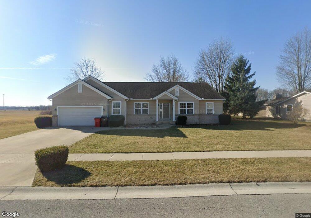
This home is located at 621 Clint Dr, Ada, OH 45810 and is currently estimated at $319,948, approximately $136 per square foot. 621 Clint Dr is a home located in Hardin County with nearby schools including Ada Elementary School and Ada High School.
Ownership History
Date
Name
Owned For
Owner Type
Purchase Details
Closed on
Aug 16, 2006
Sold by
Simon Properties Llc
Bought by
Stockert Amy Lynn and Stockert Dennis A
Current Estimated Value
Home Financials for this Owner
Home Financials are based on the most recent Mortgage that was taken out on this home.
Original Mortgage
$225,000
Outstanding Balance
$139,312
Interest Rate
6.78%
Mortgage Type
Construction
Estimated Equity
$180,636
Purchase Details
Closed on
Apr 27, 2004
Bought by
Simon Properties Llc
Create a Home Valuation Report for This Property
The Home Valuation Report is an in-depth analysis detailing your home's value as well as a comparison with similar homes in the area
Home Values in the Area
Average Home Value in this Area
Purchase History
| Date | Buyer | Sale Price | Title Company |
|---|---|---|---|
| Stockert Amy Lynn | -- | None Available | |
| Simon Properties Llc | -- | -- |
Source: Public Records
Mortgage History
| Date | Status | Borrower | Loan Amount |
|---|---|---|---|
| Open | Stockert Amy Lynn | $225,000 |
Source: Public Records
Tax History
| Year | Tax Paid | Tax Assessment Tax Assessment Total Assessment is a certain percentage of the fair market value that is determined by local assessors to be the total taxable value of land and additions on the property. | Land | Improvement |
|---|---|---|---|---|
| 2024 | $3,542 | $91,310 | $8,860 | $82,450 |
| 2023 | $3,521 | $91,310 | $8,860 | $82,450 |
| 2022 | $3,435 | $77,900 | $8,450 | $69,450 |
| 2021 | $3,769 | $77,900 | $8,450 | $69,450 |
| 2020 | $3,821 | $77,900 | $8,450 | $69,450 |
| 2019 | $3,568 | $73,590 | $8,050 | $65,540 |
| 2018 | $3,490 | $73,590 | $8,050 | $65,540 |
| 2017 | $3,427 | $73,590 | $8,050 | $65,540 |
| 2016 | $3,442 | $78,330 | $4,550 | $73,780 |
| 2015 | $3,334 | $78,330 | $4,550 | $73,780 |
| 2014 | $3,352 | $78,330 | $4,550 | $73,780 |
| 2013 | $3,318 | $73,570 | $4,550 | $69,020 |
Source: Public Records
Map
Nearby Homes
- 820 S Main St
- 710 S Main St
- 722 S Johnson St
- 318 Willeke Ave
- 314 E University Ave
- 308-310 S Simon St
- 210 N Gilbert St
- 211 S Main St
- 510 E Lehr Ave Unit 510R
- 2959 County Road 60
- 1689 County Road 50
- 420 N Simon St
- 327 W North Ave
- 530 N Main St
- 442 Edwards St
- 629 N Main St
- 503 E North Ave
- 724 N Main St
- 746 N Main St Unit 61
- 746 N Main St Unit 63
- XXX Clint Dr
- 517 Clint Dr
- 627 Clint Dr
- 622 Clint Dr
- 624 Clint Dr
- 512 Clint Dr
- 625 Clint Dr
- 508 Clint Dr
- 626 Clint Dr
- 2002 Southernview St
- 507 Clint Dr
- 613 Pleasantview St Unit 615
- 509 Pleasantview St Unit 511
- 1010 Southernview St
- 619 Pleasantview St
- 1125 Northernview Dr
- 505 Pleasantview St
- 623 Pleasantview St
- 614 Pleasantview St
- 620 Pleasantview St
Your Personal Tour Guide
Ask me questions while you tour the home.