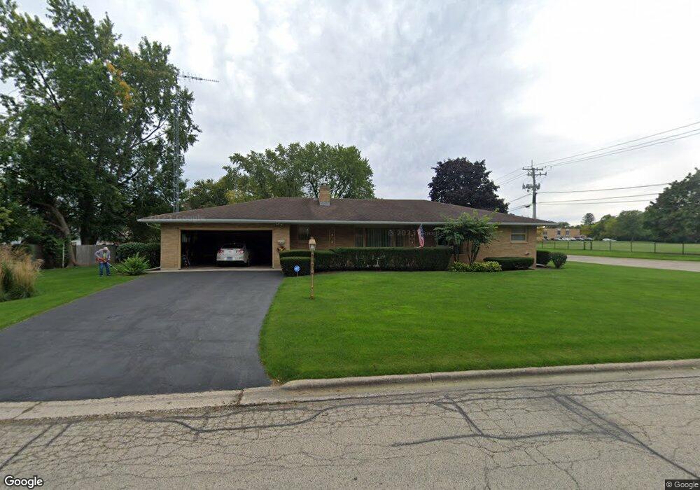
621 Conway St Woodstock, IL 60098
Estimated Value: $288,939 - $350,000
3
Beds
2
Baths
1,700
Sq Ft
$183/Sq Ft
Est. Value
About This Home
This home is located at 621 Conway St, Woodstock, IL 60098 and is currently estimated at $310,985, approximately $182 per square foot. 621 Conway St is a home located in McHenry County with nearby schools including Olson Elementary School, Creekside Middle School, and Woodstock High School.
Ownership History
Date
Name
Owned For
Owner Type
Purchase Details
Closed on
Mar 30, 2004
Sold by
Amcore Investment Group Na
Bought by
Home State Bank and Trust #5348
Current Estimated Value
Purchase Details
Closed on
Oct 14, 1994
Sold by
Hurley Dennis R
Bought by
Amcore Trust Company
Home Financials for this Owner
Home Financials are based on the most recent Mortgage that was taken out on this home.
Original Mortgage
$120,000
Interest Rate
5.75%
Create a Home Valuation Report for This Property
The Home Valuation Report is an in-depth analysis detailing your home's value as well as a comparison with similar homes in the area
Home Values in the Area
Average Home Value in this Area
Purchase History
| Date | Buyer | Sale Price | Title Company |
|---|---|---|---|
| Home State Bank | -- | -- | |
| Amcore Trust Company | $150,000 | Chicago Title |
Source: Public Records
Mortgage History
| Date | Status | Borrower | Loan Amount |
|---|---|---|---|
| Previous Owner | Amcore Trust Company | $120,000 |
Source: Public Records
Tax History Compared to Growth
Tax History
| Year | Tax Paid | Tax Assessment Tax Assessment Total Assessment is a certain percentage of the fair market value that is determined by local assessors to be the total taxable value of land and additions on the property. | Land | Improvement |
|---|---|---|---|---|
| 2024 | $6,470 | $88,223 | $8,684 | $79,539 |
| 2023 | $6,044 | $79,782 | $7,853 | $71,929 |
| 2022 | $5,960 | $70,804 | $6,969 | $63,835 |
| 2021 | $5,821 | $66,153 | $6,511 | $59,642 |
| 2020 | $5,731 | $64,343 | $6,187 | $58,156 |
| 2019 | $5,531 | $61,420 | $5,906 | $55,514 |
| 2018 | $5,443 | $59,830 | $6,736 | $53,094 |
| 2017 | $5,300 | $56,311 | $6,340 | $49,971 |
| 2016 | $5,192 | $52,139 | $5,870 | $46,269 |
| 2013 | -- | $58,036 | $12,776 | $45,260 |
Source: Public Records
Map
Nearby Homes
- 431 Washington St
- 233 Arthur Dr
- 327 Lincoln Ave
- 130 Washington St
- 150 1st St
- 1249 Prairie Ridge Trail
- 4022 Meadowridge Rd
- 3857 Riverwoods Dr
- 3917 Riverwoods Dr
- 3905 Riverwoods Dr
- 3839 Riverwoods Dr
- 3845 Riverwoods Dr
- 1288 Prairie Ridge Trail
- 1253 Prairie Ridge Trail
- 1245 Prairie Ridge Trail
- Brighton Plan at Clublands of Antioch - Horizon Series
- Meadowlark Plan at Clublands of Antioch - Horizon Series
- Siena Plan at Clublands of Antioch - Andare Series
- Napa Plan at Clublands of Antioch - Andare Series
- Starling Plan at Clublands of Antioch - Horizon Series
- 348 N Hill St
- 357 Becking Ave
- 620 Conway St
- 345 Becking Ave
- 338 N Hill St
- 337 Becking Ave
- 403 Becking Ave
- 406 N Hill St
- 609 Margaret Dr
- 331 Becking Ave
- 409 Becking Ave
- 330 N Hill St
- 412 N Hill St
- 325 Becking Ave
- 415 Becking Ave
- 314 N Hill St
- 352 Becking Ave
- 418 N Hill St
- 400 Becking Ave
- 346 Becking Ave