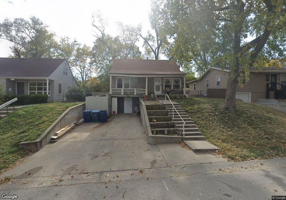
621 Dixie St Liberty, MO 64068
Estimated Value: $209,000 - $240,000
4
Beds
2
Baths
1,008
Sq Ft
$219/Sq Ft
Est. Value
About This Home
This home is located at 621 Dixie St, Liberty, MO 64068 and is currently estimated at $221,085, approximately $219 per square foot. 621 Dixie St is a home located in Clay County with nearby schools including Ridgeview Elementary School, Heritage Middle School, and Liberty North High School.
Ownership History
Date
Name
Owned For
Owner Type
Purchase Details
Closed on
Dec 19, 2006
Sold by
Barchers Otis L and Barchers Joy S
Bought by
Mcdonald Candace G and Cardwell Evelyn J
Current Estimated Value
Home Financials for this Owner
Home Financials are based on the most recent Mortgage that was taken out on this home.
Original Mortgage
$116,669
Outstanding Balance
$69,328
Interest Rate
6.2%
Mortgage Type
Purchase Money Mortgage
Estimated Equity
$151,757
Purchase Details
Closed on
Aug 17, 2006
Sold by
Mentch Elizabeth A
Bought by
Barchers Otis L and Barchers Joy S
Home Financials for this Owner
Home Financials are based on the most recent Mortgage that was taken out on this home.
Original Mortgage
$68,000
Interest Rate
6.75%
Mortgage Type
Purchase Money Mortgage
Create a Home Valuation Report for This Property
The Home Valuation Report is an in-depth analysis detailing your home's value as well as a comparison with similar homes in the area
Home Values in the Area
Average Home Value in this Area
Purchase History
| Date | Buyer | Sale Price | Title Company |
|---|---|---|---|
| Mcdonald Candace G | -- | United Title Company Inc | |
| Barchers Otis L | -- | United Title Company Inc |
Source: Public Records
Mortgage History
| Date | Status | Borrower | Loan Amount |
|---|---|---|---|
| Open | Mcdonald Candace G | $116,669 | |
| Previous Owner | Barchers Otis L | $68,000 |
Source: Public Records
Tax History
| Year | Tax Paid | Tax Assessment Tax Assessment Total Assessment is a certain percentage of the fair market value that is determined by local assessors to be the total taxable value of land and additions on the property. | Land | Improvement |
|---|---|---|---|---|
| 2025 | $1,517 | $22,230 | -- | -- |
| 2024 | $1,517 | $19,720 | -- | -- |
| 2023 | $1,542 | $19,720 | $0 | $0 |
| 2022 | $1,430 | $18,050 | $0 | $0 |
| 2021 | $1,419 | $18,050 | $4,750 | $13,300 |
| 2020 | $1,336 | $15,960 | $3,800 | $12,160 |
| 2019 | $1,336 | $15,960 | $3,800 | $12,160 |
Source: Public Records
Map
Nearby Homes
- 336 Georgia Ct
- 324 Harrison St
- 804 Sunset Ave
- 408 W Murray Rd
- 823 Reed St
- 36 N Ridge Ave
- 248 Range Line Rd
- 201 Lakeside Dr
- 5 E Brown St
- 320 N Fairview Ave
- 435 Grover St
- 194 Camelot Dr
- 915 S Prairie St
- 339 S Missouri St
- 29 Fulkerson Cir
- 813 S Main St
- 1114 W Liberty Dr
- 427 N Fairview Ave
- 307 N Gallatin St
- 425 Maple St
Your Personal Tour Guide
Ask me questions while you tour the home.