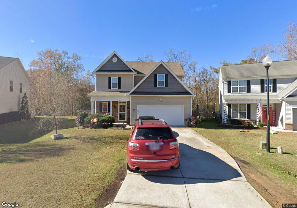
621 Mccarthy Dr Clayton, NC 27527
Estimated Value: $339,000 - $362,000
3
Beds
3
Baths
1,843
Sq Ft
$188/Sq Ft
Est. Value
About This Home
This home is located at 621 Mccarthy Dr, Clayton, NC 27527 and is currently estimated at $347,168, approximately $188 per square foot. 621 Mccarthy Dr is a home located in Johnston County with nearby schools including Riverwood Elementary School, Riverwood Middle School, and Corinth Holders High School.
Ownership History
Date
Name
Owned For
Owner Type
Purchase Details
Closed on
Jun 23, 2020
Sold by
Mupr 3 Assets Llc
Bought by
Cpi Amherst Sfr Program Owner Llc
Current Estimated Value
Purchase Details
Closed on
Oct 21, 2019
Sold by
Maness Danie K and Mcghee Maness Sarah E
Bought by
Mupr 3 Assets Llc
Purchase Details
Closed on
Jun 29, 2012
Sold by
Partlo Clayton Llc
Bought by
Maness Danie K and Mcghee Maness Sarah E
Create a Home Valuation Report for This Property
The Home Valuation Report is an in-depth analysis detailing your home's value as well as a comparison with similar homes in the area
Home Values in the Area
Average Home Value in this Area
Purchase History
| Date | Buyer | Sale Price | Title Company |
|---|---|---|---|
| Cpi Amherst Sfr Program Owner Llc | $496,000 | Bchh Inc | |
| Mupr 3 Assets Llc | $225,000 | None Available | |
| Maness Danie K | $166,000 | None Available |
Source: Public Records
Tax History
| Year | Tax Paid | Tax Assessment Tax Assessment Total Assessment is a certain percentage of the fair market value that is determined by local assessors to be the total taxable value of land and additions on the property. | Land | Improvement |
|---|---|---|---|---|
| 2025 | $3,283 | $325,070 | $85,000 | $240,070 |
| 2024 | $2,615 | $198,090 | $42,000 | $156,090 |
| 2023 | $2,555 | $198,090 | $42,000 | $156,090 |
| 2022 | $2,635 | $198,090 | $42,000 | $156,090 |
| 2021 | $2,595 | $198,090 | $42,000 | $156,090 |
| 2020 | $2,654 | $198,090 | $42,000 | $156,090 |
| 2019 | $2,654 | $198,090 | $42,000 | $156,090 |
| 2018 | $2,326 | $171,020 | $38,000 | $133,020 |
| 2017 | $2,275 | $171,020 | $38,000 | $133,020 |
| 2016 | $2,275 | $171,020 | $38,000 | $133,020 |
| 2015 | $2,232 | $171,020 | $38,000 | $133,020 |
| 2014 | $2,232 | $171,020 | $38,000 | $133,020 |
Source: Public Records
Map
Nearby Homes
- 156 Haywood Ln
- 328 Mccarthy Dr
- 1008 Sarazen Dr
- 305 E Webber Ln
- 204 Mccarthy Dr
- 400 Charleston Dr
- 317 Charleston Dr
- 524 Woodson Dr
- 629 Woodson Dr
- 117 Landry Ct
- 113 Alan Ln
- 43 Papillion Way
- 76 Omaha Way
- 24 N Brookhollow Way
- 141 Omaha Way
- 35 Rockingham Way
- 117 Churchill Way
- 94 Omaha Way
- 128 Omaha Way
- 402 Bluejay St
- 617 Mccarthy Dr
- 625 Mccarthy Dr
- 613 Mccarthy Dr
- 629 Mccarthy Dr
- 609 Mccarthy Dr
- 633 Mccarthy Dr
- 605 Mccarthy Dr
- 637 Mccarthy Dr
- 601 Mccarthy Dr
- 641 Mccarthy Dr
- 557 Mccarthy Dr
- 645 Mccarthy Dr
- 104 Duncan Ct
- 649 Mccarthy Dr
- 553 Mccarthy Dr
- 437 Hardaway Point
- 100 Duncan Ct
- 108 Duncan Ct
- 701 Mccarthy Dr
- 712 Sarazen Dr
Your Personal Tour Guide
Ask me questions while you tour the home.