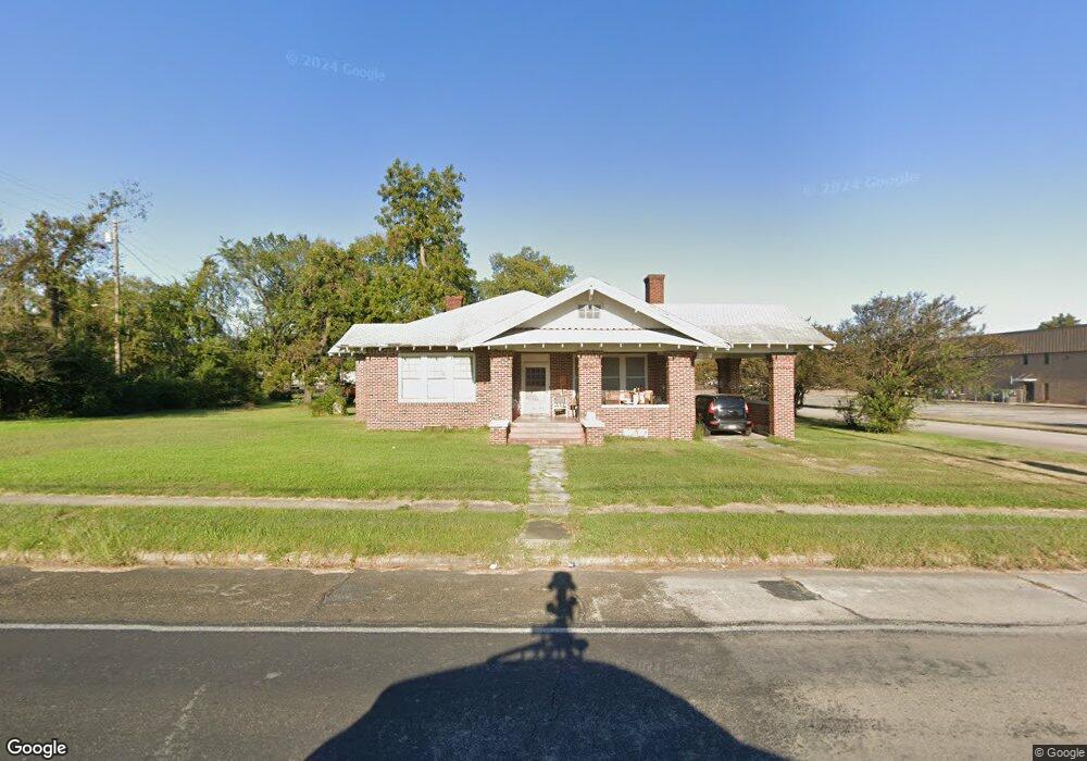
621 N 1st St Lufkin, TX 75901
Estimated Value: $146,198 - $195,000
3
Beds
1
Bath
2,000
Sq Ft
$86/Sq Ft
Est. Value
About This Home
This home is located at 621 N 1st St, Lufkin, TX 75901 and is currently estimated at $171,300, approximately $85 per square foot. 621 N 1st St is a home located in Angelina County with nearby schools including Herty Primary School, Coston Elementary School, and Lufkin Middle School.
Ownership History
Date
Name
Owned For
Owner Type
Purchase Details
Closed on
Sep 8, 2006
Sold by
Texas Rainy Day Investments Inc
Bought by
Hill Gene and Hill Marcia
Current Estimated Value
Home Financials for this Owner
Home Financials are based on the most recent Mortgage that was taken out on this home.
Original Mortgage
$76,000
Outstanding Balance
$45,342
Interest Rate
6.55%
Mortgage Type
New Conventional
Estimated Equity
$125,958
Create a Home Valuation Report for This Property
The Home Valuation Report is an in-depth analysis detailing your home's value as well as a comparison with similar homes in the area
Home Values in the Area
Average Home Value in this Area
Purchase History
| Date | Buyer | Sale Price | Title Company |
|---|---|---|---|
| Hill Gene | $76,000 | Heritage Title Services |
Source: Public Records
Mortgage History
| Date | Status | Borrower | Loan Amount |
|---|---|---|---|
| Open | Hill Gene | $76,000 |
Source: Public Records
Tax History Compared to Growth
Tax History
| Year | Tax Paid | Tax Assessment Tax Assessment Total Assessment is a certain percentage of the fair market value that is determined by local assessors to be the total taxable value of land and additions on the property. | Land | Improvement |
|---|---|---|---|---|
| 2025 | $2,342 | $117,880 | $15,570 | $102,310 |
| 2024 | $2,129 | $101,880 | $15,570 | $86,310 |
| 2023 | $1,993 | $100,310 | $15,570 | $84,740 |
| 2022 | $2,206 | $96,840 | $7,680 | $89,160 |
| 2021 | $2,335 | $101,970 | $7,680 | $94,290 |
| 2020 | $2,117 | $86,160 | $6,040 | $80,120 |
| 2019 | $2,240 | $86,160 | $6,040 | $80,120 |
| 2018 | $1,332 | $83,220 | $6,040 | $77,180 |
| 2017 | $1,332 | $103,070 | $6,040 | $97,030 |
| 2016 | $2,352 | $98,670 | $6,040 | $92,630 |
| 2015 | $1,423 | $98,670 | $6,040 | $92,630 |
| 2014 | $1,423 | $98,180 | $6,040 | $92,140 |
Source: Public Records
Map
Nearby Homes
- 521 N 1st St
- 505 N 1st St
- 301 Culverhouse St
- 1101 N 1st St
- Lt 5.2 & 6 Treadwell Ave
- 801 Rowe Ave
- 902 Cain St
- 420 Mantooth Ave
- Tract 32 Walker Loop
- 801 Oquinn Ave
- 417 Martin Luther King jr Blvd
- 408 Bob St
- 620 Mantooth Ave
- 318 Lake Alley
- 1123 Sayers St
- TBD State Highway 103
- Lot 5 Shady Elm
- Lot 9 Shady Elm
- Lot 3 Shady Elm
- Lot 8 Shady Elm
- 618 N Angelina St
- 116 W Howe Ave
- 111 Persimmon Ave
- 114 W Polk Ave
- 800 N 1st St Unit 802
- 515 N 1st St
- 114 E Polk Ave
- 508 Cain St
- 107 E Polk Ave Unit 109
- 203 E Rhodes Ave Unit 203 Rhodes Ave
- 702 N 2nd St Unit A
- 702 N 2nd St
- 112 Persimmon Ave
- 511 N 1st St
- 117 Persimmon Ave
- 115 Oak Ave
- 119 Persimmon Ave
- 111 E Polk Ave Unit 113
- 117 E Polk Ave
- 205 Oak Ave