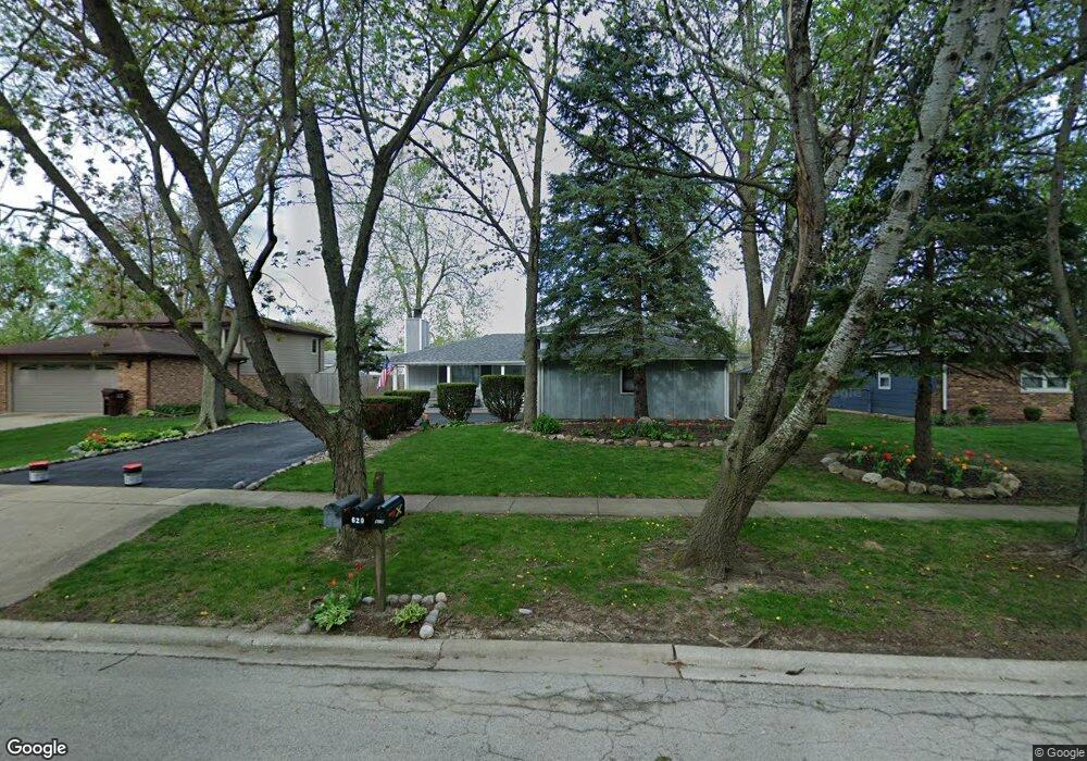
621 Southgate Rd New Lenox, IL 60451
Estimated Value: $357,000 - $425,000
--
Bed
--
Bath
--
Sq Ft
9,148
Sq Ft Lot
About This Home
This home is located at 621 Southgate Rd, New Lenox, IL 60451 and is currently estimated at $390,449. 621 Southgate Rd is a home located in Will County with nearby schools including Bentley Elementary School, Arnold J Tyler School, and Alex M Martino Jr High School.
Ownership History
Date
Name
Owned For
Owner Type
Purchase Details
Closed on
May 13, 1994
Sold by
Larsen Peter T and Larsen Joyce A
Bought by
Malecki Michael T and Malecki Kerry E
Current Estimated Value
Home Financials for this Owner
Home Financials are based on the most recent Mortgage that was taken out on this home.
Original Mortgage
$90,000
Interest Rate
8.5%
Create a Home Valuation Report for This Property
The Home Valuation Report is an in-depth analysis detailing your home's value as well as a comparison with similar homes in the area
Home Values in the Area
Average Home Value in this Area
Purchase History
| Date | Buyer | Sale Price | Title Company |
|---|---|---|---|
| Malecki Michael T | $127,000 | -- |
Source: Public Records
Mortgage History
| Date | Status | Borrower | Loan Amount |
|---|---|---|---|
| Closed | Malecki Michael T | $90,000 |
Source: Public Records
Tax History Compared to Growth
Tax History
| Year | Tax Paid | Tax Assessment Tax Assessment Total Assessment is a certain percentage of the fair market value that is determined by local assessors to be the total taxable value of land and additions on the property. | Land | Improvement |
|---|---|---|---|---|
| 2024 | $9,041 | $119,410 | $33,360 | $86,050 |
| 2023 | $9,041 | $108,851 | $30,410 | $78,441 |
| 2022 | $8,158 | $100,278 | $28,015 | $72,263 |
| 2021 | $7,739 | $94,308 | $26,347 | $67,961 |
| 2020 | $7,516 | $90,943 | $25,407 | $65,536 |
| 2019 | $7,192 | $88,123 | $24,619 | $63,504 |
| 2018 | $7,023 | $85,085 | $23,770 | $61,315 |
| 2017 | $6,671 | $82,639 | $23,087 | $59,552 |
| 2016 | $6,473 | $80,427 | $22,469 | $57,958 |
| 2015 | $6,263 | $77,896 | $21,762 | $56,134 |
| 2014 | $6,263 | $76,934 | $21,493 | $55,441 |
| 2013 | $6,263 | $77,971 | $21,783 | $56,188 |
Source: Public Records
Map
Nearby Homes
- 718 S Prairie Rd
- 808 Stonegate Rd
- 105 Roy St
- 235 Roberts Rd
- 00 NE Corner Cherry Hill Road and Moss Lane Rd
- 1046 Schoolgate Rd Unit 3
- 203 Tonell Ave
- 315 S Pine St
- 920 Barnside Rd
- 328 E Lincoln Hwy
- 1000 S Cedar Rd
- 329 Hancock Dr
- 449 Somerset Ln Unit 1
- 513 Somerset Ln
- 416 Manor Ct Unit B
- 574 Prairie Crossing Dr
- 1017 E Lincoln Hwy
- 524 Waverly Ct Unit D
- 218 Manor Dr Unit A
- 709 Young Dr
- 617 Southgate Rd
- 625 Southgate Rd
- 620 Northgate Rd
- 616 Northgate Rd
- 301 E Woodlawn Rd
- 613 Southgate Rd
- 620 Southgate Rd
- 612 Northgate Rd
- 616 Southgate Rd
- 309 E Woodlawn Rd
- 609 Southgate Rd
- 612 Southgate Rd
- 304 E Woodlawn Rd
- 608 Northgate Rd
- 220 E Woodlawn Rd Unit 3
- 222 E Woodlawn Rd
- 608 Southgate Rd
- 233 E Woodlawn Rd Unit 13
- 235 E Woodlawn Rd Unit 14
- 227 E Woodlawn Rd Unit 10