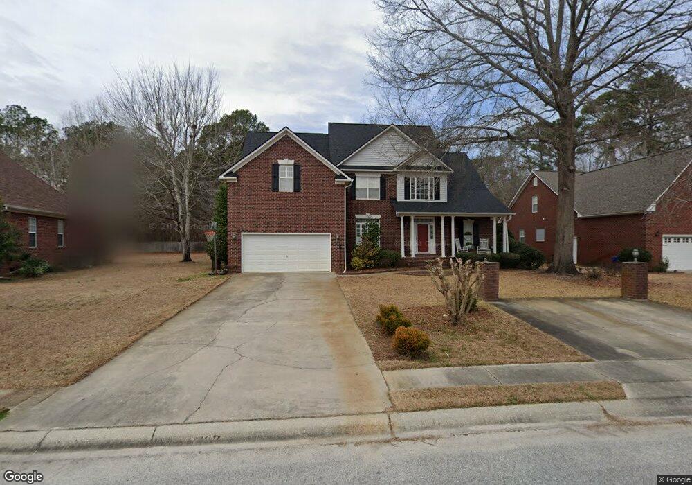
621 Traces Dr Florence, SC 29501
Estimated Value: $396,567 - $436,000
5
Beds
3
Baths
2,760
Sq Ft
$149/Sq Ft
Est. Value
About This Home
This home is located at 621 Traces Dr, Florence, SC 29501 and is currently estimated at $411,642, approximately $149 per square foot. 621 Traces Dr is a home located in Florence County with nearby schools including Carver Elementary School, Henry L. Sneed Middle School, and John W. Moore Middle School.
Ownership History
Date
Name
Owned For
Owner Type
Purchase Details
Closed on
Aug 28, 2006
Sold by
Venable Albert Gene and Venable Cheryl G
Bought by
Mcpeters Kent C and Mcpeters Karen W
Current Estimated Value
Home Financials for this Owner
Home Financials are based on the most recent Mortgage that was taken out on this home.
Original Mortgage
$70,500
Outstanding Balance
$42,338
Interest Rate
6.67%
Mortgage Type
Credit Line Revolving
Estimated Equity
$369,304
Create a Home Valuation Report for This Property
The Home Valuation Report is an in-depth analysis detailing your home's value as well as a comparison with similar homes in the area
Home Values in the Area
Average Home Value in this Area
Purchase History
| Date | Buyer | Sale Price | Title Company |
|---|---|---|---|
| Mcpeters Kent C | $270,000 | None Available |
Source: Public Records
Mortgage History
| Date | Status | Borrower | Loan Amount |
|---|---|---|---|
| Open | Mcpeters Kent C | $70,500 | |
| Open | Mcpeters Kent C | $170,000 |
Source: Public Records
Tax History Compared to Growth
Tax History
| Year | Tax Paid | Tax Assessment Tax Assessment Total Assessment is a certain percentage of the fair market value that is determined by local assessors to be the total taxable value of land and additions on the property. | Land | Improvement |
|---|---|---|---|---|
| 2024 | $1,035 | $14,411 | $1,360 | $13,051 |
| 2023 | $1,084 | $10,356 | $1,360 | $8,996 |
| 2022 | $1,304 | $10,356 | $1,360 | $8,996 |
| 2021 | $1,342 | $10,360 | $0 | $0 |
| 2020 | $1,209 | $10,360 | $0 | $0 |
| 2019 | $1,212 | $10,356 | $1,360 | $8,996 |
| 2018 | $1,096 | $10,360 | $0 | $0 |
| 2017 | $1,034 | $10,360 | $0 | $0 |
| 2016 | $953 | $10,360 | $0 | $0 |
| 2015 | $941 | $10,360 | $0 | $0 |
| 2014 | $865 | $10,356 | $1,360 | $8,996 |
Source: Public Records
Map
Nearby Homes
- 731 Coventry Ln
- 4145 Rodanthe Cir
- 711 Harriett Dr
- 608 Stoneybrook Terrace
- 711 A8 Coventry Ln
- Woodhaven Plan at Brookshire - Stonehill Collection
- Idlewood Plan at Brookshire - Stonehill Collection
- Newlin Plan at Brookshire - Watermill Collection
- Beckman Plan at Brookshire - Watermill Collection
- Lookout Plan at Brookshire - Stonehill Collection
- Pearce Plan at Brookshire - Watermill Collection
- 4165 Rodanthe Cir
- 4169 Rodanthe Cir
- 3821 Ashwood Ln
- 708 Muirfield Place
- 345 Magna Carta Rd
- 4135 W Pelican Ln
- 1728 Oakdale Terrace Blvd
- 724 Caledonia Ct
- 644 Calumet Ct
- 617 Traces Dr
- 625 Traces Dr
- 613 Traces Dr
- 629 Traces Dr
- 622 Traces Dr
- 3916 Tee Ct
- 633 Traces Dr
- 3912 Tee Ct
- 626 Traces Dr
- 630 Traces Dr
- 634 Traces Dr
- 700 S Briarleigh Rd
- 605 Traces Dr
- 3908 Tee Ct
- 701 Coventry Ln 2 A
- 3915 Tee Ct
- 701 A4 Coventry Ln
- 701 Coventry Ln
- 701 Coventry Ln Unit B8
- 701 Coventry Ln Unit B7